Victoria Harbour Light (historical)
Located in Inverclyde, Scotland Coordinates: 55°56′46″ N 4°44′42″ W
- Local time
- UTC+00:00
- Europe/London · UTC+00:00
- Elevation
- 7 m
- above sea level
- Airports
- GLA Glasgow Airport21 km
- PIK Glasgow Prestwick Airport51 km
About Victoria Harbour Light (historical)
Victoria Harbour Light (historical) is a landmark. Location: Inverclyde, Scotland. The best months to visit are June–August. The nearest airport is Glasgow Airport (21 km). Nearby sights include Cappielow and Wellpark Mid-Kirk Church.
Photos of Victoria Harbour Light (historical)
-
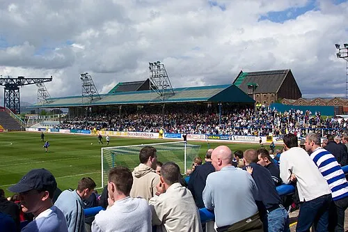
Cappielow en:User:JimJim · CC BY-SA 3.0

Climate of Victoria Harbour Light (historical)
Best months for sightseeingBest months for sightseeing: June–August.
This month · November
A wet month
Day 10° · Night 5° · Rain 180 mm
- Hottest month
- July (day 18°)
- Coldest month
- February (night 2°)
- Wettest month
- January (198 mm)
- Driest month
- May (86 mm)
Bars: average monthly low and high temperature. Below: precipitation. Monthly averages for 1970–2000 at about 18 km resolution, adjusted for elevation. Highlighted months are mild and relatively dry. Source: WorldClim 2.1 (CC BY 4.0).
Show values as a table
| Month | Jan | Feb | Mar | Apr | May | Jun | Jul | Aug | Sep | Oct | Nov | Dec |
|---|---|---|---|---|---|---|---|---|---|---|---|---|
| Average high (°C) | 7° | 7° | 9° | 11° | 15° | 17° | 18° | 18° | 16° | 13° | 10° | 8° |
| Average low (°C) | 3° | 2° | 3° | 4° | 7° | 9° | 12° | 11° | 10° | 7° | 5° | 3° |
| Precipitation (mm) | 198 | 131 | 147 | 87 | 86 | 87 | 99 | 119 | 159 | 180 | 180 | 184 |
How to get to Victoria Harbour Light (historical)
The nearest airport is Glasgow Airport (GLA), 21 km to the southeast as the crow flies. The nearest large city is Glasgow, 32 km to the east.
Airports
- Glasgow Airport (GLA) Glasgow 21 kmsoutheast
- Glasgow Prestwick Airport (PIK) Prestwick, South Ayrshire 51 kmsouth
- Campbeltown Airport (CAL) Campbeltown 82 kmsouthwest
Nearby large cities
- Glasgow Population: 626.4K 32 kmeast
- Edinburgh Population: 515K 97 kmeast
- Dundee Population: 148.2K 124 kmnortheast
- Belfast Population: 348K 168 kmsouthwest
- Aberdeen Population: 198.6K 210 kmnortheast
Straight-line distances; road distances are longer. Airport data: OurAirports.
Day trips from Victoria Harbour Light (historical)
Within 100 km: 158 historic and cultural sites, 3,557 natural sites, 1,235 lakes, rivers and coasts.
0–25 km305 places
- Great Cumbrae Island Island 23 kmSW
- Inchlonaig Island 19 kmNE
- Inchcailloch Island 19 kmNE
- Aber Isle Island 19 kmNE
25–60 km1,520 places
- Isle of Arran Island 50 kmSW
- Ayr Beach Beach 54 kmS
- Troon Beach Beach 45 kmS
- Hunterston Sands Beach 26 kmS
60–100 km3,125 places
- Colonsay Island 93 kmW
- Burntisland Beach Beach 96 kmE
- Cramond beach Beach 90 kmE
- Kiloran Beach Beach 91 kmW
Straight-line distances.
Nearby attractions & nature
Everything nearby-
Cappielow Landmark, Inverclyde1.2 km SE
-
Wellpark Mid-Kirk Church Attraction, Inverclyde0.7 km W
-
East Yard Shipyard, Port Glasgow Historic site, Inverclyde3 km E
-
Port Glasgow Lighthouse Landmark, Inverclyde3.7 km E
-
Bow Hill Mountain, Inverclyde3 km W
-
Corlick Hill Mountain, Inverclyde3.1 km S
-
Ardmore Tower Landmark, Argyll and Bute4 km NE
-
Long Craig Mountain, Inverclyde3.5 km W
Nearest towns and villages
-
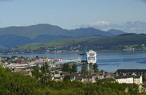 Greenock City, Inverclyde1 km W
-
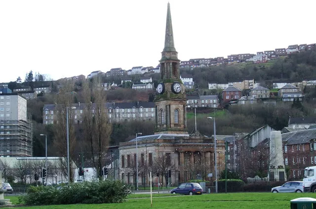 Port Glasgow Town, Inverclyde3.7 km E
-
Charing Cross Neighbourhood, Inverclyde0.3 km SW
-
Cartsburn Neighbourhood, Inverclyde0.5 km E
Sources & licences
Data last updated: