- Elevation
- 108 m
- above sea level
- Local time
- UTC+00:00
- Europe/London · UTC+00:00
- Airports
- DND Dundee Airport29 km
- EDI Edinburgh Airport43 km
About Law of Dumbuils
Law of Dumbuils is a mountain. Location: Perth and Kinross, Scotland. Elevation: 108 m. The best months to visit are June–August. The nearest airport is Dundee Airport (29 km). Nearby sights include Glenearn Hill and Culteuchar Hill.
Climate of Law of Dumbuils
Best months for sightseeingBest months for sightseeing: June–August.
This month · November
A cold month
Day 8° · Night 2° · Rain 73 mm
- Hottest month
- July (day 19°)
- Coldest month
- January (night 0°)
- Wettest month
- January (89 mm)
- Driest month
- April (45 mm)
Bars: average monthly low and high temperature. Below: precipitation. Monthly averages for 1970–2000 at about 18 km resolution, adjusted for elevation. Highlighted months are mild and relatively dry. Source: WorldClim 2.1 (CC BY 4.0).
Show values as a table
| Month | Jan | Feb | Mar | Apr | May | Jun | Jul | Aug | Sep | Oct | Nov | Dec |
|---|---|---|---|---|---|---|---|---|---|---|---|---|
| Average high (°C) | 6° | 6° | 8° | 11° | 14° | 17° | 19° | 19° | 16° | 12° | 8° | 6° |
| Average low (°C) | 0° | 0° | 2° | 3° | 6° | 8° | 10° | 10° | 8° | 5° | 2° | 1° |
| Precipitation (mm) | 89 | 58 | 64 | 45 | 54 | 55 | 57 | 58 | 71 | 81 | 73 | 77 |
How to get to Law of Dumbuils
The nearest airport is Dundee Airport (DND), 29 km to the northeast as the crow flies. For international flights: Edinburgh Airport (EDI) (43 km). The nearest large city is Dundee, 33 km to the northeast.
Airports
- Dundee Airport (DND) Dundee 29 kmnortheast
- Edinburgh Airport (EDI) Ingliston, Edinburgh 43 kmsouth
- Glasgow Airport (GLA) Glasgow 80 kmsouthwest
Nearby large cities
- Dundee Population: 148.2K 33 kmnortheast
- Edinburgh Population: 515K 46 kmsouth
- Glasgow Population: 626.4K 72 kmsouthwest
- Aberdeen Population: 198.6K 122 kmnortheast
- Newcastle upon Tyne Population: 300.1K 191 kmsoutheast
Straight-line distances; road distances are longer. Airport data: OurAirports.
Day trips from Law of Dumbuils
Within 100 km: 190 historic and cultural sites, 3,389 natural sites, 709 lakes, rivers and coasts.
0–25 km232 places
- Mugdrum Island Island 13 kmE
- St Serf's Island Island 18 kmS
- Moncreiffe Island Island 6 kmN
- Roy's Folly Island 16 kmS
25–60 km1,249 places
- Burntisland Beach Beach 34 kmSE
- Cramond beach Beach 41 kmS
- Portobello Beach Beach 48 kmSE
- Gullane Beach Beach 50 kmSE
60–100 km2,807 places
- Inchlonaig Island 76 kmW
- Inchcailloch Island 74 kmW
- Fraoch Eilean Island 99 kmW
- Ellens Isle Island 62 kmW
Straight-line distances.
Nearest towns and villages
-
 Bridge of Earn Village, Perth and Kinross3.2 km NE
-
Forgandenny Village, Perth and Kinross1.9 km NW
-
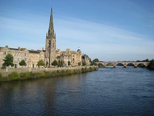 Perth City, Perth and Kinross6.7 km N
-
Kintillo Neighbourhood, Perth and Kinross3 km E
-
Craigend Village, Perth and Kinross3.6 km N
-
Glenfarg Village, Perth and Kinross7.1 km SE
Nearby attractions & nature
Everything nearby-
Glenearn Hill Mountain, Perth and Kinross1.8 km S
-
Culteuchar Hill Mountain, Perth and Kinross1.8 km S
-
West Dron Hill Mountain, Perth and Kinross2.4 km SE
-
Kirkton Hill Mountain, Perth and Kinross4 km N
-
Eastfield Hill Mountain, Perth and Kinross4.2 km S
-
Cloven Craigs Mountain, Perth and Kinross4.5 km SE
-
Moncreiffe Hill Mountain, Perth and Kinross4.5 km NE
-
Roeglen Hill Mountain, Perth and Kinross4.7 km SW
Sources & licences
Data last updated: