- Elevation
- 52 m
- above sea level
- Local time
- UTC+00:00
- Europe/London · UTC+00:00
- Airports
- DND Dundee Airport15 km
- EDI Edinburgh Airport49 km
About Murie Hill
Murie Hill is a mountain. Location: Perth and Kinross, Scotland. Elevation: 52 m. The best months to visit are June–August. The nearest airport is Dundee Airport (15 km). Nearby sights include Craiglochie and Higham Hill.
Climate of Murie Hill
Best months for sightseeingBest months for sightseeing: June–August.
This month · November
A cold month
Day 9° · Night 3° · Rain 68 mm
- Hottest month
- July (day 19°)
- Coldest month
- January (night 0°)
- Wettest month
- January (85 mm)
- Driest month
- April (46 mm)
Bars: average monthly low and high temperature. Below: precipitation. Monthly averages for 1970–2000 at about 18 km resolution, adjusted for elevation. Highlighted months are mild and relatively dry. Source: WorldClim 2.1 (CC BY 4.0).
Show values as a table
| Month | Jan | Feb | Mar | Apr | May | Jun | Jul | Aug | Sep | Oct | Nov | Dec |
|---|---|---|---|---|---|---|---|---|---|---|---|---|
| Average high (°C) | 6° | 6° | 9° | 11° | 14° | 17° | 19° | 19° | 16° | 12° | 9° | 7° |
| Average low (°C) | 0° | 1° | 2° | 3° | 6° | 9° | 11° | 11° | 8° | 6° | 3° | 1° |
| Precipitation (mm) | 85 | 55 | 61 | 46 | 53 | 56 | 57 | 58 | 69 | 78 | 68 | 74 |
How to get to Murie Hill
The nearest airport is Dundee Airport (DND), 15 km to the northeast as the crow flies. For international flights: Edinburgh Airport (EDI) (49 km). The nearest large city is Dundee, 19 km to the northeast.
Airports
- Dundee Airport (DND) Dundee 15 kmnortheast
- Edinburgh Airport (EDI) Ingliston, Edinburgh 49 kmsouth
- Glasgow Airport (GLA) Glasgow 94 kmsouthwest
Nearby large cities
- Dundee Population: 148.2K 19 kmnortheast
- Edinburgh Population: 515K 49 kmsouth
- Glasgow Population: 626.4K 86 kmsouthwest
- Aberdeen Population: 198.6K 109 kmnortheast
- Newcastle upon Tyne Population: 300.1K 188 kmsoutheast
Straight-line distances; road distances are longer. Airport data: OurAirports.
Day trips from Murie Hill
Within 100 km: 181 historic and cultural sites, 3,078 natural sites, 635 lakes, rivers and coasts.
0–25 km203 places
- Mugdrum Island Island 4 kmS
- St Serf's Island Island 23 kmS
- Moncreiffe Island Island 12 kmW
- Roy's Folly Island 23 kmSW
25–60 km1,193 places
- Burntisland Beach Beach 36 kmS
- Cramond beach Beach 45 kmS
- Portobello Beach Beach 49 kmS
- Gullane Beach Beach 46 kmSE
60–100 km2,498 places
- Inchlonaig Island 91 kmW
- Inchcailloch Island 89 kmW
- Ellens Isle Island 76 kmW
- Aber Isle Island 88 kmSW
Straight-line distances.
Nearest towns and villages
-
Errol Village, Perth and Kinross1.6 km E
-
 Newburgh Village, Fife4.1 km S
-
Leetown Village, Perth and Kinross2.5 km W
-
Elm Mews Village, Perth and Kinross2.7 km W
-
Chapelhill Village, Perth and Kinross3.3 km W
-
Kilspindie Village, Perth and Kinross3.7 km NW
Nearby attractions & nature
Everything nearby-
Craiglochie Mountain, Perth and Kinross4.2 km NW
-
Higham Hill Mountain, Fife4.4 km SE
-
Lindores Hill Mountain, Fife5.1 km SE
-
Balthayock Hill Mountain, Perth and Kinross5.1 km W
-
Glencarse Hill Mountain, Perth and Kinross5.1 km W
-
Black Cairn Hill Mountain, Fife5.2 km S
-
Mugdrum Island Island, Fife4.3 km S
-
Pans Hill Mountain, Perth and Kinross5.3 km W
More nature in United Kingdom
-
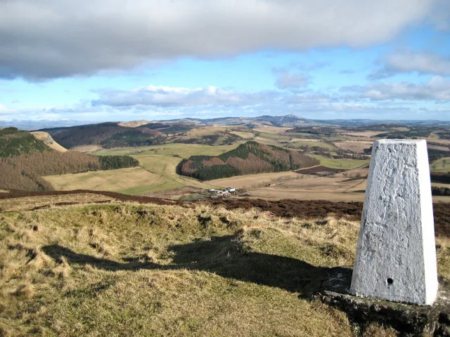 King's Seat Mountain, Perth and Kinross11 km N
-
Pole Hill Mountain, Perth and Kinross5.6 km NW
-
Craighead Mountain, Perth and Kinross5.8 km N
-
Beal Hill Mountain, Perth and Kinross6 km NW
-
Swirlhead Hill Mountain, Perth and Kinross6.5 km NW
-
Kinnaird Hill Mountain, Perth and Kinross6.9 km N
Sources & licences
Data last updated: