- Elevation
- 106 m
- above sea level
- Local time
- UTC+00:00
- Europe/London · UTC+00:00
- Airports
- GLA Glasgow Airport33 km
- EDI Edinburgh Airport44 km
About Burnhead
Burnhead is a neighbourhood. Location: South Lanarkshire, Scotland. The best months to visit are June–August. The nearest airport is Glasgow Airport (33 km). Nearby sights include Law of Maudslie and Fir Park.
Climate of Burnhead
Best months for sightseeingBest months for sightseeing: June–August.
This month · November
A wet month
Day 9° · Night 3° · Rain 148 mm
- Hottest month
- July (day 19°)
- Coldest month
- January (night 1°)
- Wettest month
- January (156 mm)
- Driest month
- April (68 mm)
Bars: average monthly low and high temperature. Below: precipitation. Monthly averages for 1970–2000 at about 18 km resolution, adjusted for elevation. Highlighted months are mild and relatively dry. Source: WorldClim 2.1 (CC BY 4.0).
Show values as a table
| Month | Jan | Feb | Mar | Apr | May | Jun | Jul | Aug | Sep | Oct | Nov | Dec |
|---|---|---|---|---|---|---|---|---|---|---|---|---|
| Average high (°C) | 6° | 6° | 8° | 11° | 15° | 17° | 19° | 18° | 15° | 12° | 9° | 7° |
| Average low (°C) | 1° | 1° | 2° | 4° | 6° | 9° | 11° | 11° | 9° | 6° | 3° | 2° |
| Precipitation (mm) | 156 | 109 | 116 | 68 | 71 | 69 | 75 | 94 | 129 | 149 | 148 | 149 |
How to get to Burnhead
The nearest airport is Glasgow Airport (GLA), 33 km to the northwest as the crow flies. The nearest large city is Glasgow, 24 km to the northwest.
Airports
- Glasgow Airport (GLA) Glasgow 33 kmnorthwest
- Edinburgh Airport (EDI) Ingliston, Edinburgh 44 kmnortheast
- Glasgow Prestwick Airport (PIK) Prestwick, South Ayrshire 47 kmsouthwest
Nearby large cities
- Glasgow Population: 626.4K 24 kmnorthwest
- Edinburgh Population: 515K 53 kmnortheast
- Dundee Population: 148.2K 102 kmnortheast
- Newcastle upon Tyne Population: 300.1K 171 kmsoutheast
- Belfast Population: 348K 178 kmsouthwest
Straight-line distances; road distances are longer. Airport data: OurAirports.
Day trips from Burnhead
Within 100 km: 192 historic and cultural sites, 3,395 natural sites, 942 lakes, rivers and coasts.
0–25 km139 places
- Spiers Island Island 18 kmN
- New Island Island 23 kmS
- Lochgoin Reservoir Lake 24 kmW
- Hogganfield Loch Lake 21 kmNW
25–60 km1,520 places
- Ayr Beach Beach 53 kmSW
- Troon Beach Beach 49 kmSW
- Hunterston Sands Beach 59 kmW
- Burntisland Beach Beach 58 kmNE
60–100 km2,870 places
- Isle of Arran Island 83 kmW
- Great Cumbrae Island Island 60 kmW
- Powillimount Beach Beach 97 kmS
- Gullane Beach Beach 78 kmNE
Straight-line distances.
Nearby attractions & nature
Everything nearby-
Law of Maudslie Mountain, South Lanarkshire4.9 km E
-
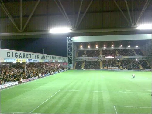 Fir Park Landmark, North Lanarkshire4.9 km N
-
Avon Water River, Scotland6.9 km NW
-
River Nethan River, Scotland7.1 km SE
-
Clydesdale Natural site, Scotland8.9 km SE
-
Swinsy Hill Mountain, South Lanarkshire7.1 km SE
Sources & licences
Data last updated: