- Elevation
- 377 m
- above sea level
- Local time
- UTC+00:00
- Europe/London · UTC+00:00
- Airports
- EDI Edinburgh Airport35 km
- DND Dundee Airport72 km
About Soutra Hill
Soutra Hill is a mountain. Location: The Scottish Borders, Scotland. Elevation: 377 m. The best months to visit are July–August. The nearest airport is Edinburgh Airport (35 km). Nearby sights include Brotherstone Hill and Hartside Hill.
Photos of Soutra Hill
-
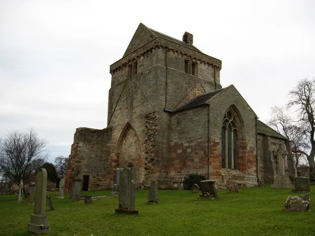
Crichton Collegiate Church Jimmydenham · Public domain

Climate of Soutra Hill
Best months for sightseeingBest months for sightseeing: July–August.
This month · November
A wet month
Day 7° · Night 1° · Rain 106 mm
- Hottest month
- July (day 17°)
- Coldest month
- January (night -1°)
- Wettest month
- October (113 mm)
- Driest month
- April (66 mm)
Bars: average monthly low and high temperature. Below: precipitation. Monthly averages for 1970–2000 at about 18 km resolution, adjusted for elevation. Highlighted months are mild and relatively dry. Source: WorldClim 2.1 (CC BY 4.0).
Show values as a table
| Month | Jan | Feb | Mar | Apr | May | Jun | Jul | Aug | Sep | Oct | Nov | Dec |
|---|---|---|---|---|---|---|---|---|---|---|---|---|
| Average high (°C) | 4° | 4° | 6° | 9° | 12° | 15° | 17° | 17° | 14° | 11° | 7° | 5° |
| Average low (°C) | -1° | -1° | 0° | 1° | 4° | 7° | 8° | 8° | 6° | 4° | 1° | 0° |
| Precipitation (mm) | 112 | 82 | 90 | 66 | 69 | 75 | 80 | 90 | 97 | 113 | 106 | 108 |
How to get to Soutra Hill
The nearest airport is Edinburgh Airport (EDI), 35 km to the northwest as the crow flies. The nearest large city is Edinburgh, 25 km to the northwest.
Airports
- Edinburgh Airport (EDI) Ingliston, Edinburgh 35 kmnorthwest
- Dundee Airport (DND) Dundee 72 kmnorth
- Glasgow Airport (GLA) Glasgow 98 kmwest
Nearby large cities
- Edinburgh Population: 515K 25 kmnorthwest
- Dundee Population: 148.2K 73 kmnorth
- Glasgow Population: 626.4K 87 kmwest
- Newcastle upon Tyne Population: 300.1K 123 kmsoutheast
- Sunderland Population: 170.1K 139 kmsoutheast
Straight-line distances; road distances are longer. Airport data: OurAirports.
Day trips from Soutra Hill
Within 100 km: 476 historic and cultural sites, 2,300 natural sites, 574 lakes, rivers and coasts.
0–25 km243 places
- Portobello Beach Beach 22 kmNW
- Monkmill Island Island 20 kmNE
- Crow Island Island 20 kmNE
- Green Craig Island 22 kmN
25–60 km1,196 places
- Burntisland Beach Beach 35 kmNW
- Cramond beach Beach 32 kmNW
- Gullane Beach Beach 25 kmN
- Seacliff Beach Beach 31 kmNE
60–100 km1,911 places
- Cheswick Sands Beach 60 kmE
- Longhoughton Beach Beach 92 kmSE
- South Wamses Island 81 kmE
- Old Law Island 71 kmE
Straight-line distances.
Nearest towns and villages
-
Gilston Village, The Scottish Borders2 km S
-
Fala Village, Midlothian2.4 km N
-
Fala Dam Village, Midlothian2.7 km NW
-
New Channelkirk Village, The Scottish Borders4.3 km SE
-
Blackshiels Village, Midlothian4.2 km NW
-
Pathhead Village, Midlothian8.2 km NW
Nearby attractions & nature
Everything nearby-
Brotherstone Hill Mountain, The Scottish Borders2.5 km SW
-
Hartside Hill Mountain, The Scottish Borders3.7 km S
-
Cakemuir Hill Mountain, The Scottish Borders4.7 km W
-
West Hill Mountain, The Scottish Borders4.9 km NE
-
Crookston North Mains Hill Mountain, The Scottish Borders5 km SW
-
Airhouse Hill Mountain, The Scottish Borders5.5 km SE
-
Carfrae Mountain, The Scottish Borders5.8 km SE
-
Ditcher Law Mountain, The Scottish Borders5.9 km E
Sources & licences
Data last updated: