Whitburn
Located in West Lothian, Scotland Coordinates: 55°52′00″ N 3°41′00″ W
- Population
- 11,490
- 11.5K
- Elevation
- 173 m
- above sea level
- Local time
- UTC+00:00
- Europe/London · UTC+00:00
About Whitburn
Whitburn is a town. Location: West Lothian, Scotland. Population: 11,490. Elevation: 173 m.
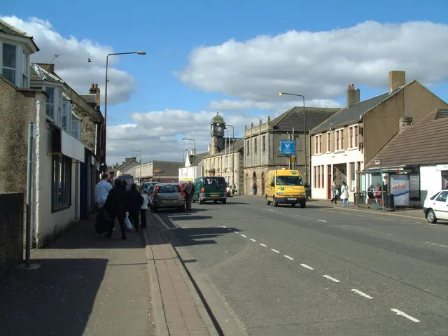
Whitburn (originally Whiteburn) is a town on the south bank of the River Almond in West Lothian, Scotland, halfway between Scotlands's two largest cities, about 23 miles (37 kilometres) east of Glasgow and 22 miles (35 kilometres) west of Edinburgh. The nearest major towns are Bathgate, four miles (six kilometres) and Livingston, six miles (ten kilometres).
Read more on Wikipedia Text: Wikipedia contributors · CC BY-SA 4.0 · shortened
In comparison
- No. 6 of 23 places in West Lothian by population
- Nearest larger town: Armadale, 2 km NW
- 18 sights and natural places within 10 km Fauldhouse Bing, Tippet Knowe
Climate of Whitburn
Best months for sightseeing: June–August.
| Month | Jan | Feb | Mar | Apr | May | Jun | Jul | Aug | Sep | Oct | Nov | Dec |
|---|---|---|---|---|---|---|---|---|---|---|---|---|
| Average high (°C) | 6° | 6° | 8° | 11° | 14° | 17° | 18° | 18° | 15° | 12° | 8° | 6° |
| Average low (°C) | 1° | 1° | 2° | 3° | 6° | 9° | 11° | 10° | 8° | 6° | 3° | 1° |
| Precipitation (mm) | 153 | 105 | 114 | 66 | 70 | 70 | 75 | 89 | 121 | 141 | 139 | 144 |
Monthly averages for 1970–2000 at about 18 km resolution, adjusted for elevation. Highlighted months are mild and relatively dry. Source: WorldClim 2.1 (CC BY 4.0).
Airports nearest to Whitburn
- Edinburgh Airport (EDI) Ingliston, Edinburgh 22 km
- Glasgow Airport (GLA) Glasgow 47 km
- Glasgow Prestwick Airport (PIK) Prestwick, South Ayrshire 69 km
Straight-line distance; airports with scheduled flights only. Source: OurAirports (public domain).
Nearby attractions & nature
Everything nearby-
Fauldhouse Bing Mountain, West Lothian4.4 km SW
-
Tippet Knowe Mountain, West Lothian4.6 km SW
-
Eastcraigs Hill Mountain, West Lothian5.3 km NW
-
Seafield Law Mountain, West Lothian5.9 km E
-
Five Sisters Bing Mountain, West Lothian6.1 km E
-
Candiehead Mountain, Falkirk9.1 km N
-
Breich Water River, Scotland7.5 km E
-
Raven Craig Mountain, West Lothian7 km NE
Other cities and towns in West Lothian
-
 Linlithgow Town, West Lothian13 km N
-
Livingston City, West Lothian11 km E
-
Broxburn Town, West Lothian15 km NE
Sources & licences
Data last updated: · 2 independent sources