- Elevation
- 7 m
- above sea level
- Local time
- UTC+00:00
- Europe/London · UTC+00:00
- Airports
- BEB Benbecula Airport7 km
- BRR Barra Airport47 km
About Rueval
Rueval is a mountain. Location: Western Isles, Scotland. Elevation: 7 m. The best months to visit are July–August. The nearest airport is Benbecula Airport (7 km). Nearby sights include Eilean Ghillechriosda and Loch Langavat.
Climate of Rueval
Best months for sightseeingBest months for sightseeing: July–August.
This month · November
A wet month
Day 9° · Night 5° · Rain 159 mm
- Hottest month
- August (day 16°)
- Coldest month
- February (night 3°)
- Wettest month
- October (163 mm)
- Driest month
- May (64 mm)
Bars: average monthly low and high temperature. Below: precipitation. Monthly averages for 1970–2000 at about 18 km resolution, adjusted for elevation. Highlighted months are mild and relatively dry. Source: WorldClim 2.1 (CC BY 4.0).
Show values as a table
| Month | Jan | Feb | Mar | Apr | May | Jun | Jul | Aug | Sep | Oct | Nov | Dec |
|---|---|---|---|---|---|---|---|---|---|---|---|---|
| Average high (°C) | 7° | 7° | 8° | 10° | 13° | 15° | 16° | 16° | 15° | 12° | 9° | 8° |
| Average low (°C) | 3° | 3° | 4° | 5° | 7° | 9° | 11° | 11° | 10° | 8° | 5° | 4° |
| Precipitation (mm) | 151 | 109 | 120 | 76 | 64 | 75 | 89 | 104 | 138 | 163 | 159 | 154 |
How to get to Rueval
The nearest airport is Benbecula Airport (BEB), 7 km to the northwest as the crow flies. The nearest large city is Glasgow, 256 km to the southeast.
Airports
- Benbecula Airport (BEB) Balivanich 7 kmnorthwest
- Barra Airport (BRR) Eoligarry 47 kmsouth
- Stornoway Airport (SYY) Stornoway, Western Isles 104 kmnortheast
Nearby large cities
- Glasgow Population: 626.4K 256 kmsoutheast
- Dundee Population: 148.2K 284 kmeast
- Edinburgh Population: 515K 301 kmsoutheast
- Aberdeen Population: 198.6K 315 kmeast
- Belfast Population: 348K 327 kmsouth
Straight-line distances; road distances are longer. Airport data: OurAirports.
Day trips from Rueval
Within 100 km: 21 historic and cultural sites, 1,228 natural sites, 1,001 lakes, rivers and coasts.
0–25 km383 places
- Siolaigh Mor Island 12 kmS
- Flodaigh Beag Island 12 kmNE
- Dùn Mòr Island 10 kmS
- Bhorogaigh Island 14 kmN
25–60 km572 places
- Hebrides Island 60 kmSE
- Isle of Harris Natural site 60 kmNE
- The Coral Beaches Beach 40 kmE
- Isle of Barra Beach Beach 53 kmS
60–100 km1,295 places
- Isle of Skye Island 65 kmE
- Island of Raasay Island 74 kmE
- Eigg Island 91 kmSE
- Scalpay Island 61 kmNE
Straight-line distances.
Nearest towns and villages
-
Isle of Benbecula Village, Western Isles3 km NW
-
Creagorry Village, Western Isles1 km W
-
Kilerivagh Village, Western Isles2.1 km S
-
Creagorry Village, Western Isles3.3 km SW
-
Àird Cumhang Village, Western Isles3.7 km SE
-
Torium Village, Western Isles3.8 km W
Nearby attractions & nature
Everything nearby-
Eilean Ghillechriosda Island, Western Isles1.2 km S
-
Loch Langavat Lake, Western Isles2 km E
-
Eilean an t-Srom Island, Western Isles2 km S
-
Stiaraval Mountain, Western Isles2.5 km NW
-
Eilean Alltromach Island, Western Isles2.1 km S
-
Dùn Ruadh Island, Western Isles2.3 km W
-
Eilean an Ruiseallaich Island, Western Isles2.3 km S
-
Eilean a' Gnip Island, Western Isles2.4 km W
More nature in United Kingdom
-
Loch Leiravagh Natural site, Western Isles3.5 km SE
-
Bàgh nam Faoileann Natural site, Western Isles5.7 km S
-
Beinn a Deas Mountain, Western Isles6.5 km SE
-
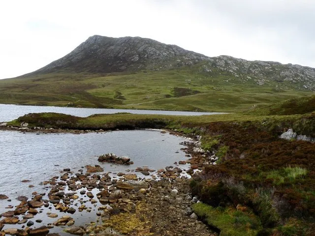 Eaval Mountain, Western Isles12 km NE
-
Ben Tarbert Mountain, Western Isles11 km S
-
Beinn Rodagraich Mountain, Western Isles8.4 km NE
Sources & licences
Data last updated: