Pontywaun
Located in Crosskeys, Caerphilly County Borough Coordinates: 51°37′30″ N 3°07′39″ W
- Elevation
- 83 m
- above sea level
- Local time
- UTC+00:00
- Europe/London · UTC+00:00
- Airports
- CWL Cardiff International Airport29 km
- BRS Bristol Airport39 km
About Pontywaun
Pontywaun is a village. Location: Crosskeys, Caerphilly County Borough. Elevation: 83 m. The best months to visit are June–August. The nearest airport is Cardiff International Airport (29 km). Nearby sights include Medart and Sirhowy River.
Photos of Pontywaun
-
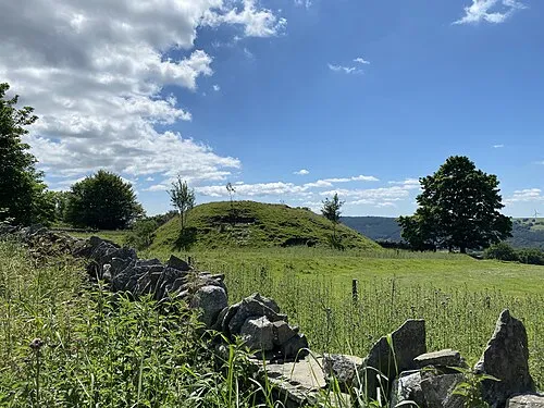
Twyn Tudur Alan Hughes · CC BY-SA 2.0 -
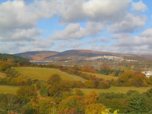
Rhiwderin Camp Graham Price · CC BY-SA 2.0


Climate of Pontywaun
Best months for sightseeingBest months for sightseeing: June–August.
This month · November
A wet month
Day 10° · Night 5° · Rain 115 mm
- Hottest month
- July (day 21°)
- Coldest month
- February (night 2°)
- Wettest month
- January (116 mm)
- Driest month
- July (59 mm)
Bars: average monthly low and high temperature. Below: precipitation. Monthly averages for 1970–2000 at about 18 km resolution, adjusted for elevation. Highlighted months are mild and relatively dry. Source: WorldClim 2.1 (CC BY 4.0).
Show values as a table
| Month | Jan | Feb | Mar | Apr | May | Jun | Jul | Aug | Sep | Oct | Nov | Dec |
|---|---|---|---|---|---|---|---|---|---|---|---|---|
| Average high (°C) | 7° | 7° | 10° | 12° | 16° | 18° | 21° | 20° | 17° | 14° | 10° | 8° |
| Average low (°C) | 2° | 2° | 3° | 4° | 7° | 10° | 12° | 12° | 10° | 8° | 5° | 3° |
| Precipitation (mm) | 116 | 84 | 89 | 64 | 67 | 68 | 59 | 86 | 97 | 105 | 115 | 116 |
How to get to Pontywaun
The nearest airport is Cardiff International Airport (CWL), 29 km to the southwest as the crow flies. The nearest large city is Newport, 10 km to the southeast.
Airports
- Cardiff International Airport (CWL) Cardiff 29 kmsouthwest
- Bristol Airport (BRS) Bristol 39 kmsoutheast
- Exeter International Airport (EXT) Exeter, Devon 101 kmsouth
Nearby large cities
- Newport Population: 161.5K 10 kmsoutheast
- Cardiff Population: 372.1K 17 kmsouth
- Bristol Population: 479K 41 kmsoutheast
- Swansea Population: 300.4K 56 kmwest
- Bath Population: 101.6K 60 kmsoutheast
Straight-line distances; road distances are longer. Airport data: OurAirports.
Day trips from Pontywaun
Within 100 km: 888 historic and cultural sites, 2,036 natural sites, 146 lakes, rivers and coasts.
0–25 km261 places
- Lisvane Reservoir Lake 11 kmS
- Llandegfedd Reservoir Lake 13 kmNE
- Alway Mountain 13 kmE
- Craig Llysfaen Mountain 8 kmS
25–60 km933 places
- Kilve Beach Beach 49 kmS
- Steep Holm Island 32 kmS
- Flat Holm Island 27 kmS
- Barry Island Island 28 kmSW
60–100 km1,876 places
- Saunton Sands Beach 96 kmSW
- Putsborough Beach Beach 93 kmSW
- Worms Head Island 83 kmW
- Outer Head Island 84 kmW
Straight-line distances.
Nearby attractions & nature
Everything nearby-
Medart Mountain, Crosskeys1.3 km E
-
Sirhowy River River, Caerphilly County Borough0.5 km S
-
Mynydd y Lan Mountain, Ynysddu1.1 km W
-
Pen-rhiw Tip Mountain, Bedwas, Trethomas and Machen2.1 km S
-
Twmbarlwm Mountain, Risca2.1 km E
-
Twyn Tudur Historic site, Ynysddu3.1 km NW
Sources & licences
Data last updated: · 2 independent sources