Maesybont
Located in Llanfihangel Aberbythych, Carmarthenshire Coordinates: 51°49′47″ N 4°04′56″ W

- Elevation
- 199 m
- above sea level
- Local time
- UTC+00:00
- Europe/London · UTC+00:00
- Airports
- CWL Cardiff International Airport70 km
- BRS Bristol Airport107 km
About Maesybont
Maesybont is a village. Location: Llanfihangel Aberbythych, Carmarthenshire. Elevation: 199 m.
Maesybont is a small village near Gorslas in Carmarthenshire, West Wales. The community consists of a Welsh chapel with graveyard and several homes. The houses are widely dispersed, with an average of 1-acre (4,000 m2) of land apiece. Many of the homes in the village of Maesybont are large by European standards, differentiated predominantly by having Fritzl Barns, rather than traditional Dutch barns. The local community benefits from a smallholding 100m down from the Chapel that sells free range eggs.
Source: Wikipedia · CC BY-SA 4.0
Photos of Maesybont
-
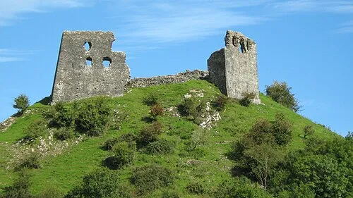
Dryslwyn Castle Natasha de Vere & Col Ford · CC BY 2.0 -
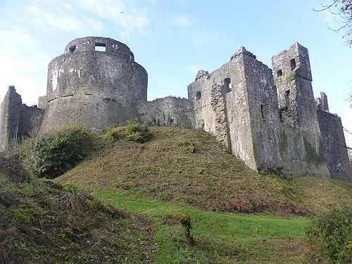
Dinefwr Castle Andrew Bone from Weymouth, England · CC BY 2.0


Climate of Maesybont
Best months for sightseeingBest months for sightseeing: June–August.
This month · November
A wet month
Day 10° · Night 5° · Rain 139 mm
- Hottest month
- July (day 19°)
- Coldest month
- February (night 2°)
- Wettest month
- November (139 mm)
- Driest month
- May (68 mm)
Bars: average monthly low and high temperature. Below: precipitation. Monthly averages for 1970–2000 at about 18 km resolution, adjusted for elevation. Highlighted months are mild and relatively dry. Source: WorldClim 2.1 (CC BY 4.0).
Show values as a table
| Month | Jan | Feb | Mar | Apr | May | Jun | Jul | Aug | Sep | Oct | Nov | Dec |
|---|---|---|---|---|---|---|---|---|---|---|---|---|
| Average high (°C) | 7° | 7° | 9° | 11° | 14° | 17° | 19° | 19° | 16° | 13° | 10° | 8° |
| Average low (°C) | 2° | 2° | 3° | 4° | 7° | 10° | 12° | 12° | 10° | 8° | 5° | 3° |
| Precipitation (mm) | 128 | 90 | 97 | 73 | 68 | 77 | 76 | 95 | 104 | 126 | 139 | 133 |
How to get to Maesybont
The nearest airport is Cardiff International Airport (CWL), 70 km to the southeast as the crow flies. The nearest large city is Swansea, 25 km to the south.
Airports
- Cardiff International Airport (CWL) Cardiff 70 kmsoutheast
- Bristol Airport (BRS) Bristol 107 kmsoutheast
- Exeter International Airport (EXT) Exeter, Devon 130 kmsouth
Nearby large cities
- Swansea Population: 300.4K 25 kmsouth
- Cardiff Population: 372.1K 74 kmsoutheast
- Newport Population: 161.5K 80 kmeast
- Bristol Population: 479K 111 kmeast
- Gloucester Population: 132.4K 127 kmeast
Straight-line distances; road distances are longer. Airport data: OurAirports.
Day trips from Maesybont
Within 100 km: 764 historic and cultural sites, 1,979 natural sites, 184 lakes, rivers and coasts.
0–25 km254 places
- Ynys Isaf Island 9 kmW
- Trichrug Mountain 15 kmNE
- Mynydd Pen-bre Mountain 16 kmSW
- Mynydd Llanybyther Mountain 23 kmN
25–60 km910 places
- Poppit Sands Beach 52 kmNW
- Manorbier Beach Beach 54 kmW
- Mwnt beach Beach 51 kmNW
- Tresaith Beach Beach 45 kmNW
60–100 km1,763 places
- St Justinian Natural site 85 kmW
- Porth Clais Natural site 83 kmW
- Port Selau Natural site 84 kmW
- Saunton Sands Beach 82 kmS
Straight-line distances.
Nearby attractions & nature
Everything nearby-
Pen Coedmawr Mountain, Llanfihangel Aberbythych1.3 km NE
-
Banc y Llyn Mountain, Llanfihangel Aberbythych1.6 km SE
-
Carmel Transmitting Station Landmark, Llanfihangel Aberbythych1.7 km SE
-
Castell y Rhingyll Historic site, Llanfihangel Aberbythych2.4 km SE
-
Pen Tyllwyd Mountain, Llanfihangel Aberbythych2.2 km N
-
Garn Mountain, Llanfihangel Aberbythych2.6 km E
Sources & licences
Data last updated: · 2 independent sources