- Elevation
- 171 m
- above sea level
- Local time
- UTC+00:00
- Europe/London · UTC+00:00
- Places inside
- 24
- listed under Ceulanamaesmawr
- Airports
- LPL Liverpool John Lennon Airport119 km
- CWL Cardiff International Airport127 km
About Ceulanamaesmawr
Ceulanamaesmawr is a municipality. Location: Ceredigion, Wales. Elevation: 171 m. The best months to visit are June–August. The nearest airport is Liverpool John Lennon Airport (119 km). Nearby sights include Moel y Llyn and Banc y Garn.
Photos of Ceulanamaesmawr
-
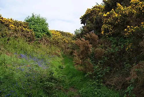
Castell Gwallter Bill Boaden · CC BY-SA 2.0 -
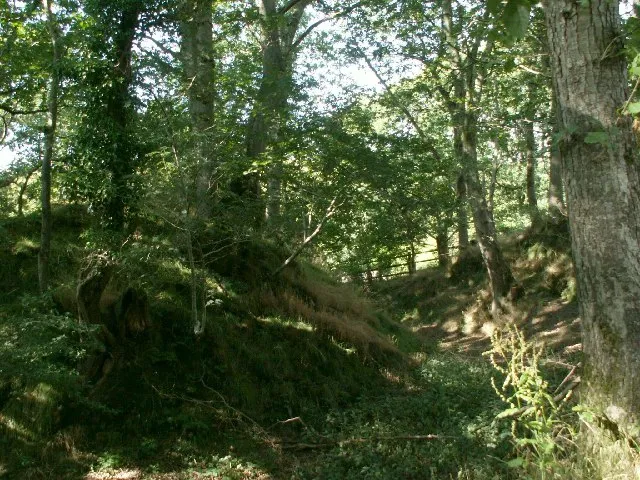
Castell Gwarcwm Nigel Callaghan · CC BY-SA 2.0


Climate of Ceulanamaesmawr
Best months for sightseeingBest months for sightseeing: June–August.
This month · November
A wet month
Day 10° · Night 4° · Rain 174 mm
- Hottest month
- July (day 19°)
- Coldest month
- February (night 1°)
- Wettest month
- November (174 mm)
- Driest month
- May (81 mm)
Bars: average monthly low and high temperature. Below: precipitation. Monthly averages for 1970–2000 at about 18 km resolution, adjusted for elevation. Highlighted months are mild and relatively dry. Source: WorldClim 2.1 (CC BY 4.0).
Show values as a table
| Month | Jan | Feb | Mar | Apr | May | Jun | Jul | Aug | Sep | Oct | Nov | Dec |
|---|---|---|---|---|---|---|---|---|---|---|---|---|
| Average high (°C) | 7° | 7° | 9° | 11° | 14° | 17° | 19° | 19° | 16° | 13° | 10° | 8° |
| Average low (°C) | 2° | 1° | 3° | 3° | 6° | 9° | 11° | 11° | 9° | 7° | 4° | 3° |
| Precipitation (mm) | 159 | 115 | 132 | 91 | 81 | 98 | 100 | 117 | 128 | 157 | 174 | 171 |
How to get to Ceulanamaesmawr
The nearest airport is Liverpool John Lennon Airport (LPL), 119 km to the northeast as the crow flies. The nearest large city is Swansea, 95 km to the south.
Airports
- Liverpool John Lennon Airport (LPL) Liverpool 119 kmnortheast
- Cardiff International Airport (CWL) Cardiff 127 kmsouth
- Manchester Airport (MAN) Manchester, Greater Manchester 147 kmnortheast
Nearby large cities
- Swansea Population: 300.4K 95 kmsouth
- Telford Population: 155.6K 102 kmeast
- Newport Population: 161.5K 117 kmsoutheast
- Birkenhead Population: 325.3K 119 kmnortheast
- Worcester Population: 101.7K 120 kmeast
Straight-line distances; road distances are longer. Airport data: OurAirports.
Day trips from Ceulanamaesmawr
Within 100 km: 819 historic and cultural sites, 2,608 natural sites, 205 lakes, rivers and coasts.
0–25 km368 places
- Llyn Mwyngi Lake 22 kmN
- Llyn Cau Lake 24 kmN
- Blue Lake Lake 25 kmN
- Dinas Mountain 21 kmE
25–60 km1,294 places
- Tresaith Beach Beach 56 kmSW
- Llangrannog's Beach Beach 52 kmSW
- Ynys Tywyn Island 52 kmN
- Ynys Lochtyn Island 51 kmSW
60–100 km1,970 places
- Anglesey Island 94 kmN
- Poppit Sands Beach 67 kmSW
- Mwnt beach Beach 62 kmSW
- Whistling Sands Beach 68 kmNW
Straight-line distances.
Places in Ceulanamaesmawr
24 placesCities & villages6
- Adams Street · Village
- Birkenhead Street · Village
- Elerch · Village
- Pentre-bach · Village
- Staylittle · Village
- Talybont · Village
Mountains & nature18
- Banc Bwlchygarreg · Mountain
- Banc Lletty Ifan Hen · Mountain
- Banc Mynyddgorddu · Mountain
- Banc Sychnant · Mountain
- Banc Ty-hen · Mountain
- Banc yr Wyn · Mountain
- Bryniau Rhyddion · Mountain
- Cefn yr Esgair · Mountain
- Cerrig yr Hafan · Mountain
- Disgwylfa · Mountain
- Esgair Fraith · Mountain
- Fynach Fawr · Mountain
- Llechwedd Gwynau · Mountain
- Moel Fferm · Mountain
- Moel Golomen · Mountain
- Moel y Garn · Mountain
- Pen Craigypistyll · Mountain
- Pen-y-sarn-ddu · Mountain
Nearby attractions & nature
Everything nearby-
Moel y Llyn Mountain, Ysgubor-y-Coed3.5 km N
-
Banc y Garn Mountain, Trefeurig4.1 km S
-
Esgair Foel-ddu Mountain, Llangynfelyn4.2 km N
-
Foel Goch Mountain, Llangynfelyn4.3 km N
-
Cefn-erglodd Mountain, Llangynfelyn4.5 km NW
-
Mynydd March Mountain, Trefeurig5.2 km SE
-
Disgwylfa Fawr Mountain, Blaenrheidol5.3 km SE
-
Banc Trawsnant Mountain, Trefeurig5.3 km S
Other cities and towns in Ceredigion
-
Geneu'r Glyn Municipality, Ceredigion7.6 km W
-
Melindwr Municipality, Ceredigion7.9 km S
-
Blaenrheidol Municipality, Ceredigion8.1 km SE
-
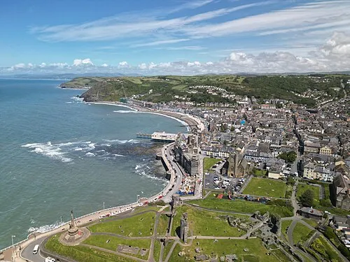 Aberystwyth Town, Aberystwyth13 km SW
-
Tirymynach Municipality, Ceredigion8.6 km SW
-
Borth Municipality, Ceredigion9.3 km W
Sources & licences
Data last updated: