- Elevation
- 88 m
- above sea level
- Local time
- UTC+00:00
- Europe/London · UTC+00:00
- Airports
- CWL Cardiff International Airport116 km
- LPL Liverpool John Lennon Airport141 km
About Llanddeiniol
Llanddeiniol is a village. Location: Llanrhystyd, Ceredigion. Elevation: 88 m. The best months to visit are June–August. The nearest airport is Cardiff International Airport (116 km). Nearby sights include Castell Cadwaladr and Cnwc y Barcud.
Photos of Llanddeiniol
-
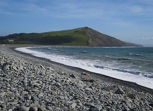
Allt Wen Anne Burgess · CC BY-SA 2.0 -
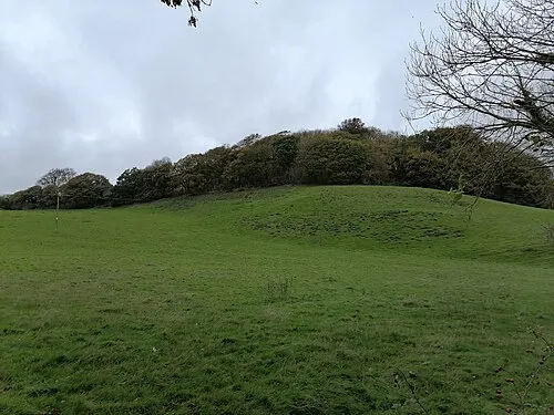
Tan y Castell PKwicipics · CC BY-SA 3.0


Climate of Llanddeiniol
Best months for sightseeingBest months for sightseeing: June–August.
This month · November
A wet month
Day 10° · Night 5° · Rain 160 mm
- Hottest month
- July (day 19°)
- Coldest month
- February (night 2°)
- Wettest month
- November (160 mm)
- Driest month
- May (75 mm)
Bars: average monthly low and high temperature. Below: precipitation. Monthly averages for 1970–2000 at about 18 km resolution, adjusted for elevation. Highlighted months are mild and relatively dry. Source: WorldClim 2.1 (CC BY 4.0).
Show values as a table
| Month | Jan | Feb | Mar | Apr | May | Jun | Jul | Aug | Sep | Oct | Nov | Dec |
|---|---|---|---|---|---|---|---|---|---|---|---|---|
| Average high (°C) | 8° | 7° | 9° | 11° | 15° | 17° | 19° | 19° | 17° | 14° | 10° | 9° |
| Average low (°C) | 3° | 2° | 3° | 4° | 7° | 10° | 12° | 12° | 10° | 8° | 5° | 3° |
| Precipitation (mm) | 146 | 105 | 118 | 81 | 75 | 90 | 90 | 109 | 118 | 146 | 160 | 156 |
How to get to Llanddeiniol
The nearest airport is Cardiff International Airport (CWL), 116 km to the southeast as the crow flies. The nearest large city is Swansea, 80 km to the south.
Airports
- Cardiff International Airport (CWL) Cardiff 116 kmsoutheast
- Liverpool John Lennon Airport (LPL) Liverpool 141 kmnortheast
- Bristol Airport (BRS) Bristol 143 kmsoutheast
Nearby large cities
- Swansea Population: 300.4K 80 kmsouth
- Newport Population: 161.5K 112 kmsoutheast
- Cardiff Population: 372.1K 114 kmsoutheast
- Telford Population: 155.6K 119 kmeast
- Worcester Population: 101.7K 130 kmeast
Straight-line distances; road distances are longer. Airport data: OurAirports.
Day trips from Llanddeiniol
Within 100 km: 772 historic and cultural sites, 2,508 natural sites, 210 lakes, rivers and coasts.
0–25 km226 places
- Garn Gron Mountain 21 kmSE
- Mynydd Bach Mountain 5 kmS
- Constitution Hill Mountain 11 kmN
- Disgwylfa Fawr Mountain 22 kmNE
25–60 km1,114 places
- Poppit Sands Beach 47 kmSW
- Mwnt beach Beach 42 kmSW
- Tresaith Beach Beach 35 kmSW
- Llangrannog's Beach Beach 31 kmSW
60–100 km2,150 places
- St Justinian Natural site 96 kmSW
- Porth Clais Natural site 95 kmSW
- Port Selau Natural site 95 kmSW
- Manorbier Beach Beach 90 kmSW
Straight-line distances.
Nearby attractions & nature
Everything nearby-
Castell Cadwaladr Historic site, Llanrhystyd2.7 km S
-
Cnwc y Barcud Mountain, Llangwyryfon2.9 km SE
-
Ty Mawr Historic site, Llanrhystyd3.6 km SW
-
Pen Tancwarel Mountain, Llanfarian3.5 km NE
-
Penciog Mountain, Llangwyryfon3.7 km E
-
Esgair-hir Mountain, Llanfarian3.7 km N
Sources & licences
Data last updated: