- Elevation
- 326 m
- above sea level
- Local time
- UTC+00:00
- Europe/London · UTC+00:00
- Airports
- CWL Cardiff International Airport121 km
- LPL Liverpool John Lennon Airport125 km
About Banc Coed-laith
Banc Coed-laith is a mountain. Location: Melindwr, Ceredigion. Elevation: 326 m. The best months to visit are July–August. The nearest airport is Cardiff International Airport (121 km). Nearby sights include Banc y Darren and Banc Trawsnant.
Photos of Banc Coed-laith
-
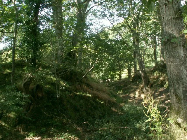
Castell Gwarcwm Nigel Callaghan · CC BY-SA 2.0

Climate of Banc Coed-laith
Best months for sightseeingBest months for sightseeing: July–August.
This month · November
A wet month
Day 9° · Night 3° · Rain 174 mm
- Hottest month
- July (day 18°)
- Coldest month
- February (night 0°)
- Wettest month
- November (174 mm)
- Driest month
- May (81 mm)
Bars: average monthly low and high temperature. Below: precipitation. Monthly averages for 1970–2000 at about 18 km resolution, adjusted for elevation. Highlighted months are mild and relatively dry. Source: WorldClim 2.1 (CC BY 4.0).
Show values as a table
| Month | Jan | Feb | Mar | Apr | May | Jun | Jul | Aug | Sep | Oct | Nov | Dec |
|---|---|---|---|---|---|---|---|---|---|---|---|---|
| Average high (°C) | 6° | 6° | 8° | 10° | 13° | 16° | 18° | 18° | 15° | 12° | 9° | 7° |
| Average low (°C) | 1° | 0° | 2° | 2° | 5° | 8° | 10° | 10° | 8° | 6° | 3° | 2° |
| Precipitation (mm) | 159 | 115 | 132 | 91 | 81 | 98 | 100 | 117 | 128 | 157 | 174 | 171 |
How to get to Banc Coed-laith
The nearest airport is Cardiff International Airport (CWL), 121 km to the south as the crow flies. The nearest large city is Swansea, 89 km to the south.
Airports
- Cardiff International Airport (CWL) Cardiff 121 kmsouth
- Liverpool John Lennon Airport (LPL) Liverpool 125 kmnortheast
- Bristol Airport (BRS) Bristol 143 kmsoutheast
Nearby large cities
- Swansea Population: 300.4K 89 kmsouth
- Telford Population: 155.6K 104 kmeast
- Newport Population: 161.5K 113 kmsoutheast
- Cardiff Population: 372.1K 117 kmsoutheast
- Worcester Population: 101.7K 119 kmeast
Straight-line distances; road distances are longer. Airport data: OurAirports.
Day trips from Banc Coed-laith
Within 100 km: 832 historic and cultural sites, 2,626 natural sites, 211 lakes, rivers and coasts.
0–25 km351 places
- Craig-yr-allt gôch Reservoir Lake 23 kmSE
- Claerwen Reservoir Lake 23 kmSE
- Dinas Mountain 22 kmE
- Cefn Mountain 18 kmN
25–60 km1,260 places
- Mwnt beach Beach 59 kmSW
- Tresaith Beach Beach 52 kmSW
- Llangrannog's Beach Beach 47 kmSW
- Ynys Tywyn Island 57 kmN
60–100 km2,058 places
- Anglesey Island 100 kmN
- Poppit Sands Beach 63 kmSW
- Whistling Sands Beach 71 kmNW
- Traeth Penllech Beach 71 kmNW
Straight-line distances.
Nearest towns and villages
-
Goginan Village, Melindwr1.3 km S
-
Dollwen Village, Melindwr1.5 km SW
-
Capel Bangor Village, Melindwr3.9 km SW
-
Cwmsymlog Village, Trefeurig1.5 km N
-
Cwmbrwyno Village, Melindwr2.2 km SE
-
Banc y Darren Village, Trefeurig1.8 km W
Nearby attractions & nature
Everything nearby-
Banc y Darren Mountain, Trefeurig1.5 km W
-
Banc Trawsnant Mountain, Trefeurig1.7 km NE
-
Banc Hafodau Mountain, Melindwr2.4 km SE
-
Banc y Garn Mountain, Trefeurig2.4 km NE
-
Mynydd March Mountain, Trefeurig3 km NE
-
Esgair Gorlan Mountain, Melindwr3.1 km E
-
Banc Lletty Ifan Hen Mountain, Ceulanamaesmawr3.7 km NE
-
Mynydd Ponterwyd Mountain, Blaenrheidol3.8 km E
Sources & licences
Data last updated: