- Elevation
- 82 m
- above sea level
- Local time
- UTC+00:00
- Europe/London · UTC+00:00
- Airports
- LPL Liverpool John Lennon Airport75 km
- IOM Isle of Man Airport102 km
About Nant-y-Felin
Nant-y-Felin is a neighbourhood. Location: Llanfairfechan, Conwy. The best months to visit are June–August. The nearest airport is Liverpool John Lennon Airport (75 km). Nearby sights include Clip y Orsedd and Penmaen Mawr.
Photos of Nant-y-Felin
-
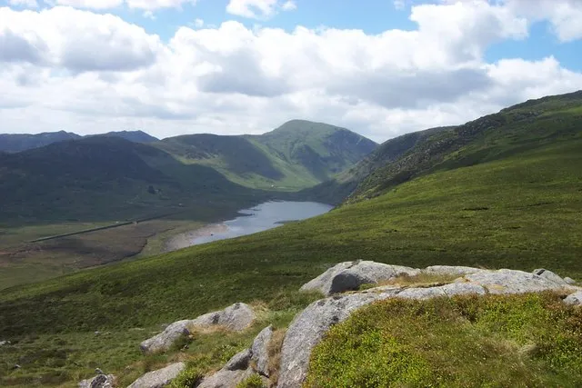
Carneddau see below · CC BY-SA 2.0

Climate of Nant-y-Felin
Best months for sightseeingBest months for sightseeing: June–August.
This month · November
A wet month
Day 10° · Night 5° · Rain 160 mm
- Hottest month
- July (day 20°)
- Coldest month
- February (night 2°)
- Wettest month
- November (160 mm)
- Driest month
- May (77 mm)
Bars: average monthly low and high temperature. Below: precipitation. Monthly averages for 1970–2000 at about 18 km resolution, adjusted for elevation. Highlighted months are mild and relatively dry. Source: WorldClim 2.1 (CC BY 4.0).
Show values as a table
| Month | Jan | Feb | Mar | Apr | May | Jun | Jul | Aug | Sep | Oct | Nov | Dec |
|---|---|---|---|---|---|---|---|---|---|---|---|---|
| Average high (°C) | 8° | 8° | 9° | 12° | 15° | 18° | 20° | 19° | 17° | 14° | 10° | 8° |
| Average low (°C) | 3° | 2° | 3° | 4° | 7° | 10° | 12° | 12° | 10° | 8° | 5° | 4° |
| Precipitation (mm) | 142 | 105 | 121 | 85 | 77 | 84 | 87 | 104 | 119 | 144 | 160 | 153 |
How to get to Nant-y-Felin
The nearest airport is Liverpool John Lennon Airport (LPL), 75 km to the east as the crow flies. The nearest large city is Birkenhead, 66 km to the east.
Airports
- Liverpool John Lennon Airport (LPL) Liverpool 75 kmeast
- Isle of Man Airport (IOM) Castletown, Rushen 102 kmnorthwest
- Manchester Airport (MAN) Manchester, Greater Manchester 113 kmeast
Nearby large cities
- Birkenhead Population: 325.3K 66 kmeast
- Liverpool Population: 496.8K 69 kmeast
- St Helens Population: 183.2K 85 kmeast
- Blackpool Population: 145K 88 kmnortheast
- Warrington Population: 172.3K 94 kmeast
Straight-line distances; road distances are longer. Airport data: OurAirports.
Day trips from Nant-y-Felin
Within 100 km: 372 historic and cultural sites, 1,472 natural sites, 163 lakes, rivers and coasts.
0–25 km260 places
- Anglesey Island 24 kmW
- Traeth Lligwy Beach 23 kmNW
- Puffin Island Island 9 kmNW
- Ynys Moelfre Island 21 kmNW
25–60 km711 places
- Porth Towyn Beach Beach 58 kmSW
- Thurstaston Beach Beach 56 kmE
- Ynys Tywyn Island 38 kmS
- West Mouse Island 43 kmNW
60–100 km1,036 places
- British Isles Island 84 kmN
- Whistling Sands Beach 68 kmSW
- Traeth Penllech Beach 62 kmSW
- Formby Beach Beach 68 kmNE
Straight-line distances.
Nearby attractions & nature
Everything nearby-
Clip y Orsedd Mountain, Llanfairfechan2.7 km E
-
Penmaen Mawr Mountain, Penmaenmawr2.2 km NE
-
Yr Orsedd Mountain, Llanfairfechan2.8 km S
-
Pen y Cydgoed Mountain, Aber2.4 km SW
-
Foel-ganol Mountain, Aber2.6 km S
-
Aber Castle Mound Historic site, Aber3.3 km SW
Sources & licences
Data last updated: