Newcastle Higher
Located in County Borough of Bridgend, Wales Coordinates: 51°31′59″ N 3°36′16″ W
- Elevation
- 91 m
- above sea level
- Local time
- UTC+00:00
- Europe/London · UTC+00:00
- Places inside
- 5
- listed under Newcastle Higher
- Airports
- CWL Cardiff International Airport24 km
- BRS Bristol Airport64 km
About Newcastle Higher
Newcastle Higher is a municipality. Location: County Borough of Bridgend, Wales. Elevation: 91 m. The best months to visit are June–August. The nearest airport is Cardiff International Airport (24 km). Nearby sights include Coity Castle and Mynydd Baedan.
Photos of Newcastle Higher
-
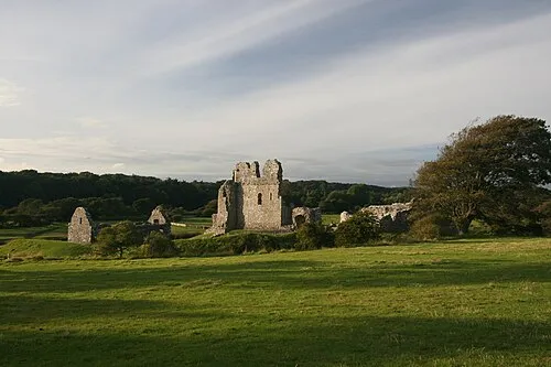
Ogmore Castle Ewan Topping from Amsterdam, Netherlands · CC BY 2.0 -
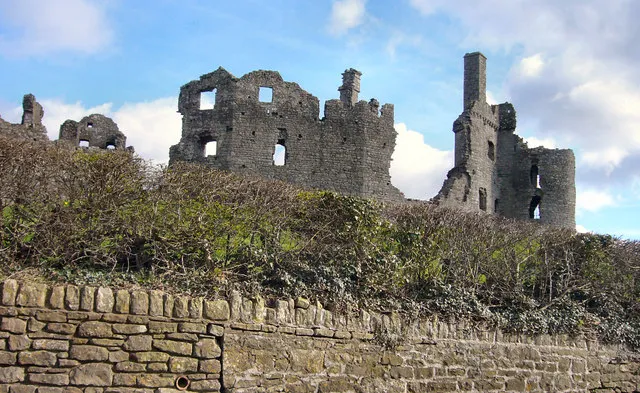
Coity Castle kenneth rees · CC BY-SA 2.0 -
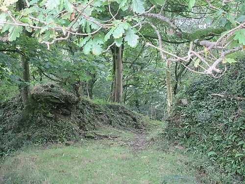
Llangynwyd Castle FruitMonkey · CC BY-SA 4.0


Climate of Newcastle Higher
Best months for sightseeingBest months for sightseeing: June–August.
This month · November
A wet month
Day 11° · Night 5° · Rain 146 mm
- Hottest month
- July (day 20°)
- Coldest month
- February (night 2°)
- Wettest month
- November (146 mm)
- Driest month
- May (76 mm)
Bars: average monthly low and high temperature. Below: precipitation. Monthly averages for 1970–2000 at about 18 km resolution, adjusted for elevation. Highlighted months are mild and relatively dry. Source: WorldClim 2.1 (CC BY 4.0).
Show values as a table
| Month | Jan | Feb | Mar | Apr | May | Jun | Jul | Aug | Sep | Oct | Nov | Dec |
|---|---|---|---|---|---|---|---|---|---|---|---|---|
| Average high (°C) | 8° | 7° | 10° | 12° | 16° | 18° | 20° | 20° | 17° | 14° | 11° | 9° |
| Average low (°C) | 3° | 2° | 3° | 5° | 8° | 10° | 13° | 13° | 11° | 8° | 5° | 4° |
| Precipitation (mm) | 141 | 100 | 107 | 77 | 76 | 80 | 78 | 100 | 113 | 129 | 146 | 143 |
How to get to Newcastle Higher
The nearest airport is Cardiff International Airport (CWL), 24 km to the southeast as the crow flies. The nearest large city is Swansea, 25 km to the northwest.
Airports
- Cardiff International Airport (CWL) Cardiff 24 kmsoutheast
- Bristol Airport (BRS) Bristol 64 kmeast
- Exeter International Airport (EXT) Exeter, Devon 90 kmsouth
Nearby large cities
- Swansea Population: 300.4K 25 kmnorthwest
- Cardiff Population: 372.1K 30 kmeast
- Newport Population: 161.5K 42 kmeast
- Bristol Population: 479K 71 kmeast
- Bath Population: 101.6K 88 kmeast
Straight-line distances; road distances are longer. Airport data: OurAirports.
Day trips from Newcastle Higher
Within 100 km: 835 historic and cultural sites, 1,922 natural sites, 168 lakes, rivers and coasts.
0–25 km203 places
- Mynydd Marchywel Mountain 24 kmNW
- Cefn Eglwysilan Mountain 22 kmE
- Foel Fynyddau Mountain 15 kmNW
- Garth Hill Mountain 22 kmE
25–60 km904 places
- Kilve Beach Beach 46 kmSE
- Worms Head Island 50 kmW
- Steep Holm Island 40 kmSE
- Flat Holm Island 38 kmSE
60–100 km1,818 places
- Poppit Sands Beach 99 kmNW
- Saunton Sands Beach 65 kmSW
- Mouthmill Beach Beach 81 kmSW
- Putsborough Beach Beach 61 kmSW
Straight-line distances.
Places in Newcastle Higher
5 placesBar: population relative to the most populous place in this list.
Cities & villages3
- Court Colman · Village
- Fountain · Village
- Pen-y-fai · Village
Mountains & nature1
- Tycribwr Hill · Mountain
Nearby attractions & nature
Everything nearby-
Coity Castle Historic site, Coity Higher3.7 km E
-
Mynydd Baedan Mountain, Llangynwyd Lower3.3 km NW
-
Llynfi River River, Wales2.4 km NE
-
Coity Castle Seigeworks Historic site, Coity Higher3.7 km E
-
Newcastle Bridgend Castle Historic site, Bridgend3.1 km SE
-
Ogmore Castle Historic site, St. Bride's Major5.9 km S
-
Brackla Hill Mountain, Brackla4.1 km SE
-
Stormy Down Mountain, Laleston4.6 km SW
Other cities and towns in County Borough of Bridgend
-
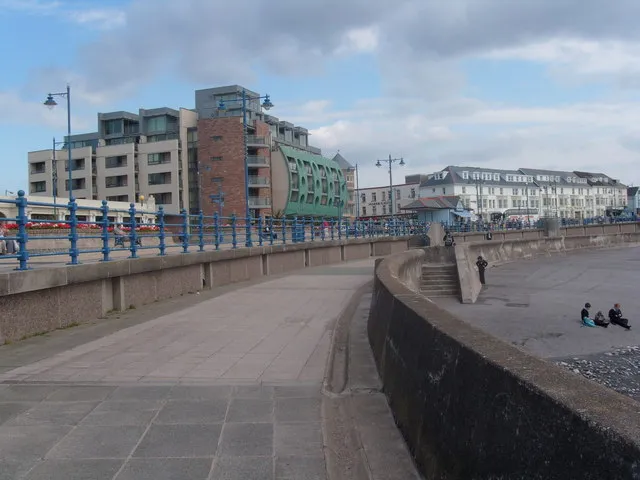 Porthcawl Town, Porthcawl9.1 km SW
-
Coity Higher Municipality, County Borough of Bridgend3.5 km E
-
Bridgend Municipality, County Borough of Bridgend3.8 km SE
-
St. Bride's Minor Municipality, County Borough of Bridgend3.4 km NE
-
Llangynwyd Lower Municipality, County Borough of Bridgend3.2 km NW
-
Brackla Municipality, County Borough of Bridgend4.2 km SE
Sources & licences
Data last updated: