- Elevation
- 440 m
- above sea level
- Local time
- UTC+00:00
- Europe/London · UTC+00:00
- Airports
- LPL Liverpool John Lennon Airport38 km
- MAN Manchester Airport70 km
About Moel y Plas
Moel y Plas is a mountain. Location: Llanarmon-yn-Ial, Denbighshire. Elevation: 440 m. The best months to visit are June–August. The nearest airport is Liverpool John Lennon Airport (38 km). Nearby sights include Moel Llanfair and Moel y Waun.
Photos of Moel y Plas
-
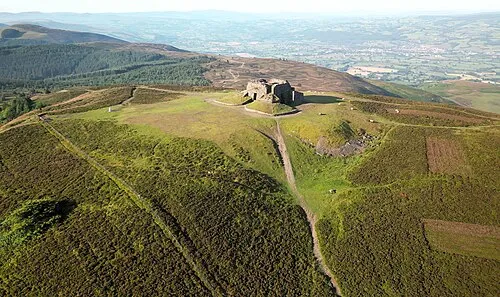
Moel Famau Llywelyn2000 · CC BY-SA 4.0 -
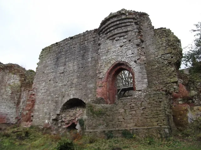
Ruthin Castle Eirian Evans · CC BY-SA 2.0 -
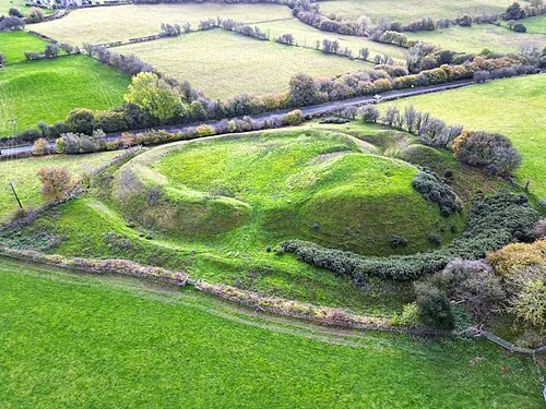
Tomen y Rhodwydd Llywelyn2000 · CC BY-SA 4.0


Climate of Moel y Plas
Best months for sightseeingBest months for sightseeing: June–August.
This month · November
A wet month
Day 8° · Night 2° · Rain 114 mm
- Hottest month
- July (day 18°)
- Coldest month
- February (night -1°)
- Wettest month
- November (114 mm)
- Driest month
- May (65 mm)
Bars: average monthly low and high temperature. Below: precipitation. Monthly averages for 1970–2000 at about 18 km resolution, adjusted for elevation. Highlighted months are mild and relatively dry. Source: WorldClim 2.1 (CC BY 4.0).
Show values as a table
| Month | Jan | Feb | Mar | Apr | May | Jun | Jul | Aug | Sep | Oct | Nov | Dec |
|---|---|---|---|---|---|---|---|---|---|---|---|---|
| Average high (°C) | 5° | 5° | 7° | 9° | 13° | 16° | 18° | 17° | 15° | 11° | 8° | 6° |
| Average low (°C) | -1° | -1° | 0° | 1° | 4° | 7° | 9° | 9° | 7° | 4° | 2° | 0° |
| Precipitation (mm) | 98 | 74 | 87 | 69 | 65 | 74 | 65 | 84 | 93 | 98 | 114 | 106 |
How to get to Moel y Plas
The nearest airport is Liverpool John Lennon Airport (LPL), 38 km to the northeast as the crow flies. The nearest large city is Birkenhead, 37 km to the northeast.
Airports
- Liverpool John Lennon Airport (LPL) Liverpool 38 kmnortheast
- Manchester Airport (MAN) Manchester, Greater Manchester 70 kmnortheast
- Birmingham Airport (BHX) Birmingham, West Midlands 123 kmsoutheast
Nearby large cities
- Birkenhead Population: 325.3K 37 kmnortheast
- Liverpool Population: 496.8K 40 kmnortheast
- St Helens Population: 183.2K 52 kmnortheast
- Warrington Population: 172.3K 55 kmnortheast
- Wigan Population: 175.4K 65 kmnortheast
Straight-line distances; road distances are longer. Airport data: OurAirports.
Day trips from Moel y Plas
Within 100 km: 697 historic and cultural sites, 2,152 natural sites, 201 lakes, rivers and coasts.
0–25 km248 places
- Llyn Brân Lake 21 kmW
- Alwen Reservoir Lake 23 kmW
- Mwdwl-eithin Mountain 20 kmSW
- Cyrn-y-Brain Mountain 8 kmSE
25–60 km1,044 places
- Thurstaston Beach Beach 28 kmN
- Formby Beach Beach 54 kmN
- Ainsdale Beach Beach 59 kmN
- Puffin Island Island 58 kmNW
60–100 km1,758 places
- Anglesey Island 76 kmW
- Traeth Penllech Beach 99 kmW
- Porth Towyn Beach Beach 96 kmW
- Traeth Lligwy Beach 75 kmNW
Straight-line distances.
Nearest towns and villages
-
Llanarmon-yn-Ial Village, Llanarmon-yn-Ial2.1 km E
-
Llanbedr-Dyffryn-Clwyd Village, Llanbedr Dyffryn Clwyd4.5 km NW
-
Ruthin City, Ruthin5.8 km NW
-
Graig-fechan Village, Llanfair Dyffryn Clwyd2.6 km SW
-
Pentre-celyn Village, Llanfair Dyffryn Clwyd3 km SW
-
Plâs-Llanrhydd Village, Llanfair Dyffryn Clwyd3.1 km W
Nearby attractions & nature
Everything nearby-
Moel Llanfair Mountain, Llanfair Dyffryn Clwyd1.1 km N
-
Moel y Waun Mountain, Llanarmon-yn-Ial2 km S
-
Moel Gyw Mountain, Llanbedr Dyffryn Clwyd2.1 km N
-
Pen Llanerch Mountain, Llanarmon-yn-Ial3.7 km NE
-
Moel Eithinen Mountain, Llanbedr Dyffryn Clwyd3.8 km N
-
Tomen y Faerdre Historic site, Llanarmon-yn-Ial2.4 km E
-
Bryn Alyn Mountain, Llanarmon-yn-Ial4.5 km NE
-
Pen-y-Ffrith Mountain, Llandegla4.6 km E
Sources & licences
Data last updated: