- Elevation
- 312 m
- above sea level
- Local time
- UTC+00:00
- Europe/London · UTC+00:00
- Airports
- LPL Liverpool John Lennon Airport34 km
- MAN Manchester Airport64 km
About Maes Maelor
Maes Maelor is a village. Location: Llanfynydd, Flintshire. Elevation: 312 m. The best months to visit are June–August. The nearest airport is Liverpool John Lennon Airport (34 km). Nearby sights include Pen Tan y Bryn and Plas-gwyn Mountain.
Photos of Maes Maelor
-
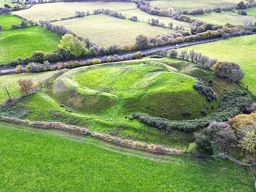
Tomen y Rhodwydd Llywelyn2000 · CC BY-SA 4.0 -
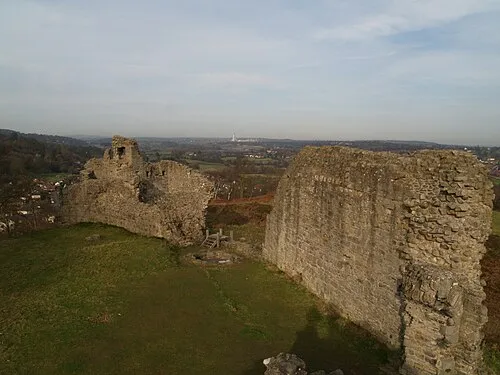
Caergwrle Castle Clint Heacock · CC BY-SA 3.0


Climate of Maes Maelor
Best months for sightseeingBest months for sightseeing: June–August.
This month · November
A wet month
Day 8° · Night 2° · Rain 100 mm
- Hottest month
- July (day 19°)
- Coldest month
- February (night 0°)
- Wettest month
- November (100 mm)
- Driest month
- July (60 mm)
Bars: average monthly low and high temperature. Below: precipitation. Monthly averages for 1970–2000 at about 18 km resolution, adjusted for elevation. Highlighted months are mild and relatively dry. Source: WorldClim 2.1 (CC BY 4.0).
Show values as a table
| Month | Jan | Feb | Mar | Apr | May | Jun | Jul | Aug | Sep | Oct | Nov | Dec |
|---|---|---|---|---|---|---|---|---|---|---|---|---|
| Average high (°C) | 6° | 6° | 8° | 10° | 14° | 16° | 19° | 18° | 15° | 12° | 8° | 7° |
| Average low (°C) | 0° | 0° | 1° | 2° | 5° | 8° | 10° | 10° | 8° | 5° | 2° | 1° |
| Precipitation (mm) | 85 | 64 | 75 | 63 | 62 | 68 | 60 | 76 | 84 | 89 | 100 | 94 |
How to get to Maes Maelor
The nearest airport is Liverpool John Lennon Airport (LPL), 34 km to the northeast as the crow flies. The nearest large city is Birkenhead, 36 km to the north.
Airports
- Liverpool John Lennon Airport (LPL) Liverpool 34 kmnortheast
- Manchester Airport (MAN) Manchester, Greater Manchester 64 kmnortheast
- Birmingham Airport (BHX) Birmingham, West Midlands 116 kmsoutheast
Nearby large cities
- Birkenhead Population: 325.3K 36 kmnorth
- Liverpool Population: 496.8K 39 kmnorth
- St Helens Population: 183.2K 49 kmnortheast
- Warrington Population: 172.3K 51 kmnortheast
- Newcastle-under-Lyme Population: 127.7K 61 kmeast
Straight-line distances; road distances are longer. Airport data: OurAirports.
Day trips from Maes Maelor
Within 100 km: 721 historic and cultural sites, 2,193 natural sites, 204 lakes, rivers and coasts.
0–25 km231 places
- Cyrn-y-Brain Mountain 6 kmSW
- Craig Bron-banog Mountain 23 kmW
- Moel Llys-y-coed Mountain 15 kmNW
- Moel y Gamelin Mountain 10 kmSW
25–60 km1,000 places
- Thurstaston Beach Beach 29 kmN
- Formby Beach Beach 55 kmN
- Ainsdale Beach Beach 60 kmN
- Hilbre Island Island 35 kmN
60–100 km1,887 places
- Anglesey Island 84 kmW
- Traeth Lligwy Beach 82 kmNW
- St Anne's Beach Beach 75 kmN
- Ynys Tywyn Island 69 kmW
Straight-line distances.
Nearby attractions & nature
Everything nearby-
Pen Tan y Bryn Mountain, Llanfynydd0.6 km NE
-
Plas-gwyn Mountain Mountain, Brymbo1.3 km SE
-
Pen-Llan-y-gwr Mountain, Llanfynydd2.2 km NE
-
Moel Garegog NE Top Mountain, Llandegla1.8 km W
-
Moel Garegog Mountain, Llandegla3.1 km W
-
Pen-y-Ffrith Mountain, Llandegla3.1 km W
Sources & licences
Data last updated: