- Elevation
- 113 m
- above sea level
- Local time
- UTC+00:00
- Europe/London · UTC+00:00
- Places inside
- 8
- listed under Goetre Fawr
- Airports
- BRS Bristol Airport44 km
- CWL Cardiff International Airport45 km
About Goetre Fawr
Goetre Fawr is a municipality. Location: Monmouthshire, Wales. Elevation: 113 m. The best months to visit are June–August. The nearest airport is Bristol Airport (44 km). Nearby sights include Trostrey Castle and Pontypool Park.
Photos of Goetre Fawr
-
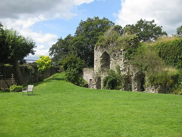
Usk Castle Pauline Eccles · CC BY-SA 2.0 -
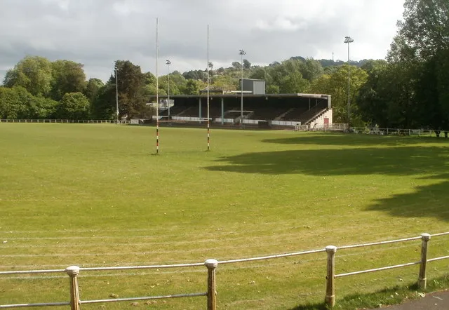
Pontypool Park Jaggery · CC BY-SA 2.0


Climate of Goetre Fawr
Best months for sightseeingBest months for sightseeing: June–August.
This month · November
A cold month
Day 10° · Night 4° · Rain 90 mm
- Hottest month
- July (day 20°)
- Coldest month
- February (night 2°)
- Wettest month
- January (96 mm)
- Driest month
- July (46 mm)
Bars: average monthly low and high temperature. Below: precipitation. Monthly averages for 1970–2000 at about 18 km resolution, adjusted for elevation. Highlighted months are mild and relatively dry. Source: WorldClim 2.1 (CC BY 4.0).
Show values as a table
| Month | Jan | Feb | Mar | Apr | May | Jun | Jul | Aug | Sep | Oct | Nov | Dec |
|---|---|---|---|---|---|---|---|---|---|---|---|---|
| Average high (°C) | 7° | 7° | 9° | 12° | 16° | 18° | 20° | 20° | 17° | 14° | 10° | 8° |
| Average low (°C) | 2° | 2° | 3° | 4° | 7° | 10° | 12° | 12° | 10° | 7° | 4° | 3° |
| Precipitation (mm) | 96 | 68 | 72 | 56 | 59 | 60 | 46 | 72 | 79 | 84 | 90 | 95 |
How to get to Goetre Fawr
The nearest airport is Bristol Airport (BRS), 44 km to the southeast as the crow flies. The nearest large city is Newport, 17 km to the south.
Airports
- Bristol Airport (BRS) Bristol 44 kmsoutheast
- Cardiff International Airport (CWL) Cardiff 45 kmsouthwest
- Exeter International Airport (EXT) Exeter, Devon 116 kmsouth
Nearby large cities
- Newport Population: 161.5K 17 kmsouth
- Cardiff Population: 372.1K 32 kmsouthwest
- Bristol Population: 479K 42 kmsoutheast
- Gloucester Population: 132.4K 54 kmeast
- Bath Population: 101.6K 60 kmsoutheast
Straight-line distances; road distances are longer. Airport data: OurAirports.
Day trips from Goetre Fawr
Within 100 km: 940 historic and cultural sites, 2,103 natural sites, 131 lakes, rivers and coasts.
0–25 km284 places
- Llandegfedd Reservoir Lake 6 kmS
- Alway Mountain 17 kmS
- Sugar Loaf Mountain 14 kmN
- Pen y Gader-fawr Mountain 25 kmN
25–60 km1,046 places
- Steep Holm Island 45 kmS
- Flat Holm Island 41 kmS
- Barry Island Island 43 kmSW
- Sully Island Island 41 kmS
60–100 km1,844 places
- Kilve Beach Beach 63 kmS
- Worms Head Island 94 kmW
- Outer Head Island 95 kmW
- Glover's Island Island 82 kmNE
Straight-line distances.
Places in Goetre Fawr
8 placesCities & villages7
- Croes y pant · Village
- Goetre · Village
- Little Mill · Village
- Mamhilad · Village
- Nant-y-derry · Village
- Pencroesoped · Village
- Penperlleni · Village
Mountains & nature1
- Mynydd Garnclochdy · Mountain
Nearby attractions & nature
Everything nearby-
Trostrey Castle Historic site, Gwehelog Fawr4.5 km E
-
Pontypool Park Landmark, Pontymoile5.3 km SW
-
Castell Crov Historic site, Llanarth4.5 km E
-
Pen Coed Di-haul Mountain, Llanbadoc3.9 km S
-
St Marys Yard Mound Historic site, Llanover3.8 km NE
-
Twyn y Cryn Mountain, Llanbadoc4.5 km S
-
Pant y colin Historic site, Gwehelog Fawr5.4 km E
-
Castle Arnold Historic site, Llanover4.8 km N
Other cities and towns in Monmouthshire
-
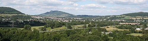 Abergavenny Town, Abergavenny9 km N
-
Gwehelog Fawr Municipality, Monmouthshire6 km E
-
Llanarth Municipality, Monmouthshire8.4 km NE
-
Llangybi Municipality, Monmouthshire9 km S
-
Llanfoist Fawr Municipality, Monmouthshire9 km NW
-
Usk Municipality, Monmouthshire8 km SE
Sources & licences
Data last updated: