Mynydd Marchywel
Located in Cilybebyll, Neath Port Talbot Coordinates: 51°43′09″ N 3°47′05″ W
- Elevation
- 418 m
- above sea level
- Local time
- UTC+00:00
- Europe/London · UTC+00:00
- Airports
- CWL Cardiff International Airport47 km
- BRS Bristol Airport83 km
About Mynydd Marchywel
Mynydd Marchywel is a mountain. Location: Cilybebyll, Neath Port Talbot. Elevation: 418 m. The best months to visit are June–August. The nearest airport is Cardiff International Airport (47 km). Nearby sights include Mynydd Marchywel North Top and Pen Alltwen.
Photos of Mynydd Marchywel
-
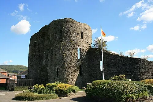
Neath Castle Darren Wyn Rees at Aberdare Blog · CC BY 3.0 -
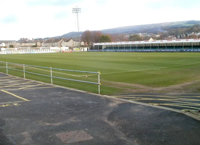
The Gnoll John Grayson · CC BY-SA 2.0


Climate of Mynydd Marchywel
Best months for sightseeingBest months for sightseeing: June–August.
This month · November
A wet month
Day 8° · Night 3° · Rain 156 mm
- Hottest month
- July (day 18°)
- Coldest month
- February (night 0°)
- Wettest month
- November (156 mm)
- Driest month
- May (79 mm)
Bars: average monthly low and high temperature. Below: precipitation. Monthly averages for 1970–2000 at about 18 km resolution, adjusted for elevation. Highlighted months are mild and relatively dry. Source: WorldClim 2.1 (CC BY 4.0).
Show values as a table
| Month | Jan | Feb | Mar | Apr | May | Jun | Jul | Aug | Sep | Oct | Nov | Dec |
|---|---|---|---|---|---|---|---|---|---|---|---|---|
| Average high (°C) | 5° | 5° | 7° | 10° | 13° | 16° | 18° | 18° | 15° | 12° | 8° | 6° |
| Average low (°C) | 0° | 0° | 1° | 3° | 6° | 8° | 11° | 11° | 9° | 6° | 3° | 2° |
| Precipitation (mm) | 152 | 107 | 115 | 83 | 79 | 85 | 83 | 105 | 117 | 139 | 156 | 156 |
How to get to Mynydd Marchywel
The nearest airport is Cardiff International Airport (CWL), 47 km to the southeast as the crow flies. The nearest large city is Swansea, 15 km to the southwest.
Airports
- Cardiff International Airport (CWL) Cardiff 47 kmsoutheast
- Bristol Airport (BRS) Bristol 83 kmsoutheast
- Exeter International Airport (EXT) Exeter, Devon 113 kmsouth
Nearby large cities
- Swansea Population: 300.4K 15 kmsouthwest
- Cardiff Population: 372.1K 50 kmsoutheast
- Newport Population: 161.5K 56 kmeast
- Bristol Population: 479K 87 kmeast
- Bath Population: 101.6K 106 kmeast
Straight-line distances; road distances are longer. Airport data: OurAirports.
Day trips from Mynydd Marchywel
Within 100 km: 879 historic and cultural sites, 2,087 natural sites, 181 lakes, rivers and coasts.
0–25 km224 places
- Middle Head Island 21 kmSW
- Trichrug Mountain 20 kmN
- Fan Gyhirych Mountain 19 kmNE
- Black Mountain Mountain 16 kmN
25–60 km1,014 places
- Worms Head Island 41 kmSW
- Flat Holm Island 60 kmSE
- Barry Island Island 50 kmSE
- Sully Island Island 54 kmSE
60–100 km1,909 places
- Poppit Sands Beach 76 kmNW
- Saunton Sands Beach 75 kmSW
- Mouthmill Beach Beach 90 kmSW
- Putsborough Beach Beach 71 kmSW
Straight-line distances.
Nearest towns and villages
-
Crynant Village, Crynant2.8 km NE
-
 Pontardawe Village, Pontardawe4.5 km W
-
Ystalyfera Town, Ystalyfera5.4 km N
-
Rhos Village, Cilybebyll3 km W
-
Gellinudd Village, Cilybebyll3.1 km W
-
Cilybebyll Village, Cilybebyll3.1 km W
Nearby attractions & nature
Everything nearby-
Mynydd Marchywel North Top Mountain, Cilybebyll2.1 km N
-
Pen Alltwen Mountain, Cilybebyll3.6 km W
-
Mynydd Allt-y-grug Mountain, Ystalyfera4.6 km N
-
Cefnllan Mountain, Pontardawe5.1 km NW
-
Mynydd Drumau Mountain, Dyffryn Clydach5.6 km SW
-
Cefn Gwrhyd Mountain, Pontardawe6.1 km NW
-
Mynydd Gellionnen Mountain, Pontardawe6.5 km W
-
Neath Abbey Craig Mountain, Dyffryn Clydach7 km SW
Sources & licences
Data last updated: