- Elevation
- 426 m
- above sea level
- Local time
- UTC+00:00
- Europe/London · UTC+00:00
- Airports
- LPL Liverpool John Lennon Airport87 km
- BHX Birmingham Airport88 km
About Lan Fawr
Lan Fawr is a mountain. Location: Churchstoke, Powys. Elevation: 426 m. The best months to visit are June–August. The nearest airport is Liverpool John Lennon Airport (87 km). Nearby sights include Corndon Hill and Roundton.
Photos of Lan Fawr
-
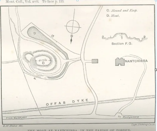
Nantcribba Castle Vize · Public domain

Climate of Lan Fawr
Best months for sightseeingBest months for sightseeing: June–August.
This month · November
A wet month
Day 8° · Night 2° · Rain 100 mm
- Hottest month
- July (day 19°)
- Coldest month
- February (night -1°)
- Wettest month
- December (105 mm)
- Driest month
- July (57 mm)
Bars: average monthly low and high temperature. Below: precipitation. Monthly averages for 1970–2000 at about 18 km resolution, adjusted for elevation. Highlighted months are mild and relatively dry. Source: WorldClim 2.1 (CC BY 4.0).
Show values as a table
| Month | Jan | Feb | Mar | Apr | May | Jun | Jul | Aug | Sep | Oct | Nov | Dec |
|---|---|---|---|---|---|---|---|---|---|---|---|---|
| Average high (°C) | 5° | 5° | 7° | 10° | 14° | 16° | 19° | 18° | 15° | 11° | 8° | 6° |
| Average low (°C) | -1° | -1° | 0° | 2° | 4° | 7° | 9° | 9° | 7° | 4° | 2° | 0° |
| Precipitation (mm) | 102 | 74 | 80 | 63 | 59 | 68 | 57 | 75 | 83 | 91 | 100 | 105 |
How to get to Lan Fawr
The nearest airport is Liverpool John Lennon Airport (LPL), 87 km to the north as the crow flies. The nearest large city is Telford, 42 km to the east.
Airports
- Liverpool John Lennon Airport (LPL) Liverpool 87 kmnorth
- Birmingham Airport (BHX) Birmingham, West Midlands 88 kmeast
- Manchester Airport (MAN) Manchester, Greater Manchester 101 kmnortheast
Nearby large cities
- Telford Population: 155.6K 42 kmeast
- Wolverhampton Population: 263.7K 62 kmeast
- Dudley Population: 199.1K 65 kmeast
- Worcester Population: 101.7K 70 kmsoutheast
- West Bromwich Population: 103.1K 71 kmeast
Straight-line distances; road distances are longer. Airport data: OurAirports.
Day trips from Lan Fawr
Within 100 km: 915 historic and cultural sites, 2,638 natural sites, 181 lakes, rivers and coasts.
0–25 km392 places
- Reservoir Lake 23 kmNE
- Beacon Hill Mountain 23 kmSW
- Stiperstones Mountain 7 kmE
- Corndon Hill Mountain 1 kmE
25–60 km1,318 places
- The Island Island 40 kmSE
- Duckbay Island Island 56 kmNE
- Lake Vyrnwy Lake 41 kmNW
- Pen-y-gareg Reservoir Lake 49 kmSW
60–100 km2,024 places
- Thurstaston Beach Beach 86 kmN
- Ynys Tywyn Island 84 kmNW
- Saint Tudwals Island East Island 99 kmW
- Hilbre Island Island 92 kmN
Straight-line distances.
Nearest towns and villages
-
The Marsh Village, Churchstoke1 km NE
-
Priest Weston Village, Chirbury with Brompton0.9 km NW
-
 Hyssington Village, Churchstoke3 km SE
-
Old Church Stoke Village, Churchstoke2.2 km SW
-
White Grit Village, Churchstoke2.2 km E
-
Fishpool Village, Churchstoke2.3 km E
Nearby attractions & nature
Everything nearby-
Corndon Hill Mountain, Churchstoke0.9 km E
-
Roundton Mountain, Churchstoke1.6 km S
-
Todleth Hill Mountain, Churchstoke2.4 km S
-
Fishpool Hill Mountain, Churchstoke2.5 km SE
-
The Knoll Mountain, Chirbury with Brompton2.5 km NW
-
Stapeley Hill Mountain, Chirbury with Brompton2.9 km NE
-
Bank Farm Top Mountain, Churchstoke2.9 km SE
-
Mucklewick Hill Mountain, Worthen with Shelve3.4 km E
Sources & licences
Data last updated: