- Elevation
- 589 m
- above sea level
- Local time
- UTC+00:00
- Europe/London · UTC+00:00
- Airports
- LPL Liverpool John Lennon Airport80 km
- MAN Manchester Airport109 km
About Carreg y Big
Carreg y Big is a mountain. Location: Llanwddyn, Powys. Elevation: 589 m. The best months to visit are July. The nearest airport is Liverpool John Lennon Airport (80 km). Nearby sights include Moel Llygoed and Mynydd Coch East Top.
Photos of Carreg y Big
-
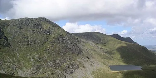
Aran Fawddwy No machine-readable author provided. Velela assumed · Public domain -
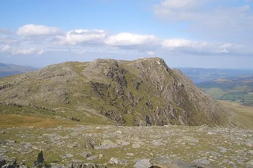
Aran Benllyn Gabby77 · Public domain


Climate of Carreg y Big
Best months for sightseeingBest months for sightseeing: July.
This month · November
A wet month
Day 7° · Night 1° · Rain 176 mm
- Hottest month
- July (day 16°)
- Coldest month
- February (night -1°)
- Wettest month
- December (178 mm)
- Driest month
- May (87 mm)
Bars: average monthly low and high temperature. Below: precipitation. Monthly averages for 1970–2000 at about 18 km resolution, adjusted for elevation. Highlighted months are mild and relatively dry. Source: WorldClim 2.1 (CC BY 4.0).
Show values as a table
| Month | Jan | Feb | Mar | Apr | May | Jun | Jul | Aug | Sep | Oct | Nov | Dec |
|---|---|---|---|---|---|---|---|---|---|---|---|---|
| Average high (°C) | 4° | 4° | 6° | 8° | 12° | 15° | 16° | 16° | 14° | 10° | 7° | 5° |
| Average low (°C) | -1° | -1° | 0° | 1° | 3° | 6° | 8° | 8° | 6° | 4° | 1° | 0° |
| Precipitation (mm) | 168 | 122 | 141 | 98 | 87 | 98 | 94 | 115 | 129 | 155 | 176 | 178 |
Other places to visit in this season: July
How to get to Carreg y Big
The nearest airport is Liverpool John Lennon Airport (LPL), 80 km to the northeast as the crow flies. The nearest large city is Telford, 78 km to the east.
Airports
- Liverpool John Lennon Airport (LPL) Liverpool 80 kmnortheast
- Manchester Airport (MAN) Manchester, Greater Manchester 109 kmnortheast
- Birmingham Airport (BHX) Birmingham, West Midlands 130 kmeast
Nearby large cities
- Telford Population: 155.6K 78 kmeast
- Birkenhead Population: 325.3K 80 kmnortheast
- Liverpool Population: 496.8K 82 kmnortheast
- Newcastle-under-Lyme Population: 127.7K 95 kmeast
- St Helens Population: 183.2K 95 kmnortheast
Straight-line distances; road distances are longer. Airport data: OurAirports.
Day trips from Carreg y Big
Within 100 km: 732 historic and cultural sites, 2,363 natural sites, 185 lakes, rivers and coasts.
0–25 km416 places
- Ynys Goediog Island 22 kmNW
- Lake Vyrnwy Lake 7 kmNE
- Bala Lake Lake 13 kmN
- Llyn Mwyngi Lake 23 kmSW
25–60 km1,506 places
- Ynys Tywyn Island 40 kmNW
- Saint Tudwals Island West Island 59 kmW
- Saint Tudwals Islands Island 59 kmW
- Saint Tudwals Island East Island 58 kmW
60–100 km1,358 places
- Anglesey Island 76 kmNW
- Tresaith Beach Beach 94 kmSW
- Llangrannog's Beach Beach 90 kmSW
- Whistling Sands Beach 77 kmW
Straight-line distances.
Nearest towns and villages
-
 Llanymawddwy Village, Mawddwy2.7 km SW
-
Pennant Village, Mawddwy2.2 km W
-
Mawddwy Municipality, Gwynedd7.6 km SW
-
Llanwddyn Village, Llanwddyn9.1 km E
-
Ddôl Cownwy Village, Llanwddyn9.1 km E
-
Aber Cowarch Village, Mawddwy7.6 km W
Nearby attractions & nature
Everything nearby-
Moel Llygoed Mountain, Mawddwy0.8 km S
-
Mynydd Coch East Top Mountain, Banwy1.3 km E
-
Bryn Glas Mountain, Mawddwy1.4 km N
-
Bryn Mawr Mountain, Llanwddyn3 km NE
-
Foel Lluestbadlon Mountain, Mawddwy3.1 km S
-
Drum Ddu Mountain, Banwy3.4 km S
-
Foel y Groes Mountain, Llanwddyn3.5 km N
-
Y Gribin (old GR) Mountain, Mawddwy3.8 km SW
Sources & licences
Data last updated: