Grimscote
Liegt in Cold Higham, South Northamptonshire District Koordinaten: 52°10′36″ N 1°02′56″ W

- Einwohner
- 241
- 241
- Höhe
- 145 m
- über dem Meeresspiegel
- Ortszeit
- UTC+00:00
- Europe/London · UTC+00:00
- Flughäfen
- BHX Birmingham Airport57 km
- LTN London Luton Airport58 km
Über Grimscote
Grimscote ist ein Dorf. Lage: Cold Higham, South Northamptonshire District. Einwohner: 241. Höhe: 145 m. Die beste Reisezeit: Juni–August. Nächster Flughafen: Birmingham Airport (57 km). In der Nähe: Farthingstone Castle Dykes und Bury Mount.
Fotos: Grimscote
-

Philip Jeffrey · CC BY-SA 2.0 -

Philip Jeffrey · CC BY-SA 2.0 -
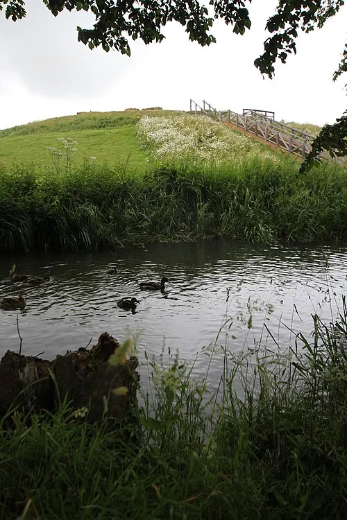
Bury Mount Cj1340 · CC BY-SA 3.0


Klima in Grimscote
Beste Monate für BesichtigungenBeste Monate für Besichtigungen: Juni–August.
Dieser Monat · November
Ein kalter Monat
Tag 9° · Nacht 3° · Regen 59 mm
- Wärmster Monat
- Juli (Tag 21°)
- Kältester Monat
- Februar (Nacht 1°)
- Nassester Monat
- Dezember (61 mm)
- Trockenster Monat
- Februar (42 mm)
Balken: mittlere Monatstiefst- und -höchsttemperatur. Darunter: Niederschlag. Monatsmittel 1970–2000 bei etwa 18 km Auflösung, höhenkorrigiert. Hervorgehobene Monate sind mild und relativ trocken. Quelle: WorldClim 2.1 (CC BY 4.0).
Werte als Tabelle anzeigen
| Monat | Jan | Feb | Mär | Apr | Mai | Jun | Jul | Aug | Sep | Okt | Nov | Dez |
|---|---|---|---|---|---|---|---|---|---|---|---|---|
| Mittleres Maximum (°C) | 6° | 7° | 9° | 12° | 16° | 19° | 21° | 21° | 18° | 14° | 9° | 7° |
| Mittleres Minimum (°C) | 1° | 1° | 2° | 3° | 6° | 9° | 11° | 11° | 9° | 6° | 3° | 2° |
| Niederschlag (mm) | 59 | 42 | 51 | 47 | 51 | 56 | 50 | 59 | 58 | 57 | 59 | 61 |
Anreise nach Grimscote
Nächster Flughafen ist Birmingham Airport (BHX), Luftlinie 57 km Richtung Nordwesten. Nächste Großstadt ist Northampton, 14 km Richtung Nordosten.
Flughäfen
- Birmingham Airport (BHX) Birmingham, West Midlands 57 kmNordwesten
- London Luton Airport (LTN) Luton, Luton 58 kmSüdosten
- East Midlands Airport (EMA) Nottingham, Leicestershire 75 kmNorden
Großstädte in der Nähe
- Northampton Einwohner: 245.899 14 kmNordosten
- Milton Keynes Einwohner: 256.385 25 kmSüdosten
- Bedford Einwohner: 106.940 40 kmOsten
- Coventry Einwohner: 345.324 41 kmNordwesten
- Oxford Einwohner: 162.100 49 kmSüden
Luftlinie; die Straßenentfernung ist länger. Flughafendaten: OurAirports.
Tagesausflüge ab Grimscote
Im Umkreis von 100 km: 864 historische und kulturelle Stätten, 568 Naturorte, 248 Seen, Flüsse und Küsten.
0–25 km86 Orte
- Monkey Island Insel 17 kmS
- Tongwell Lake See 24 kmSO
- Lodge Lake See 24 kmSO
- Oat Hill Berg 25 kmW
25–60 km474 Orte
- Andersey Island Insel 59 kmS
- Rose Isle Insel 53 kmS
- Lock Wood Island Insel 57 kmS
- Abbey Meadow Insel 58 kmS
60–100 km1.120 Orte
- White Hart Lane Wahrzeichen 93 kmSO
- The Lynch Insel 77 kmS
- Holm Island Insel 90 kmSO
- Sunbury Court Insel 97 kmSO
Luftlinie.
Sehenswertes & Natur in der Nähe
Alles in der Nähe-
Farthingstone Castle Dykes Historische Stätte, Farthingstone4,6 km NW
-
Bury Mount Historische Stätte, Towcester6,4 km SO
-
Weedon Lois Castle Mound Historische Stätte, Weston and Weedon8,2 km SW
-
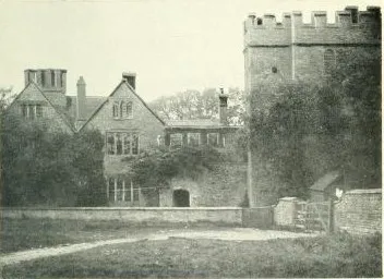 Astwell Castle Historische Stätte, Helmdon10 km SW
-
Canons Ashby Castle Hill Historische Stätte, Canons Ashby8,1 km W
-
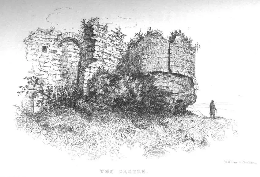 Northampton Castle Historische Stätte, Northampton12 km NO
Quellen & Lizenzen
Daten zuletzt aktualisiert: · 2 unabhängige Quellen