Grimscote
Located in Cold Higham, South Northamptonshire District Coordinates: 52°10′36″ N 1°02′56″ W

- Population
- 241
- 241
- Elevation
- 145 m
- above sea level
- Local time
- UTC+00:00
- Europe/London · UTC+00:00
- Airports
- BHX Birmingham Airport57 km
- LTN London Luton Airport58 km
About Grimscote
Grimscote is a village. Location: Cold Higham, South Northamptonshire District. Population: 241. Elevation: 145 m.
Grimscote is a hamlet in the civil parish of Cold Higham, in the West Northamptonshire district of Northamptonshire, England. Grimscote is one of 4 settlements (Cold Higham, Fosters Booth (West) and Potcote) that make up Cold Higham parish. According to the 2011 UK census, the population in Grimscote in 2011 was 241. It is understood that the name Grimscote means "Grim's Cott", Grim being another name for Woden.
Source: Wikipedia · CC BY-SA 4.0
Photos of Grimscote
-

Philip Jeffrey · CC BY-SA 2.0 -

Philip Jeffrey · CC BY-SA 2.0 -
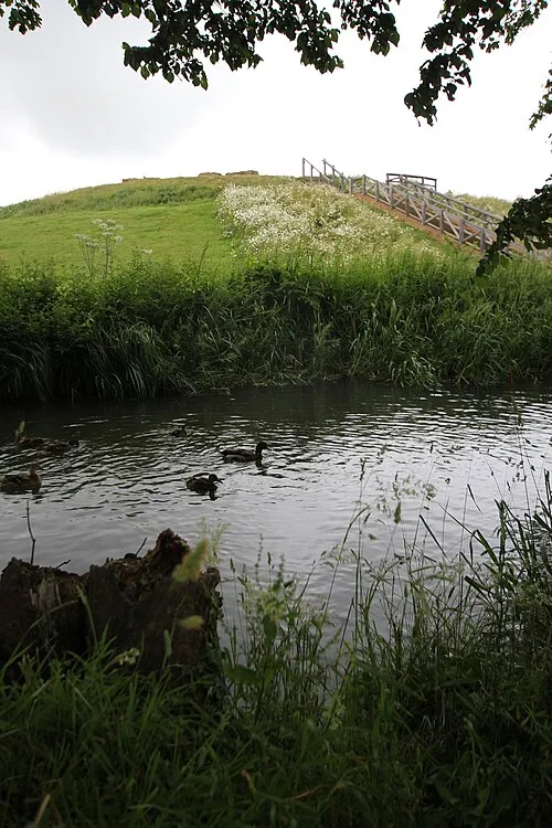
Bury Mount Cj1340 · CC BY-SA 3.0


Climate of Grimscote
Best months for sightseeingBest months for sightseeing: June–August.
This month · November
A cold month
Day 9° · Night 3° · Rain 59 mm
- Hottest month
- July (day 21°)
- Coldest month
- February (night 1°)
- Wettest month
- December (61 mm)
- Driest month
- February (42 mm)
Bars: average monthly low and high temperature. Below: precipitation. Monthly averages for 1970–2000 at about 18 km resolution, adjusted for elevation. Highlighted months are mild and relatively dry. Source: WorldClim 2.1 (CC BY 4.0).
Show values as a table
| Month | Jan | Feb | Mar | Apr | May | Jun | Jul | Aug | Sep | Oct | Nov | Dec |
|---|---|---|---|---|---|---|---|---|---|---|---|---|
| Average high (°C) | 6° | 7° | 9° | 12° | 16° | 19° | 21° | 21° | 18° | 14° | 9° | 7° |
| Average low (°C) | 1° | 1° | 2° | 3° | 6° | 9° | 11° | 11° | 9° | 6° | 3° | 2° |
| Precipitation (mm) | 59 | 42 | 51 | 47 | 51 | 56 | 50 | 59 | 58 | 57 | 59 | 61 |
How to get to Grimscote
The nearest airport is Birmingham Airport (BHX), 57 km to the northwest as the crow flies. The nearest large city is Northampton, 14 km to the northeast.
Airports
- Birmingham Airport (BHX) Birmingham, West Midlands 57 kmnorthwest
- London Luton Airport (LTN) Luton, Luton 58 kmsoutheast
- East Midlands Airport (EMA) Nottingham, Leicestershire 75 kmnorth
Nearby large cities
- Northampton Population: 245.9K 14 kmnortheast
- Milton Keynes Population: 256.4K 25 kmsoutheast
- Bedford Population: 106.9K 40 kmeast
- Coventry Population: 345.3K 41 kmnorthwest
- Oxford Population: 162.1K 49 kmsouth
Straight-line distances; road distances are longer. Airport data: OurAirports.
Day trips from Grimscote
Within 100 km: 864 historic and cultural sites, 568 natural sites, 248 lakes, rivers and coasts.
0–25 km86 places
- Monkey Island Island 17 kmS
- Tongwell Lake Lake 24 kmSE
- Lodge Lake Lake 24 kmSE
- Oat Hill Mountain 25 kmW
25–60 km474 places
- Andersey Island Island 59 kmS
- Rose Isle Island 53 kmS
- Lock Wood Island Island 57 kmS
- Abbey Meadow Island 58 kmS
60–100 km1,120 places
- White Hart Lane Landmark 93 kmSE
- The Lynch Island 77 kmS
- Holm Island Island 90 kmSE
- Sunbury Court Island 97 kmSE
Straight-line distances.
Nearby attractions & nature
Everything nearby-
Farthingstone Castle Dykes Historic site, Farthingstone4.6 km NW
-
Bury Mount Historic site, Towcester6.4 km SE
-
Weedon Lois Castle Mound Historic site, Weston and Weedon8.2 km SW
-
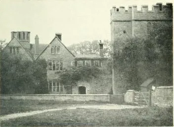 Astwell Castle Historic site, Helmdon10 km SW
-
Sewardsley Priory Historic site, Easton Neston7.1 km SE
-
Canons Ashby Castle Hill Historic site, Canons Ashby8.1 km W
Sources & licences
Data last updated: · 2 independent sources