Oberleidenberg
Located in Wolfsberg, Politischer Bezirk Wolfsberg Coordinates: 46°53′12″ N 14°47′33″ E
- Population
- 378
- 378
- Elevation
- 1,022 m
- above sea level
- Local time
- UTC+01:00
- Europe/Vienna · UTC+01:00
- Airports
- KLU Klagenfurt Airport44 km
- GRZ Graz Airport51 km
About Oberleidenberg
Oberleidenberg is a village. Location: Wolfsberg, Politischer Bezirk Wolfsberg. Population: 378. Elevation: 1,022 m. The best months to visit are June–September. The nearest airport is Klagenfurt Airport (44 km). Nearby sights include Bischofeck and Lavanttal-Arena.
Climate of Oberleidenberg
Best months for sightseeingBest months for sightseeing: June–September.
This month · November
A cold month
Day 5° · Night -3° · Rain 96 mm
- Hottest month
- July (day 21°)
- Coldest month
- January (night -8°)
- Wettest month
- July (154 mm)
- Driest month
- January (50 mm)
Bars: average monthly low and high temperature. Below: precipitation. Monthly averages for 1970–2000 at about 18 km resolution, adjusted for elevation. Highlighted months are mild and relatively dry. Source: WorldClim 2.1 (CC BY 4.0).
Show values as a table
| Month | Jan | Feb | Mar | Apr | May | Jun | Jul | Aug | Sep | Oct | Nov | Dec |
|---|---|---|---|---|---|---|---|---|---|---|---|---|
| Average high (°C) | 1° | 3° | 6° | 10° | 16° | 19° | 21° | 21° | 17° | 12° | 5° | 1° |
| Average low (°C) | -8° | -7° | -4° | 0° | 5° | 8° | 10° | 10° | 6° | 2° | -3° | -6° |
| Precipitation (mm) | 50 | 54 | 81 | 92 | 107 | 149 | 154 | 136 | 116 | 102 | 96 | 74 |
Other places to visit in this season: June July August September
How to get to Oberleidenberg
The nearest airport is Klagenfurt Airport (KLU), 44 km to the southwest as the crow flies. The nearest large city is Klagenfurt, 47 km to the southwest.
Airports
- Klagenfurt Airport (KLU) Klagenfurt am Wörthersee 44 kmsouthwest
- Graz Airport (GRZ) Feldkirchen bei Graz 51 kmeast
- Ljubljana Jože Pučnik Airport (LJU) Zgornji Brnik 78 kmsouth
Nearby large cities
- Klagenfurt Population: 100.3K 47 kmsouthwest
- Graz Population: 303.3K 53 kmeast
- Ljubljana Population: 272.2K 95 kmsouth
- Zagreb Population: 663.6K 150 kmsoutheast
- Linz Population: 204.8K 162 kmnorth
Straight-line distances; road distances are longer. Airport data: OurAirports.
Day trips from Oberleidenberg
Within 100 km: 288 historic and cultural sites, 2,047 natural sites, 735 lakes, rivers and coasts.
0–25 km141 places
- Wildsee Lake 23 kmNW
- Raucheck Mountain 12 kmSE
- Moschkogel Mountain 17 kmSE
- Zoderkogel Mountain 9 kmSE
25–60 km878 places
- Ribnica Lake Lake 56 kmSE
- Mrzla Gora Mountain 60 kmS
- Raduha Mountain 52 kmS
- Olševa Mountain 51 kmS
60–100 km2,051 places
- Lake Bohinj Lake 98 kmSW
- Lake Bled Lake 79 kmSW
- Triglav Mountain 92 kmSW
- Šmarna gora Mountain 88 kmS
Straight-line distances.
Nearby attractions & nature
Everything nearby-
Bischofeck Mountain, Wolfsberg5.6 km NW
-
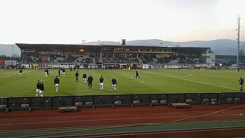 Lavanttal-Arena Landmark, Wolfsberg8.1 km SE
-
Talübergang Lavant Landmark, Bad St. Leonhard im Lavanttal5.3 km NE
-
Schulterkogel Mountain, Bad St. Leonhard im Lavanttal5.5 km N
-
Waldensteiner Bach River, Carinthia5.5 km NE
-
Übelskogel Mountain, Bad St. Leonhard im Lavanttal6.8 km NE
Sources & licences
Data last updated: