Schwaig
Located in Baldramsdorf, Spittal an der Drau District Coordinates: 46°47′00″ N 13°29′00″ E
- Population
- 83
- 83
- Elevation
- 590 m
- above sea level
- Local time
- UTC+01:00
- Europe/Vienna · UTC+01:00
- Airports
- KLU Klagenfurt Airport67 km
- LJU Ljubljana Jože Pučnik Airport97 km
About Schwaig
Schwaig is a village. Location: Baldramsdorf, Spittal an der Drau District. Population: 83. Elevation: 590 m. The best months to visit are June–September. The nearest airport is Klagenfurt Airport (67 km). Nearby sights include Martennock and Schloss Schüttbach.
Climate of Schwaig
Best months for sightseeingBest months for sightseeing: June–September.
This month · November
A wet month
Day 8° · Night 1° · Rain 124 mm
- Hottest month
- July (day 24°)
- Coldest month
- January (night -4°)
- Wettest month
- July (164 mm)
- Driest month
- February (61 mm)
Bars: average monthly low and high temperature. Below: precipitation. Monthly averages for 1970–2000 at about 18 km resolution, adjusted for elevation. Highlighted months are mild and relatively dry. Source: WorldClim 2.1 (CC BY 4.0).
Show values as a table
| Month | Jan | Feb | Mar | Apr | May | Jun | Jul | Aug | Sep | Oct | Nov | Dec |
|---|---|---|---|---|---|---|---|---|---|---|---|---|
| Average high (°C) | 4° | 6° | 9° | 13° | 18° | 22° | 24° | 24° | 20° | 15° | 8° | 5° |
| Average low (°C) | -4° | -3° | 0° | 3° | 8° | 11° | 13° | 13° | 10° | 5° | 1° | -3° |
| Precipitation (mm) | 71 | 61 | 85 | 111 | 131 | 161 | 164 | 147 | 141 | 136 | 124 | 90 |
Other places to visit in this season: June July August September
How to get to Schwaig
The nearest airport is Klagenfurt Airport (KLU), 67 km to the east as the crow flies. The nearest large city is Klagenfurt, 65 km to the east.
Airports
- Klagenfurt Airport (KLU) Klagenfurt am Wörthersee 67 kmeast
- Ljubljana Jože Pučnik Airport (LJU) Zgornji Brnik 97 kmsoutheast
- Trieste Airport (TRS) Ronchi dei Legionari/Trieste 106 kmsouth
Nearby large cities
- Klagenfurt Population: 100.3K 65 kmeast
- Salzburg Population: 157.2K 118 kmnorth
- Graz Population: 303.3K 152 kmeast
- Innsbruck Population: 132.5K 167 kmwest
- Rijeka Population: 108K 178 kmsoutheast
Straight-line distances; road distances are longer. Airport data: OurAirports.
Day trips from Schwaig
Within 100 km: 231 historic and cultural sites, 3,178 natural sites, 836 lakes, rivers and coasts.
0–25 km230 places
- Weissensee Lake 13 kmSW
- Unterer Zwenberger See Lake 22 kmNW
- Lake Pressegg Lake 18 kmS
- Oberer Zwenberger See Lake 23 kmNW
25–60 km1,114 places
- Vorderer Langtalsee Lake 59 kmNW
- Wildsee Lake 54 kmN
- Brettersee Lake 60 kmNW
- Kachelsee Lake 59 kmNW
60–100 km2,901 places
- Hoher Dachstein Mountain 78 kmN
- Sille River 80 kmW
- Fürlegsee Lake 77 kmNW
- Seeriessee Lake 66 kmN
Straight-line distances.
Nearby attractions & nature
Everything nearby-
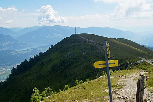 Martennock Mountain, Baldramsdorf1.9 km S
-
Schloss Schüttbach Historic site, Spittal an der Drau1.3 km E
-
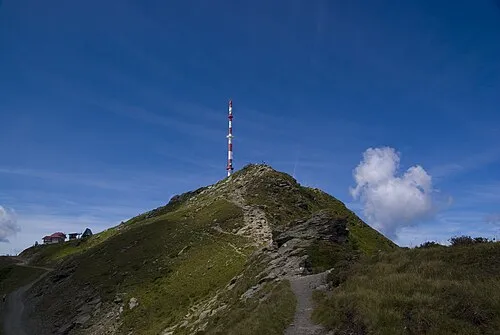 Goldeck Mountain, Baldramsdorf3.2 km SW
-
Ortenburg Historic site, Baldramsdorf3.1 km NW
-
Oberer Fratres Berg Mountain, Seeboden3.7 km N
-
Sender Goldeck Landmark, Stockenboi3.3 km SW
Sources & licences
Data last updated: