Rechberg
Located in Eisenkappel-Vellach, Völkermarkt District Coordinates: 46°31′42″ N 14°34′46″ E
- Population
- 142
- 142
- Elevation
- 587 m
- above sea level
- Local time
- UTC+01:00
- Europe/Vienna · UTC+01:00
- Airports
- KLU Klagenfurt Airport22 km
- LJU Ljubljana Jože Pučnik Airport35 km
About Rechberg
Rechberg is a village. Location: Eisenkappel-Vellach, Völkermarkt District. Population: 142. Elevation: 587 m. The best months to visit are May–August. The nearest airport is Klagenfurt Airport (22 km). Nearby sights include Jegartkogel and Jovanberg.
Photos of Rechberg
-
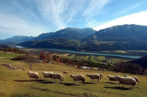
Hochobir Johann Jaritz · CC BY-SA 4.0 -
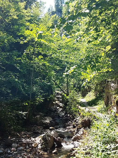
Kupitzklamm Stuhlfauth Thomas · CC BY-SA 4.0 -
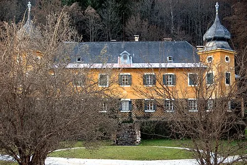
Schloss Hagenegg Johann Jaritz · CC BY-SA 4.0


Climate of Rechberg
Best months for sightseeingBest months for sightseeing: May–August.
This month · November
A wet month
Day 6° · Night -1° · Rain 113 mm
- Hottest month
- July (day 24°)
- Coldest month
- January (night -7°)
- Wettest month
- June (137 mm)
- Driest month
- January (48 mm)
Bars: average monthly low and high temperature. Below: precipitation. Monthly averages for 1970–2000 at about 18 km resolution, adjusted for elevation. Highlighted months are mild and relatively dry. Source: WorldClim 2.1 (CC BY 4.0).
Show values as a table
| Month | Jan | Feb | Mar | Apr | May | Jun | Jul | Aug | Sep | Oct | Nov | Dec |
|---|---|---|---|---|---|---|---|---|---|---|---|---|
| Average high (°C) | 1° | 4° | 9° | 13° | 19° | 22° | 24° | 23° | 19° | 13° | 6° | 1° |
| Average low (°C) | -7° | -6° | -2° | 2° | 7° | 10° | 12° | 11° | 8° | 3° | -1° | -5° |
| Precipitation (mm) | 48 | 50 | 73 | 92 | 96 | 137 | 137 | 119 | 112 | 115 | 113 | 73 |
How to get to Rechberg
The nearest airport is Klagenfurt Airport (KLU), 22 km to the northwest as the crow flies. The nearest large city is Klagenfurt, 24 km to the northwest.
Airports
- Klagenfurt Airport (KLU) Klagenfurt am Wörthersee 22 kmnorthwest
- Ljubljana Jože Pučnik Airport (LJU) Zgornji Brnik 35 kmsouth
- Graz Airport (GRZ) Feldkirchen bei Graz 83 kmnortheast
Nearby large cities
- Klagenfurt Population: 100.3K 24 kmnorthwest
- Ljubljana Population: 272.2K 53 kmsouth
- Graz Population: 303.3K 89 kmnortheast
- Zagreb Population: 663.6K 134 kmsoutheast
- Rijeka Population: 108K 134 kmsouth
Straight-line distances; road distances are longer. Airport data: OurAirports.
Day trips from Rechberg
Within 100 km: 206 historic and cultural sites, 1,159 natural sites, 482 lakes, rivers and coasts.
0–25 km216 places
- Mrzla Gora Mountain 18 kmS
- Grintavec Mountain 19 kmS
- Kalški Greben Mountain 22 kmS
- Storžič Mountain 24 kmSW
25–60 km430 places
- Ribnica Lake Lake 53 kmE
- Lake Bled Lake 41 kmSW
- Triglav Mountain 59 kmW
- Šmarna gora Mountain 45 kmS
60–100 km1,201 places
- Raša River 96 kmSW
- Lake Bohinj Lake 61 kmSW
- Prestreljenik Mountain 87 kmW
- Porezen Mountain 61 kmSW
Straight-line distances.
Nearby attractions & nature
Everything nearby-
Jegartkogel Mountain, Sittersdorf3.1 km E
-
Jovanberg Mountain, Eisenkappel-Vellach4.6 km SW
-
Ruine Türkenschanze Historic site, Eisenkappel-Vellach3.7 km S
-
Altberg Mountain, Gallizien3.6 km W
-
Schloss Hagenegg Historic site, Eisenkappel-Vellach5.4 km S
-
Waschnig Mountain, Eisenkappel-Vellach4.9 km S
Sources & licences
Data last updated: