Fadenthal
Located in St. Aegyd am Neuwalde, Politischer Bezirk Lilienfeld Coordinates: 47°49′31″ N 15°21′49″ E
- Elevation
- 893 m
- above sea level
- Local time
- UTC+01:00
- Europe/Vienna · UTC+01:00
- Airports
- GRZ Graz Airport93 km
- VIE Vienna International Airport95 km
About Fadenthal
Fadenthal is a village. Location: St. Aegyd am Neuwalde, Politischer Bezirk Lilienfeld. Elevation: 893 m. The best months to visit are June–September. The nearest airport is Graz Airport (93 km). Nearby sights include Grosser Sulzberg and Kleiner Sulzberg.
Photos of Fadenthal
-
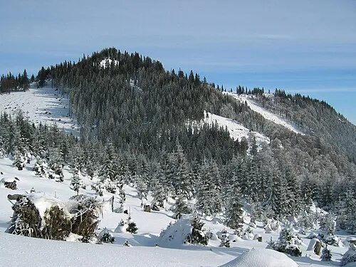
Grosser Sulzberg Michael Schmid · CC BY-SA 4.0 -
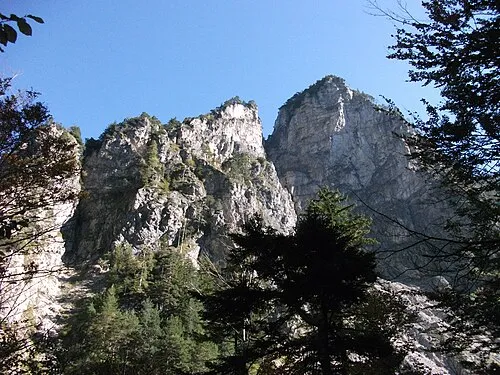
Hintere Tormäuer Edelmauswaldgeist · CC0 -
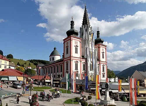
Mariazell Basilica C.Stadler/Bwag · CC BY-SA 3.0 at


Climate of Fadenthal
Best months for sightseeingBest months for sightseeing: June–September.
This month · November
A cold month
Day 6° · Night -2° · Rain 79 mm
- Hottest month
- July (day 21°)
- Coldest month
- January (night -5°)
- Wettest month
- July (166 mm)
- Driest month
- February (65 mm)
Bars: average monthly low and high temperature. Below: precipitation. Monthly averages for 1970–2000 at about 18 km resolution, adjusted for elevation. Highlighted months are mild and relatively dry. Source: WorldClim 2.1 (CC BY 4.0).
Show values as a table
| Month | Jan | Feb | Mar | Apr | May | Jun | Jul | Aug | Sep | Oct | Nov | Dec |
|---|---|---|---|---|---|---|---|---|---|---|---|---|
| Average high (°C) | 2° | 3° | 6° | 10° | 16° | 19° | 21° | 21° | 17° | 12° | 6° | 3° |
| Average low (°C) | -5° | -5° | -2° | 1° | 6° | 9° | 11° | 10° | 7° | 3° | -2° | -4° |
| Precipitation (mm) | 67 | 65 | 87 | 88 | 118 | 141 | 166 | 134 | 112 | 79 | 79 | 77 |
Other places to visit in this season: June July August September
How to get to Fadenthal
The nearest airport is Graz Airport (GRZ), 93 km to the south as the crow flies. The nearest large city is Graz, 84 km to the south.
Airports
- Graz Airport (GRZ) Feldkirchen bei Graz 93 kmsouth
- Vienna International Airport (VIE) Vienna 95 kmeast
- Linz-Hörsching Airport (LNZ) Linz 99 kmnorthwest
Nearby large cities
- Graz Population: 303.3K 84 kmsouth
- Linz Population: 204.8K 97 kmnorthwest
- Bratislava Population: 423.7K 135 kmeast
- Klagenfurt Population: 100.3K 156 kmsouthwest
- Győr Population: 129.3K 171 kmeast
Straight-line distances; road distances are longer. Airport data: OurAirports.
Day trips from Fadenthal
Within 100 km: 558 historic and cultural sites, 2,129 natural sites, 609 lakes, rivers and coasts.
0–25 km187 places
- Türnsee Lake 25 kmSW
- Obersee Lake 22 kmW
- Mittersee Lake 22 kmW
- Lunzer See Lake 24 kmW
25–60 km702 places
- Gassner Camel Riding School Natural site 49 kmN
- Teufelssee Lake 38 kmSW
- Sackwiesensee Lake 35 kmSW
- Leopoldsteiner See Lake 48 kmSW
60–100 km2,407 places
- Klamm Natural site 86 kmSW
- Gusen I Concentration Camp Historic site 83 kmNW
- Donauinsel Island 92 kmNE
- Treffnersee Lake 69 kmSW
Straight-line distances.
Nearby attractions & nature
Everything nearby-
Grosser Sulzberg Mountain, St. Aegyd am Neuwalde1.7 km NE
-
Kleiner Sulzberg Mountain, St. Aegyd am Neuwalde2.9 km E
-
Büchleralpe Mountain, Mitterbach am Erlaufsee2.4 km W
-
Hubertus see Lake, Styria1.9 km S
-
Dreispitz Mountain, Mariazell3.2 km SE
-
Garschkogel Mountain, Annaberg4.8 km NE
Sources & licences
Data last updated: