Nölling
Located in Dunkelsteinerwald, Politischer Bezirk Melk Coordinates: 48°15′00″ N 15°26′00″ E
- Population
- 36
- 36
- Elevation
- 458 m
- above sea level
- Local time
- UTC+01:00
- Europe/Vienna · UTC+01:00
- Airports
- VIE Vienna International Airport86 km
- LNZ Linz-Hörsching Airport93 km
About Nölling
Nölling is a village. Location: Dunkelsteinerwald, Politischer Bezirk Melk. Population: 36. Elevation: 458 m.
Nölling is a settlement in the municipality of Dunkelsteinerwald in Melk District, Lower Austria in northeastern Austria.
Source: Wikipedia · CC BY-SA 4.0
Photos of Nölling
-
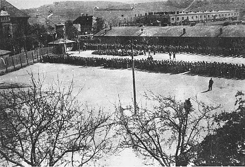
Melk Concentration Camp Unknown author Unknown author · Public domain

Climate of Nölling
Best months for sightseeingBest months for sightseeing: June–August.
This month · November
A cold month
Day 6° · Night -1° · Rain 48 mm
- Hottest month
- July (day 23°)
- Coldest month
- January (night -5°)
- Wettest month
- July (93 mm)
- Driest month
- January (30 mm)
Bars: average monthly low and high temperature. Below: precipitation. Monthly averages for 1970–2000 at about 18 km resolution, adjusted for elevation. Highlighted months are mild and relatively dry. Source: WorldClim 2.1 (CC BY 4.0).
Show values as a table
| Month | Jan | Feb | Mar | Apr | May | Jun | Jul | Aug | Sep | Oct | Nov | Dec |
|---|---|---|---|---|---|---|---|---|---|---|---|---|
| Average high (°C) | 2° | 3° | 8° | 13° | 18° | 21° | 23° | 23° | 18° | 12° | 6° | 3° |
| Average low (°C) | -5° | -5° | -1° | 2° | 7° | 10° | 12° | 12° | 8° | 4° | -1° | -4° |
| Precipitation (mm) | 30 | 32 | 42 | 52 | 72 | 89 | 93 | 80 | 56 | 40 | 48 | 38 |
How to get to Nölling
The nearest airport is Vienna International Airport (VIE), 86 km to the east as the crow flies. The nearest large city is Linz, 85 km to the west.
Airports
- Vienna International Airport (VIE) Vienna 86 kmeast
- Linz-Hörsching Airport (LNZ) Linz 93 kmwest
- České Budějovice South Bohemian Airport (JCL) České Budějovice 107 kmnorthwest
Nearby large cities
- Linz Population: 204.8K 85 kmwest
- Bratislava Population: 423.7K 125 kmeast
- Graz Population: 303.3K 131 kmsouth
- Brno Population: 404.3K 136 kmnortheast
- Győr Population: 129.3K 176 kmeast
Straight-line distances; road distances are longer. Airport data: OurAirports.
Day trips from Nölling
Within 100 km: 542 historic and cultural sites, 2,216 natural sites, 551 lakes, rivers and coasts.
0–25 km61 places
- Gassner Camel Riding School Natural site 12 kmW
- Weitenberg Mountain 19 kmN
- Wachtberg Mountain 20 kmW
- Wachberg Mountain 7 kmSW
25–60 km795 places
- Waldsee Lake 46 kmE
- Vienna Forest Lake Lake 51 kmE
- Obersee Lake 57 kmSW
- Mittersee Lake 54 kmSW
60–100 km2,453 places
- Gusen I Concentration Camp Historic site 72 kmW
- Donauinsel Island 78 kmE
- Steinsee Lake 67 kmE
- Schellensee Lake 66 kmE
Straight-line distances.
Nearby attractions & nature
Everything nearby-
Hohenwartberg Mountain, Schönbühel-Aggsbach3.9 km N
-
Hohenegg Historic site, Hafnerbach3.7 km E
-
Dunkelsteiner Wald Natural site, Lower Austria3.7 km E
-
Melk Concentration Camp Historic site, Melk6.7 km SW
-
Wachberg Mountain, Melk6.7 km SW
-
Sierning River, Lower Austria5.7 km S
Other cities and towns in Dunkelsteinerwald
-
Lottersberg Village, Dunkelsteinerwald3.1 km NE
-
 Gansbach Village, Dunkelsteinerwald6.8 km NE
-
Mauer bei Melk Village, Dunkelsteinerwald2.9 km SW
-
Neu-Gerolding Village, Dunkelsteinerwald2.1 km SW
-
Hohenwarth Village, Dunkelsteinerwald1.7 km NW
-
Kochholz Village, Dunkelsteinerwald2.6 km NE
Sources & licences
Data last updated: · 2 independent sources