Lutschaun
Located in Sankt Barbara im Mürztal, Bruck-Mürzzuschlag District Coordinates: 47°32′27″ N 15°30′25″ E
- Population
- 453
- 453
- Elevation
- 638 m
- above sea level
- Local time
- UTC+01:00
- Europe/Vienna · UTC+01:00
- Airports
- GRZ Graz Airport61 km
- VIE Vienna International Airport102 km
About Lutschaun
Lutschaun is a village. Location: Sankt Barbara im Mürztal, Bruck-Mürzzuschlag District. Population: 453. Elevation: 638 m. The best months to visit are June–September. The nearest airport is Graz Airport (61 km). Nearby sights include Lutschaun and Mehlstüblberg.
Photos of Lutschaun
-
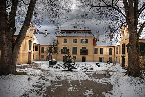
Schloss Oberkindberg ThomasW01 · CC BY 3.0 -
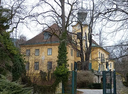
Schloss Feistritz Niki.L · CC BY-SA 4.0


Climate of Lutschaun
Best months for sightseeingBest months for sightseeing: June–September.
This month · November
A cold month
Day 7° · Night 0° · Rain 75 mm
- Hottest month
- July (day 23°)
- Coldest month
- January (night -5°)
- Wettest month
- July (148 mm)
- Driest month
- January (56 mm)
Bars: average monthly low and high temperature. Below: precipitation. Monthly averages for 1970–2000 at about 18 km resolution, adjusted for elevation. Highlighted months are mild and relatively dry. Source: WorldClim 2.1 (CC BY 4.0).
Show values as a table
| Month | Jan | Feb | Mar | Apr | May | Jun | Jul | Aug | Sep | Oct | Nov | Dec |
|---|---|---|---|---|---|---|---|---|---|---|---|---|
| Average high (°C) | 3° | 5° | 8° | 12° | 18° | 21° | 23° | 23° | 19° | 14° | 7° | 4° |
| Average low (°C) | -5° | -4° | -1° | 3° | 7° | 10° | 12° | 12° | 9° | 5° | 0° | -3° |
| Precipitation (mm) | 56 | 56 | 77 | 79 | 108 | 131 | 148 | 124 | 102 | 77 | 75 | 68 |
Other places to visit in this season: June July August September
How to get to Lutschaun
The nearest airport is Graz Airport (GRZ), 61 km to the south as the crow flies. The nearest large city is Graz, 53 km to the south.
Airports
- Graz Airport (GRZ) Feldkirchen bei Graz 61 kmsouth
- Vienna International Airport (VIE) Vienna 102 kmnortheast
- Maribor Edvard Rusjan Airport (MBX) Maribor 119 kmsouth
Nearby large cities
- Graz Population: 303.3K 53 kmsouth
- Linz Population: 204.8K 125 kmnorthwest
- Klagenfurt Population: 100.3K 137 kmsouthwest
- Bratislava Population: 423.7K 137 kmnortheast
- Győr Population: 129.3K 161 kmeast
Straight-line distances; road distances are longer. Airport data: OurAirports.
Day trips from Lutschaun
Within 100 km: 513 historic and cultural sites, 2,002 natural sites, 654 lakes, rivers and coasts.
0–25 km198 places
- Dürrsee Lake 18 kmNW
- Granegg Mountain 9 kmSE
- Zeller Staritzen Mountain 25 kmNW
- Zeberer Alpe Mountain 17 kmW
25–60 km818 places
- Türnsee Lake 31 kmNW
- Teufelssee Lake 42 kmW
- Sackwiesensee Lake 34 kmW
- Obersee Lake 44 kmNW
60–100 km2,153 places
- Gassner Camel Riding School Natural site 82 kmN
- Klamm Natural site 90 kmW
- Wildsee Lake 90 kmSW
- Treffnersee Lake 72 kmW
Straight-line distances.
Nearby attractions & nature
Everything nearby-
Lutschaun Mountain, Sankt Barbara im Mürztal2 km NW
-
Mehlstüblberg Mountain, Sankt Barbara im Mürztal3.4 km NW
-
Spreglitz Graben Natural site, Styria2.7 km S
-
Hochreiterkogel Mountain, Sankt Barbara im Mürztal3.7 km NW
-
Scheibsgraben Natural site, Styria3.4 km NW
-
Fressnitzgraben Natural site, Styria4.6 km E
Sources & licences
Data last updated: