Sankt Katharein an der Laming
Located in Tragöß-Sankt Katharein, Bruck-Mürzzuschlag District Coordinates: 47°28′14″ N 15°09′47″ E
- Population
- 274
- 274
- Elevation
- 646 m
- above sea level
- Local time
- UTC+01:00
- Europe/Vienna · UTC+01:00
- Airports
- GRZ Graz Airport57 km
- KLU Klagenfurt Airport111 km
About Sankt Katharein an der Laming
Sankt Katharein an der Laming is a village. Location: Tragöß-Sankt Katharein, Bruck-Mürzzuschlag District. Population: 274. Elevation: 646 m. The best months to visit are June–September. The nearest airport is Graz Airport (57 km). Nearby sights include Lercheck and Kletschach Kogel.
Photos of Sankt Katharein an der Laming
-
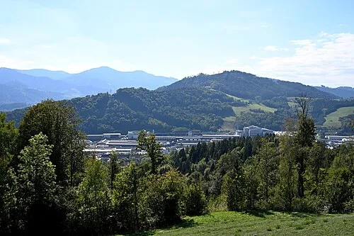
Emberg Herzi Pinki · CC BY-SA 4.0 -
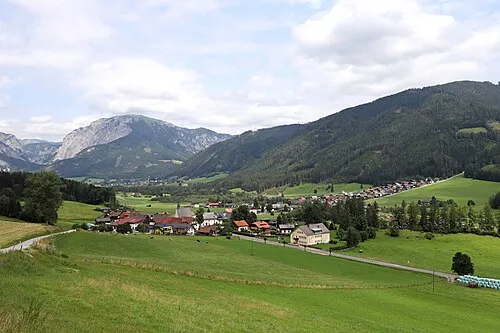
Tragöss Tal Christian Pirkl · CC BY-SA 4.0


Climate of Sankt Katharein an der Laming
Best months for sightseeingBest months for sightseeing: June–September.
This month · November
A cold month
Day 7° · Night -1° · Rain 66 mm
- Hottest month
- July (day 23°)
- Coldest month
- January (night -5°)
- Wettest month
- July (146 mm)
- Driest month
- January (47 mm)
Bars: average monthly low and high temperature. Below: precipitation. Monthly averages for 1970–2000 at about 18 km resolution, adjusted for elevation. Highlighted months are mild and relatively dry. Source: WorldClim 2.1 (CC BY 4.0).
Show values as a table
| Month | Jan | Feb | Mar | Apr | May | Jun | Jul | Aug | Sep | Oct | Nov | Dec |
|---|---|---|---|---|---|---|---|---|---|---|---|---|
| Average high (°C) | 3° | 5° | 9° | 12° | 18° | 21° | 23° | 23° | 19° | 13° | 7° | 3° |
| Average low (°C) | -5° | -4° | -1° | 2° | 7° | 11° | 12° | 12° | 9° | 4° | -1° | -4° |
| Precipitation (mm) | 47 | 49 | 70 | 71 | 98 | 129 | 146 | 126 | 100 | 74 | 66 | 60 |
Other places to visit in this season: June July August September
How to get to Sankt Katharein an der Laming
The nearest airport is Graz Airport (GRZ), 57 km to the south as the crow flies. The nearest large city is Graz, 50 km to the southeast.
Airports
- Graz Airport (GRZ) Feldkirchen bei Graz 57 kmsouth
- Klagenfurt Airport (KLU) Klagenfurt am Wörthersee 111 kmsouthwest
- Linz-Hörsching Airport (LNZ) Linz 112 kmnorthwest
Nearby large cities
- Graz Population: 303.3K 50 kmsoutheast
- Linz Population: 204.8K 114 kmnorthwest
- Klagenfurt Population: 100.3K 114 kmsouthwest
- Salzburg Population: 157.2K 163 kmwest
- Bratislava Population: 423.7K 164 kmnortheast
Straight-line distances; road distances are longer. Airport data: OurAirports.
Day trips from Sankt Katharein an der Laming
Within 100 km: 300 historic and cultural sites, 2,120 natural sites, 671 lakes, rivers and coasts.
0–25 km212 places
- Türnsee Lake 22 kmN
- Teufelssee Lake 22 kmNW
- Sackwiesensee Lake 15 kmNW
- Dürrsee Lake 17 kmNE
25–60 km1,126 places
- Treffnersee Lake 47 kmW
- Gemeinsee Lake 58 kmW
- Grüner See Lake 58 kmW
- Geißrinksee Lake 58 kmW
60–100 km1,753 places
- Gassner Camel Riding School Natural site 89 kmN
- Klamm Natural site 64 kmW
- Mislinja River 100 kmS
- Meža River 99 kmS
Straight-line distances.
Nearby attractions & nature
Everything nearby-
Lercheck Mountain, Tragöß-Sankt Katharein1.4 km N
-
Kletschach Kogel Mountain, Tragöß-Sankt Katharein3.2 km SW
-
Floning Mountain, Kapfenberg3.1 km NE
-
Lonschitz Graben Natural site, Styria5.1 km N
-
Himmel Mountain, Thörl5.8 km NE
-
Oisching Graben Natural site, Styria5.1 km N
Sources & licences
Data last updated: