Annenkogel
Located in Hartberg Umgebung, Hartberg-Fürstenfeld District Coordinates: 47°18′05″ N 15°54′04″ E
- Elevation
- 860 m
- above sea level
- Local time
- UTC+01:00
- Europe/Vienna · UTC+01:00
- Airports
- GRZ Graz Airport49 km
- MBX Maribor Edvard Rusjan Airport93 km
About Annenkogel
Annenkogel is a mountain. Location: Hartberg Umgebung, Hartberg-Fürstenfeld District. Elevation: 860 m. The best months to visit are June–August. The nearest airport is Graz Airport (49 km). Nearby sights include Wullmenstein and Ringkogel.
Photos of Annenkogel
-
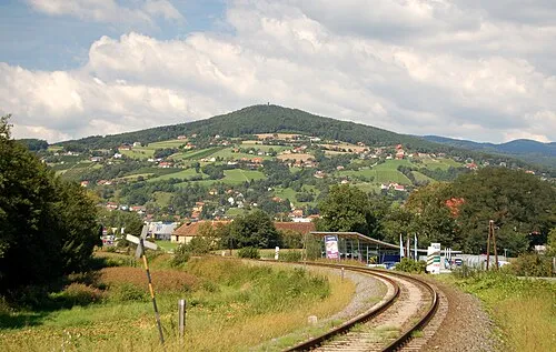
Ringkogel Herzi Pinki · CC BY-SA 3.0 -
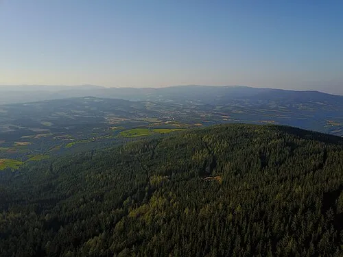
Pongratzer Kogel Julian Wurzer · CC BY-SA 4.0 -
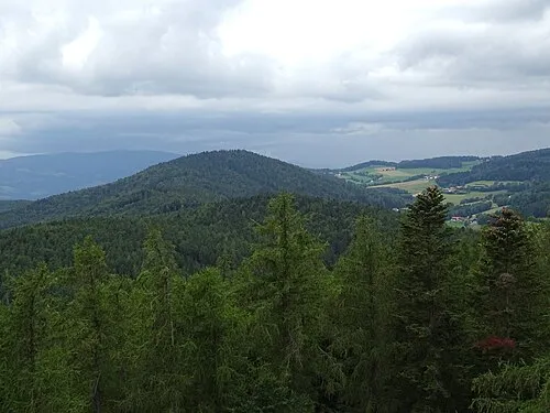
Wullmenstein Liuthalas · CC BY-SA 4.0 -
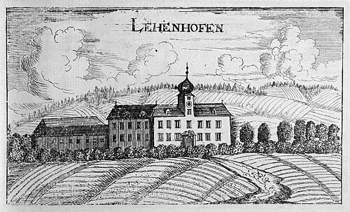
Schloss Lehenshofen Georg Matthäus Vischer · Public domain


Climate of Annenkogel
Best months for sightseeingBest months for sightseeing: June–August.
This month · November
A cold month
Day 5° · Night -3° · Rain 59 mm
- Hottest month
- July (day 22°)
- Coldest month
- January (night -8°)
- Wettest month
- July (112 mm)
- Driest month
- January (32 mm)
Bars: average monthly low and high temperature. Below: precipitation. Monthly averages for 1970–2000 at about 18 km resolution, adjusted for elevation. Highlighted months are mild and relatively dry. Source: WorldClim 2.1 (CC BY 4.0).
Show values as a table
| Month | Jan | Feb | Mar | Apr | May | Jun | Jul | Aug | Sep | Oct | Nov | Dec |
|---|---|---|---|---|---|---|---|---|---|---|---|---|
| Average high (°C) | 0° | 2° | 7° | 11° | 17° | 20° | 22° | 21° | 17° | 12° | 5° | 1° |
| Average low (°C) | -8° | -7° | -3° | 1° | 5° | 8° | 10° | 10° | 6° | 1° | -3° | -6° |
| Precipitation (mm) | 32 | 34 | 50 | 57 | 85 | 109 | 112 | 96 | 75 | 62 | 59 | 45 |
How to get to Annenkogel
The nearest airport is Graz Airport (GRZ), 49 km to the southwest as the crow flies. The nearest large city is Graz, 43 km to the southwest.
Airports
- Graz Airport (GRZ) Feldkirchen bei Graz 49 kmsouthwest
- Maribor Edvard Rusjan Airport (MBX) Maribor 93 kmsouth
- Vienna International Airport (VIE) Vienna 103 kmnortheast
Nearby large cities
- Graz Population: 303.3K 43 kmsouthwest
- Bratislava Population: 423.7K 131 kmnortheast
- Győr Population: 129.3K 137 kmeast
- Klagenfurt Population: 100.3K 143 kmsouthwest
- Linz Population: 204.8K 165 kmnorthwest
Straight-line distances; road distances are longer. Airport data: OurAirports.
Day trips from Annenkogel
Within 100 km: 234 historic and cultural sites, 1,333 natural sites, 448 lakes, rivers and coasts.
0–25 km73 places
- Herrenstein Mountain 23 kmN
- Zeiseleck Mountain 13 kmNW
- Totterfeld Mountain 8 kmSE
- Tommer Mountain 15 kmN
25–60 km826 places
- Waldteiche Lake 37 kmS
- Dürrsee Lake 57 kmNW
- Thaler See Lake 48 kmSW
- Wundschuher Teich Lake 55 kmSW
60–100 km1,116 places
- Pohorje Mountain 92 kmS
- Ščavnica River 92 kmS
- Jezero Pernica Lake 80 kmS
- Vienna Forest Lake Lake 99 kmN
Straight-line distances.
Nearest towns and villages
-
Löffelbach Village, Hartberg Umgebung3.2 km SE
-
Winzendorf Village, Pöllau2.4 km SW
-
Sankt Anna Village, Hartberg Umgebung1 km SW
-
Pöllauberg Municipality, Hartberg-Fürstenfeld District3.5 km NW
-
Oberneuberg Village, Pöllauberg3.1 km NW
-
Flattendorf Village, Hartberg Umgebung4 km S
Nearby attractions & nature
Everything nearby-
Wullmenstein Mountain, Hartberg Umgebung1.3 km E
-
Ringkogel Mountain, Hartberg3.7 km E
-
Pongratzer Kogel Mountain, Vorau5.5 km N
-
Masenberg Mountain, Pöllauberg5.6 km N
-
Pucheggberg Mountain, Grafendorf bei Hartberg6.5 km N
-
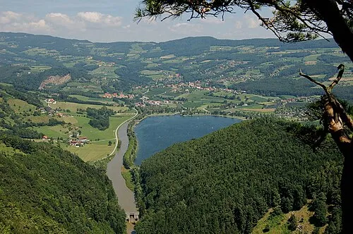 Buchkogel Mountain, Stubenberg8.6 km SW
-
Beistein Mountain, Grafendorf bei Hartberg8.1 km NE
-
Sternbauer Kogel Mountain, Pöllau8.4 km NW
Sources & licences
Data last updated: · 2 independent sources