Schweighof
Located in Arzl im Pitztal, Politischer Bezirk Imst Coordinates: 47°12′00″ N 10°47′00″ E
- Elevation
- 1,083 m
- above sea level
- Local time
- UTC+01:00
- Europe/Vienna · UTC+01:00
- Airports
- INN Innsbruck Airport43 km
- BZO Bolzano Airport92 km
About Schweighof
Schweighof is a village. Location: Arzl im Pitztal, Politischer Bezirk Imst. Elevation: 1,083 m. The best months to visit are June–September. The nearest airport is Innsbruck Airport (43 km). Nearby sights include Walderbach and Pitzbach.
Photos of Schweighof
-
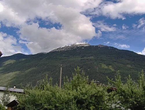
Tschirgant Tubantia · CC BY-SA 3.0

Climate of Schweighof
Best months for sightseeingBest months for sightseeing: June–September.
This month · November
A cold month
Day 6° · Night 0° · Rain 74 mm
- Hottest month
- July (day 21°)
- Coldest month
- January (night -4°)
- Wettest month
- July (141 mm)
- Driest month
- February (60 mm)
Bars: average monthly low and high temperature. Below: precipitation. Monthly averages for 1970–2000 at about 18 km resolution, adjusted for elevation. Highlighted months are mild and relatively dry. Source: WorldClim 2.1 (CC BY 4.0).
Show values as a table
| Month | Jan | Feb | Mar | Apr | May | Jun | Jul | Aug | Sep | Oct | Nov | Dec |
|---|---|---|---|---|---|---|---|---|---|---|---|---|
| Average high (°C) | 3° | 4° | 7° | 10° | 15° | 18° | 21° | 21° | 17° | 13° | 6° | 4° |
| Average low (°C) | -4° | -4° | -1° | 2° | 6° | 9° | 11° | 11° | 8° | 5° | 0° | -3° |
| Precipitation (mm) | 61 | 60 | 69 | 74 | 97 | 130 | 141 | 134 | 90 | 70 | 74 | 69 |
Other places to visit in this season: June July August September
How to get to Schweighof
The nearest airport is Innsbruck Airport (INN), 43 km to the east as the crow flies. The nearest large city is Innsbruck, 47 km to the east.
Airports
- Innsbruck Airport (INN) Innsbruck 43 kmeast
- Bolzano Airport (BZO) Bolzano (BZ) 92 kmsoutheast
- Memmingen Allgau Airport (FMM) Memmingen 97 kmnorthwest
Nearby large cities
- Innsbruck Population: 132.5K 47 kmeast
- Munich Population: 1.5M 120 kmnortheast
- Augsburg Population: 301.1K 131 kmnorth
- Ulm Population: 120.5K 146 kmnorthwest
- Winterthur Population: 111.8K 159 kmwest
Straight-line distances; road distances are longer. Airport data: OurAirports.
Day trips from Schweighof
Within 100 km: 295 historic and cultural sites, 5,250 natural sites, 1,168 lakes, rivers and coasts.
0–25 km267 places
- Wilder See Lake 15 kmSE
- Weissensee Lake 20 kmN
- Wasensee Lake 23 kmSW
- Urg See Lake 21 kmSW
25–60 km2,672 places
- Lai da Minschun Lake 59 kmSW
- Lajet da Lischana Lake 60 kmSW
- Lai da Fasch'Alba Lake 56 kmSW
- Lai d'Immez Lake 59 kmSW
60–100 km3,774 places
- Bayerisches Oberland Mountain 67 kmNE
- Schloss Hirschberg am Haarsee Historic site 75 kmNE
- Lake Davos Lake 82 kmSW
- Weiher Diepoldsau Lake 86 kmW
Straight-line distances.
Nearby attractions & nature
Everything nearby-
Walderbach River, Tyrol1.9 km N
-
Pitzbach River, Tyrol2.2 km NW
-
Sechszeiger = Leiner Kögele Mountain, Jerzens3.8 km S
-
Tschirgant Mountain, Karres4.7 km N
-
Zeigerberg Mountain, Jerzens3.7 km S
-
Mutkopf Mountain, Roppen3.5 km E
Sources & licences
Data last updated: