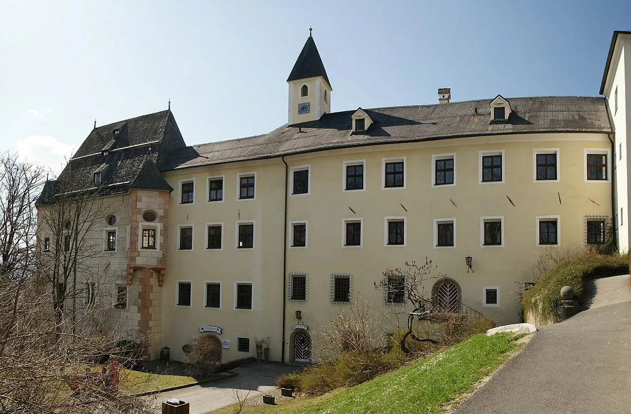
Weiherburg
Local name: Schloss Weiherburg
Located in Ainet, Politischer Bezirk Lienz Coordinates: 46°52′39″ N 12°40′30″ E
- Local time
- UTC+01:00
- Europe/Vienna · UTC+01:00
- Elevation
- 914 m
- above sea level
- Airports
- SZG Salzburg Airport105 km
- INN Innsbruck Airport110 km
About Weiherburg
Weiherburg is a historic site. Location: Ainet, Politischer Bezirk Lienz. The best months to visit are June–September. The nearest airport is Salzburg Airport (105 km). Nearby sights include Krassbach and Sankt Helena.
At a glance
- Built
- 1460
- Heritage designation
- Listed objects in Austria
Source: Wikidata
Photos of Weiherburg
-

Wilfredor · CC0 -

Wilfredor · CC0 -

Leonhard Lenz · CC0 -

Rijksmuseum · CC0 -

Alpenzoo1000 · CC BY-SA 4.0


Climate of Weiherburg
Best months for sightseeingBest months for sightseeing: June–September.
This month · November
A wet month
Day 8° · Night 2° · Rain 112 mm
- Hottest month
- July (day 21°)
- Coldest month
- January (night -3°)
- Wettest month
- July (165 mm)
- Driest month
- February (72 mm)
Bars: average monthly low and high temperature. Below: precipitation. Monthly averages for 1970–2000 at about 18 km resolution, adjusted for elevation. Highlighted months are mild and relatively dry. Source: WorldClim 2.1 (CC BY 4.0).
Show values as a table
| Month | Jan | Feb | Mar | Apr | May | Jun | Jul | Aug | Sep | Oct | Nov | Dec |
|---|---|---|---|---|---|---|---|---|---|---|---|---|
| Average high (°C) | 4° | 5° | 7° | 10° | 15° | 19° | 21° | 21° | 18° | 14° | 8° | 5° |
| Average low (°C) | -3° | -3° | 0° | 3° | 7° | 11° | 13° | 13° | 10° | 7° | 2° | -1° |
| Precipitation (mm) | 76 | 72 | 96 | 111 | 126 | 149 | 165 | 150 | 119 | 109 | 112 | 90 |
Other places to visit in this season: June July August September
How to get to Weiherburg
The nearest airport is Salzburg Airport (SZG), 105 km to the north as the crow flies. The nearest large city is Innsbruck, 106 km to the northwest.
Airports
- Salzburg Airport (SZG) Salzburg 105 kmnorth
- Innsbruck Airport (INN) Innsbruck 110 kmnorthwest
- Bolzano Airport (BZO) Bolzano (BZ) 113 kmsouthwest
Nearby large cities
- Innsbruck Population: 132.5K 106 kmnorthwest
- Salzburg Population: 157.2K 106 kmnorth
- Klagenfurt Population: 100.3K 128 kmeast
- Munich Population: 1.5M 163 kmnorthwest
- Linz Population: 204.8K 200 kmnortheast
Straight-line distances; road distances are longer. Airport data: OurAirports.
Day trips from Weiherburg
Within 100 km: 132 historic and cultural sites, 3,812 natural sites, 720 lakes, rivers and coasts.
0–25 km462 places
- Sille River 21 kmSW
- Vorderer Langtalsee Lake 16 kmNE
- Schwarzsee Lake 24 kmN
- Sandersee Lake 22 kmN
25–60 km1,696 places
- Fürlegsee Lake 29 kmN
- Eissee Lake 31 kmNW
- Brandlsee Lake 40 kmN
- Brechlsee Lake 37 kmN
60–100 km2,506 places
- Hoher Dachstein Mountain 97 kmNE
- Piz Gralba Mountain 78 kmSW
- Piz Miara Mountain 78 kmSW
- Croda Nera Mountain 84 kmSW
Straight-line distances.
Nearby attractions & nature
Everything nearby-
Krassbach River, Tyrol0.5 km S
-
Sankt Helena Attraction, Oberlienz4.5 km E
-
 Schleinitz Mountain, Ainet6 km E
-
Rotkofel Mountain, Ainet4.3 km N
-
Kleines Schöberl Mountain, Ainet4.4 km E
-
Niederer Prijakt Mountain, Ainet5.1 km NE
-
Schlaitnerkofel Mountain, Assling5.4 km SW
-
Lavantspitze Mountain, Assling5.4 km SW
Nearest towns and villages
Sources & licences
Data last updated: · 2 independent sources