Aguntum
Located in Dölsach, Politischer Bezirk Lienz Coordinates: 46°49′44″ N 12°49′20″ E
- Local time
- UTC+01:00
- Europe/Vienna · UTC+01:00
- Elevation
- 667 m
- above sea level
- Airports
- SZG Salzburg Airport108 km
- KLU Klagenfurt Airport118 km
About Aguntum
Aguntum is a historic site. Location: Dölsach, Politischer Bezirk Lienz.
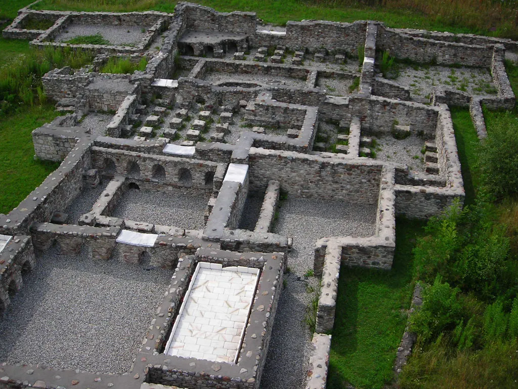
The ruins of Aguntum are an ancient Roman site in East Tirol, Austria, located approximately four kilometres (2.5 mi) east of Lienz in the Drau valley. The city appears to have been built to exploit the local sources of iron, copper, zinc and gold. During the early Christian era, the city was the site of a bishopric, which, having ceased to be a residential diocese, is today listed by the Catholic Church as a titular see.
Source: Wikipedia · CC BY-SA 4.0
At a glance
- Heritage designation
- Listed objects in Austria
- Official website
- aguntum.at
Source: Wikidata
Climate of Aguntum
Best months for sightseeingBest months for sightseeing: June–September.
This month · November
A cold month
Day 9° · Night 2° · Rain 96 mm
- Hottest month
- July (day 23°)
- Coldest month
- January (night -3°)
- Wettest month
- July (151 mm)
- Driest month
- February (54 mm)
Bars: average monthly low and high temperature. Below: precipitation. Monthly averages for 1970–2000 at about 18 km resolution, adjusted for elevation. Highlighted months are mild and relatively dry. Source: WorldClim 2.1 (CC BY 4.0).
Show values as a table
| Month | Jan | Feb | Mar | Apr | May | Jun | Jul | Aug | Sep | Oct | Nov | Dec |
|---|---|---|---|---|---|---|---|---|---|---|---|---|
| Average high (°C) | 5° | 6° | 9° | 12° | 18° | 21° | 23° | 23° | 20° | 15° | 9° | 5° |
| Average low (°C) | -3° | -2° | 1° | 4° | 8° | 12° | 14° | 14° | 11° | 7° | 2° | -1° |
| Precipitation (mm) | 56 | 54 | 71 | 89 | 114 | 139 | 151 | 138 | 112 | 104 | 96 | 68 |
Other places to visit in this season: June July August September
How to get to Aguntum
The nearest airport is Salzburg Airport (SZG), 108 km to the north as the crow flies. The nearest large city is Salzburg, 109 km to the north.
Airports
- Salzburg Airport (SZG) Salzburg 108 kmnorth
- Klagenfurt Airport (KLU) Klagenfurt am Wörthersee 118 kmeast
- Bolzano Airport (BZO) Bolzano (BZ) 122 kmwest
Nearby large cities
- Salzburg Population: 157.2K 109 kmnorth
- Klagenfurt Population: 100.3K 116 kmeast
- Innsbruck Population: 132.5K 119 kmnorthwest
- Munich Population: 1.5M 173 kmnorthwest
- Linz Population: 204.8K 198 kmnortheast
Straight-line distances; road distances are longer. Airport data: OurAirports.
Nearby attractions & nature
Everything nearby-
Rauchkofel Mountain, Tristach4.3 km SW
-
Debantbach River, Tyrol2.7 km SE
-
Drau River, Tyrol3 km W
-
Schloss Bruck museum Museum, Lienz5.6 km W
-
Schloss Bruck Historic site, Lienz5.6 km W
-
 Zettersfeld Mountain, Nußdorf-Debant5.8 km NW
-
Isel River, Tyrol3.3 km W
-
Stronachkogel Mountain, Winklern4.7 km NE
Nearest towns and villages
Sources & licences
Data last updated: · 2 independent sources