Klaunz
Located in Matrei in Osttirol, Politischer Bezirk Lienz Coordinates: 47°00′00″ N 12°33′00″ E
- Population
- 161
- 161
- Elevation
- 1,185 m
- above sea level
- Local time
- UTC+01:00
- Europe/Vienna · UTC+01:00
- Airports
- SZG Salzburg Airport95 km
- INN Innsbruck Airport96 km
About Klaunz
Klaunz is a village. Location: Matrei in Osttirol, Politischer Bezirk Lienz. Population: 161. Elevation: 1,185 m. The best months to visit are July–August. The nearest airport is Salzburg Airport (95 km). Nearby sights include Tauernbach and Bretterwandbach.
Photos of Klaunz
-
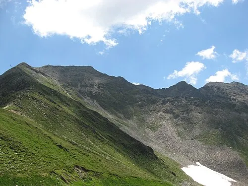
Roter Kogel Clemens Stockner · CC BY-SA 3.0 -
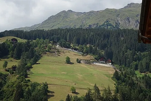
Deferegger Riegel PantheraLeo1359531 · CC BY-SA 4.0 -
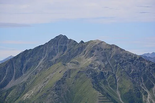
Gorner Michael Kranewitter · CC BY-SA 4.0


Climate of Klaunz
Best months for sightseeingBest months for sightseeing: July–August.
This month · November
A cold month
Day 6° · Night -1° · Rain 94 mm
- Hottest month
- July (day 20°)
- Coldest month
- January (night -5°)
- Wettest month
- July (158 mm)
- Driest month
- February (60 mm)
Bars: average monthly low and high temperature. Below: precipitation. Monthly averages for 1970–2000 at about 18 km resolution, adjusted for elevation. Highlighted months are mild and relatively dry. Source: WorldClim 2.1 (CC BY 4.0).
Show values as a table
| Month | Jan | Feb | Mar | Apr | May | Jun | Jul | Aug | Sep | Oct | Nov | Dec |
|---|---|---|---|---|---|---|---|---|---|---|---|---|
| Average high (°C) | 2° | 3° | 6° | 9° | 14° | 17° | 20° | 19° | 16° | 12° | 6° | 3° |
| Average low (°C) | -5° | -5° | -2° | 1° | 5° | 8° | 11° | 11° | 8° | 4° | -1° | -4° |
| Precipitation (mm) | 61 | 60 | 77 | 90 | 113 | 142 | 158 | 144 | 109 | 96 | 94 | 72 |
How to get to Klaunz
The nearest airport is Salzburg Airport (SZG), 95 km to the north as the crow flies. The nearest large city is Innsbruck, 92 km to the west.
Airports
- Salzburg Airport (SZG) Salzburg 95 kmnorth
- Innsbruck Airport (INN) Innsbruck 96 kmwest
- Bolzano Airport (BZO) Bolzano (BZ) 111 kmsouthwest
Nearby large cities
- Innsbruck Population: 132.5K 92 kmwest
- Salzburg Population: 157.2K 96 kmnortheast
- Klagenfurt Population: 100.3K 140 kmeast
- Munich Population: 1.5M 146 kmnorthwest
- Ljubljana Population: 272.2K 183 kmsoutheast
Straight-line distances; road distances are longer. Airport data: OurAirports.
Day trips from Klaunz
Within 100 km: 195 historic and cultural sites, 4,180 natural sites, 854 lakes, rivers and coasts.
0–25 km790 places
- Fürlegsee Lake 16 kmN
- Vorderer Langtalsee Lake 18 kmE
- Eissee Lake 15 kmNW
- Schmiedingersee Lake 25 kmNE
25–60 km1,522 places
- Sille River 26 kmS
- Brandlsee Lake 31 kmNE
- Brechlsee Lake 29 kmNE
- Kleiner Paarsee Lake 53 kmNE
60–100 km2,917 places
- Hoher Dachstein Mountain 96 kmNE
- Frauenchiemsee Island 97 kmN
- Herreninsel Island 96 kmN
- Piz Gralba Mountain 79 kmSW
Straight-line distances.
Nearby attractions & nature
Everything nearby-
Tauernbach River, Tyrol1.3 km W
-
Bretterwandbach River, Tyrol1.3 km W
-
Goldriedbach River, Tyrol1.3 km E
-
Schloss Weißenstein Historic site, Matrei in Osttirol2.2 km NW
-
Kaltenhauser Wald Natural site, Tyrol1.9 km N
-
Prosseggklamm Natural site, Tyrol2.2 km NW
Other cities and towns in Matrei in Osttirol

Sources & licences
Data last updated: