Waschenberg [Windhaag bei Freistadt]
Located in Windhaag bei Freistadt, Freistadt District Coordinates: 48°35′28″ N 14°35′29″ E
- Elevation
- 967 m
- above sea level
- Local time
- UTC+01:00
- Europe/Vienna · UTC+01:00
- Airports
- JCL České Budějovice South Bohemian Airport41 km
- LNZ Linz-Hörsching Airport50 km
About Waschenberg [Windhaag bei Freistadt]
Waschenberg [Windhaag bei Freistadt] is a mountain. Location: Windhaag bei Freistadt, Freistadt District. Elevation: 967 m. The best months to visit are June–August. The nearest airport is České Budějovice South Bohemian Airport (41 km). Nearby sights include Steinbühel [Windhaag bei Freistadt] and Kamenec.
Photos of Waschenberg [Windhaag bei Freistadt]
-
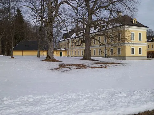
Schloss Rosenhof Luckyprof Luckyprof · CC BY-SA 3.0 -
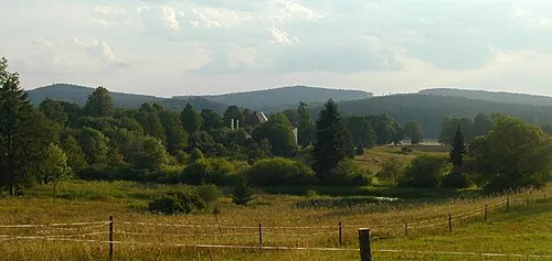
Kamenec che · CC BY-SA 2.5


Climate of Waschenberg [Windhaag bei Freistadt]
Best months for sightseeingBest months for sightseeing: June–August.
This month · November
A cold month
Day 4° · Night -3° · Rain 65 mm
- Hottest month
- July (day 20°)
- Coldest month
- January (night -8°)
- Wettest month
- July (123 mm)
- Driest month
- February (55 mm)
Bars: average monthly low and high temperature. Below: precipitation. Monthly averages for 1970–2000 at about 18 km resolution, adjusted for elevation. Highlighted months are mild and relatively dry. Source: WorldClim 2.1 (CC BY 4.0).
Show values as a table
| Month | Jan | Feb | Mar | Apr | May | Jun | Jul | Aug | Sep | Oct | Nov | Dec |
|---|---|---|---|---|---|---|---|---|---|---|---|---|
| Average high (°C) | -1° | 1° | 5° | 9° | 15° | 18° | 20° | 20° | 15° | 10° | 4° | 0° |
| Average low (°C) | -8° | -7° | -4° | -1° | 4° | 7° | 9° | 9° | 5° | 1° | -3° | -6° |
| Precipitation (mm) | 60 | 55 | 68 | 67 | 84 | 109 | 123 | 98 | 74 | 57 | 65 | 71 |
How to get to Waschenberg [Windhaag bei Freistadt]
The nearest airport is České Budějovice South Bohemian Airport (JCL), 41 km to the north as the crow flies. The nearest large city is Linz, 39 km to the southwest.
Airports
- České Budějovice South Bohemian Airport (JCL) České Budějovice 41 kmnorth
- Linz-Hörsching Airport (LNZ) Linz 50 kmsouthwest
- Salzburg Airport (SZG) Salzburg 148 kmsouthwest
Nearby large cities
- Linz Population: 204.8K 39 kmsouthwest
- Salzburg Population: 157.2K 145 kmsouthwest
- Brno Population: 404.3K 162 kmnortheast
- Prague Population: 1.2M 167 kmnorth
- Graz Population: 303.3K 181 kmsouth
Straight-line distances; road distances are longer. Airport data: OurAirports.
Day trips from Waschenberg [Windhaag bei Freistadt]
Within 100 km: 164 historic and cultural sites, 1,231 natural sites, 401 lakes, rivers and coasts.
0–25 km38 places
- Unter-Rosenhofer Teich Lake 7 kmSE
- Ober-Rosenhofer Teich Lake 7 kmSE
- Zeissberg Mountain 17 kmSW
- Wach Berg Mountain 18 kmE
25–60 km432 places
- Gusen I Concentration Camp Historic site 38 kmS
- Hutbühel Mountain 55 kmNE
- Geißbühel Mountain 57 kmNE
- Steinbühel Mountain 59 kmNE
60–100 km1,326 places
- Gassner Camel Riding School Natural site 62 kmSE
- Obersee Lake 95 kmS
- Mittersee Lake 91 kmSE
- Lunzer See Lake 87 kmSE
Straight-line distances.
Nearest towns and villages
-
Predetschlag Village, Windhaag bei Freistadt1 km SE
-
Windhaag bei Freistadt Village, Windhaag bei Freistadt2.2 km W
-
Mairspindt Village, Windhaag bei Freistadt1.8 km NW
-
Oberwindhaag Village, Windhaag bei Freistadt1.8 km SW
-
Obernschlag Village, Windhaag bei Freistadt1.7 km SE
-
Unterwald Village, Windhaag bei Freistadt2.9 km N
Nearby attractions & nature
Everything nearby-
Steinbühel [Windhaag bei Freistadt] Mountain, Leopoldschlag3.3 km W
-
Kamenec Mountain, Pohorská Ves5.8 km E
-
Viehberg (Freiwald) [Sandl] Mountain, Sandl4.1 km SE
-
Viehberg Mountain, Sandl4.9 km S
-
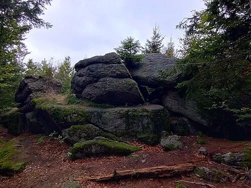 Myslivna Mountain, Pohorská Ves8.2 km NE
-
Hintere Schanzer berg Mountain, Bad Großpertholz8.6 km E
-
Ober-Rosenhofer Teich Lake, Upper Austria6.7 km SE
-
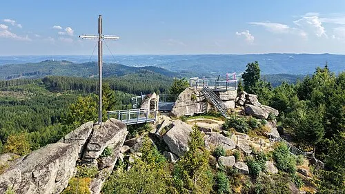 Nebelstein Mountain, Moorbad Harbach15 km NE
Sources & licences
Data last updated: