Mitterberg
Located in Bad Ischl, Politischer Bezirk Gmunden Coordinates: 47°40′00″ N 13°39′00″ E
- Elevation
- 1,101 m
- above sea level
- Local time
- UTC+01:00
- Europe/Vienna · UTC+01:00
- Airports
- SZG Salzburg Airport50 km
- LNZ Linz-Hörsching Airport75 km
About Mitterberg
Mitterberg is a mountain. Location: Bad Ischl, Politischer Bezirk Gmunden. Elevation: 1,101 m. The best months to visit are July–August. The nearest airport is Salzburg Airport (50 km). Nearby sights include Kleiner Rosenkogel and Großer Rosenkogel.
Photos of Mitterberg
-
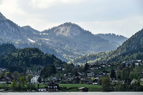
Pötschenstein Bernhard Holub · CC BY-SA 4.0 -
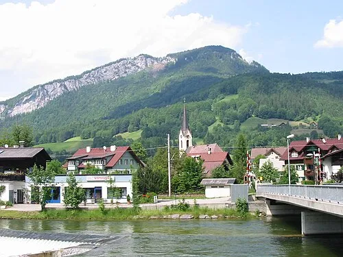
Predigstuhl ZL · Public domain -
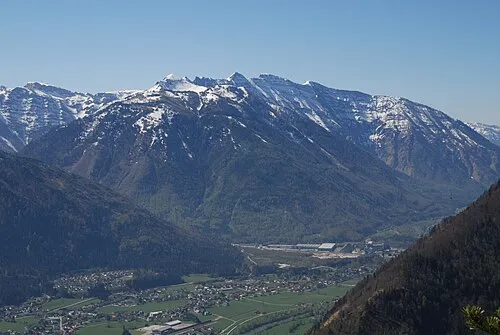
Hohe Schrott Tigerente · CC BY-SA 4.0 -
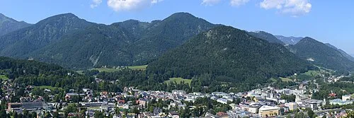
Hochjoch Linie29 · CC BY-SA 4.0


Climate of Mitterberg
Best months for sightseeingBest months for sightseeing: July–August.
This month · November
A wet month
Day 4° · Night -3° · Rain 108 mm
- Hottest month
- July (day 19°)
- Coldest month
- January (night -7°)
- Wettest month
- July (198 mm)
- Driest month
- February (85 mm)
Bars: average monthly low and high temperature. Below: precipitation. Monthly averages for 1970–2000 at about 18 km resolution, adjusted for elevation. Highlighted months are mild and relatively dry. Source: WorldClim 2.1 (CC BY 4.0).
Show values as a table
| Month | Jan | Feb | Mar | Apr | May | Jun | Jul | Aug | Sep | Oct | Nov | Dec |
|---|---|---|---|---|---|---|---|---|---|---|---|---|
| Average high (°C) | 0° | 1° | 5° | 8° | 14° | 17° | 19° | 19° | 15° | 10° | 4° | 1° |
| Average low (°C) | -7° | -7° | -4° | -1° | 4° | 7° | 9° | 9° | 6° | 2° | -3° | -6° |
| Precipitation (mm) | 97 | 85 | 111 | 105 | 123 | 175 | 198 | 169 | 125 | 95 | 108 | 115 |
How to get to Mitterberg
The nearest airport is Salzburg Airport (SZG), 50 km to the west as the crow flies. The nearest large city is Salzburg, 48 km to the west.
Airports
- Salzburg Airport (SZG) Salzburg 50 kmwest
- Linz-Hörsching Airport (LNZ) Linz 75 kmnortheast
- Klagenfurt Airport (KLU) Klagenfurt am Wörthersee 125 kmsoutheast
Nearby large cities
- Salzburg Population: 157.2K 48 kmwest
- Linz Population: 204.8K 86 kmnortheast
- Klagenfurt Population: 100.3K 126 kmsoutheast
- Graz Population: 303.3K 151 kmsoutheast
- Munich Population: 1.5M 164 kmwest
Straight-line distances; road distances are longer. Airport data: OurAirports.
Day trips from Mitterberg
Within 100 km: 296 historic and cultural sites, 3,364 natural sites, 1,135 lakes, rivers and coasts.
0–25 km581 places
- Hoher Dachstein Mountain 22 kmS
- Augstsee Lake 10 kmE
- Ostersee Lake 11 kmE
- Sommersbergsee Lake 8 kmSE
25–60 km1,663 places
- Klamm Natural site 53 kmE
- Seeriessee Lake 36 kmS
- Untersee Lake 35 kmS
- Wildsee Lake 46 kmS
60–100 km2,551 places
- Frauenchiemsee Island 95 kmW
- Herreninsel Island 96 kmW
- Gusen I Concentration Camp Historic site 89 kmNE
- Fürlegsee Lake 98 kmSW
Straight-line distances.
Nearest towns and villages
-
 Lauffen Village, Bad Ischl2.6 km W
-
Perneck Village, Bad Ischl2.6 km N
-
Bad Goisern Municipality, Politischer Bezirk Gmunden3.5 km SW
-
Eck Village, Bad Ischl3.2 km N
-
Pichlern Neighbourhood, Bad Goisern2.2 km SE
-
Reiterndorf Village, Bad Ischl4.4 km N
Nearby attractions & nature
Everything nearby-
Kleiner Rosenkogel Mountain, Bad Ischl<0.1 km N
-
Großer Rosenkogel Mountain, Bad Ischl<0.1 km N
-
Hoher Rosenkogel Mountain, Bad Ischl1.3 km E
-
Gstichkogel Mountain, Bad Ischl1.3 km W
-
Predigstuhl Mountain, Bad Goisern2.2 km SW
-
Kufberg Mountain, Bad Ischl2.2 km NW
-
Kolowratshöhe Mountain, Bad Ischl2.2 km NE
-
Predigtkogel Mountain, Bad Ischl2.2 km NW
More nature in Austria
-
Lauffner Berg Mountain, Bad Ischl3.1 km NW
-
Tauern Mountain, Bad Ischl3.1 km NE
-
Hohe Schrott Mountain, Bad Ischl6.7 km NE
-
Höherstein Mountain, Bad Ischl5.3 km E
-
Hubkogel Mountain, Bad Ischl3.7 km N
-
Hochjoch Mountain, Bad Ischl7.8 km N
Sources & licences
Data last updated: · 2 independent sources