Rauhe Klaus
Located in Mellau, Politischer Bezirk Bregenz Coordinates: 47°22′09″ N 9°52′53″ E
- Elevation
- 685 m
- above sea level
- Local time
- UTC+01:00
- Europe/Vienna · UTC+01:00
- Airports
- ACH Sankt Gallen Altenrhein Airport27 km
- FDH Bodensee Airport Friedrichshafen44 km
About Rauhe Klaus
Rauhe Klaus is a natural site. Location: Mellau, Politischer Bezirk Bregenz. The best months to visit are June–September. The nearest airport is Sankt Gallen Altenrhein Airport (27 km). Nearby sights include Spitz and Klauser Wasserfall.
Photos of Rauhe Klaus
-
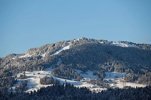
Hochälpele Ursusilvae · CC BY-SA 4.0 -
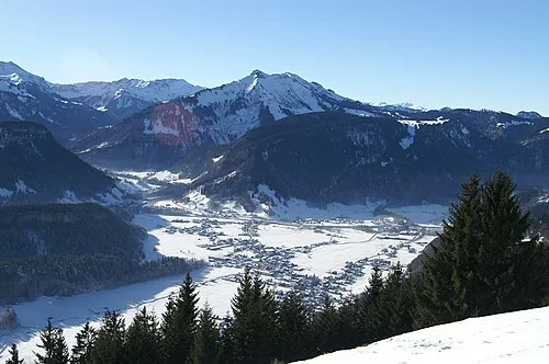
Hangspitze Böhringer friedrich · CC BY-SA 2.5 -
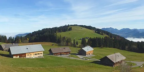
Geißkopf Reinhard Müller · CC BY-SA 4.0 -
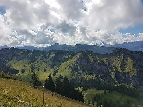
Grebentobel Asurnipal · CC BY-SA 4.0


Climate of Rauhe Klaus
Best months for sightseeingBest months for sightseeing: June–September.
This month · November
A wet month
Day 8° · Night 1° · Rain 123 mm
- Hottest month
- July (day 22°)
- Coldest month
- January (night -3°)
- Wettest month
- July (186 mm)
- Driest month
- January (96 mm)
Bars: average monthly low and high temperature. Below: precipitation. Monthly averages for 1970–2000 at about 18 km resolution, adjusted for elevation. Highlighted months are mild and relatively dry. Source: WorldClim 2.1 (CC BY 4.0).
Show values as a table
| Month | Jan | Feb | Mar | Apr | May | Jun | Jul | Aug | Sep | Oct | Nov | Dec |
|---|---|---|---|---|---|---|---|---|---|---|---|---|
| Average high (°C) | 4° | 5° | 8° | 12° | 17° | 20° | 22° | 22° | 18° | 14° | 8° | 4° |
| Average low (°C) | -3° | -3° | 0° | 3° | 7° | 10° | 13° | 13° | 9° | 6° | 1° | -2° |
| Precipitation (mm) | 96 | 98 | 101 | 115 | 133 | 178 | 186 | 170 | 132 | 103 | 123 | 110 |
Other places to visit in this season: June July August September
How to get to Rauhe Klaus
The nearest airport is Sankt Gallen Altenrhein Airport (ACH), 27 km to the northwest as the crow flies. For international flights: Bodensee Airport Friedrichshafen (FDH) (44 km). The nearest large city is Winterthur, 89 km to the west.
Airports
- Sankt Gallen Altenrhein Airport (ACH) St. Gallen 27 kmnorthwest
- Bodensee Airport Friedrichshafen (FDH) Friedrichshafen 44 kmnorthwest
- Memmingen Allgau Airport (FMM) Memmingen 74 kmnorth
Nearby large cities
- Winterthur Population: 111.8K 89 kmwest
- Zurich Population: 415.4K 101 kmwest
- Innsbruck Population: 132.5K 115 kmeast
- Ulm Population: 120.5K 115 kmnorth
- Reutlingen Population: 112.6K 135 kmnorth
Straight-line distances; road distances are longer. Airport data: OurAirports.
Day trips from Rauhe Klaus
Within 100 km: 402 historic and cultural sites, 5,651 natural sites, 1,240 lakes, rivers and coasts.
0–25 km579 places
- Weiher Diepoldsau Lake 16 kmW
- Alter Rhein Lake 18 kmW
- Nollen Lake 17 kmW
- Nollen Lake 16 kmW
25–60 km2,350 places
- Walensee Lake 59 kmSW
- Voralpsee Lake 45 kmSW
- Gotschnaseeli Lake 57 kmS
- Uttwiler Weiher Lake 47 kmNW
60–100 km4,364 places
- Mainau Island 64 kmNW
- Dominikanerinsel Konstanz Island 62 kmNW
- Strandbad Steckborn Beach 76 kmNW
- Ufenau Island 85 kmW
Straight-line distances.
Nearest towns and villages
Nearby attractions & nature
Everything nearby-
Spitz Mountain, Reuthe0.4 km SE
-
Klauser Wasserfall Natural site, Mellau0.7 km SW
-
Fluh Bach River, Mellau0.7 km SW
-
Stennwald Natural site, Reuthe0.9 km SE
-
Simonsbach River, Mellau1 km SW
-
Hangspitze Mountain, Mellau2.6 km SW
-
Gschwandtele Wald Natural site, Reuthe1.6 km W
-
Gopfberg Mountain, Schnepfau1.8 km SE
Sources & licences
Data last updated: