Arrondissement of Mons
Located in Hainaut Province, Wallonia Coordinates: 50°26′53″ N 3°51′48″ E
- Elevation
- 26 m
- above sea level
- Local time
- UTC+01:00
- Europe/Brussels · UTC+01:00
- Places inside
- 13
- listed under Arrondissement of Mons
- Airports
- CRL Brussels South Charleroi Airport42 km
- LIL Lille Airport56 km
About Arrondissement of Mons
Arrondissement of Mons is a municipality. Location: Hainaut Province, Wallonia. Elevation: 26 m. The best months to visit are June–September. The nearest airport is Brussels South Charleroi Airport (42 km). Nearby sights include Wasmes and Vieille Haine.
Climate of Arrondissement of Mons
Best months for sightseeingBest months for sightseeing: June–September.
This month · November
A cold month
Day 10° · Night 4° · Rain 75 mm
- Hottest month
- August (day 24°)
- Coldest month
- February (night 1°)
- Wettest month
- November (75 mm)
- Driest month
- February (52 mm)
Bars: average monthly low and high temperature. Below: precipitation. Monthly averages for 1970–2000 at about 18 km resolution, adjusted for elevation. Highlighted months are mild and relatively dry. Source: WorldClim 2.1 (CC BY 4.0).
Show values as a table
| Month | Jan | Feb | Mar | Apr | May | Jun | Jul | Aug | Sep | Oct | Nov | Dec |
|---|---|---|---|---|---|---|---|---|---|---|---|---|
| Average high (°C) | 6° | 7° | 10° | 14° | 18° | 21° | 23° | 24° | 20° | 15° | 10° | 7° |
| Average low (°C) | 1° | 1° | 3° | 4° | 8° | 11° | 13° | 12° | 10° | 7° | 4° | 2° |
| Precipitation (mm) | 64 | 52 | 67 | 54 | 66 | 73 | 67 | 58 | 59 | 70 | 75 | 72 |
Other places to visit in this season: June July August September
How to get to Arrondissement of Mons
The nearest airport is Brussels South Charleroi Airport (CRL), 42 km to the east as the crow flies. The nearest large city is Charleroi, 41 km to the east.
Airports
- Brussels South Charleroi Airport (CRL) Charleroi 42 kmeast
- Lille Airport (LIL) Lesquin 56 kmwest
- Brussels Airport (BRU) Zaventem 67 kmnortheast
Nearby large cities
- Charleroi Population: 200.1K 41 kmeast
- Anderlecht Population: 160.6K 54 kmnortheast
- Brussels Population: 1M 56 kmnortheast
- Schaarbeek Population: 132.8K 59 kmnortheast
- Lille Population: 238.7K 61 kmwest
Straight-line distances; road distances are longer. Airport data: OurAirports.
Day trips from Arrondissement of Mons
Within 100 km: 288 historic and cultural sites, 786 natural sites, 943 lakes, rivers and coasts.
0–25 km166 places
- Lac des Herbieres Lake 5 kmW
- Les marais d'HArchies Lake 13 kmW
- Mont Panisel Mountain 8 kmE
- Terril de l'Héribus Mountain 6 kmE
25–60 km729 places
- Étang de Virelles Lake 54 kmSE
- Étang de Séloignes Lake 57 kmSE
- Étang d'Oise Lake 57 kmSE
- Étang du Moulin Lake 45 kmSE
60–100 km1,122 places
- Het Eiland Island 86 kmN
- Île d'Androssart Island 75 kmSE
- Kleine Weel Lake 96 kmN
- Hofstademeer Lake 75 kmNE
Straight-line distances.
Places in Arrondissement of Mons
13 places- 1 Mons 95.6K
- 2 Saint-Ghislain 23.3K
- 3 Frameries 21.9K
- 4 Colfontaine 20.8K
- 5 Boussu 19.8K
- 6 Quaregnon 19K
- 7 Dour 16.6K
- 8 Jurbise 10.4K
- 9 Quévy 8.1K
- 10 Hensies 6.8K
- 11 Quiévrain 6.8K
- 12 Honnelles 5.2K
- 13 Lens 4.5K
Bar: population relative to the most populous place in this list.
Nearby attractions & nature
Everything nearby-
Wasmes River, Wallonia1 km W
-
Vieille Haine River, Hainaut Province2.4 km W
-
Gronde River, Hainaut Province3 km NW
-
Trouille River, Hainaut Province3.5 km E
-
Haine River, Hainaut Province4.6 km W
-
Bois de Baudour Natural site, Hainaut Province5.1 km N
-
Trouillon River, Hainaut Province5 km E
-
Colfontaine River, Hainaut Province5.1 km S
Other cities and towns in Hainaut Province
-
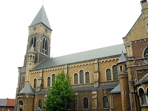 Jemappes Town, Mons2 km E
-
Saint-Ghislain Town, Saint-Ghislain3.2 km W
-
Quaregnon Town, Quaregnon0.8 km S
-
Flénu Town, Mons2 km SE
-
Colfontaine Town, Colfontaine3.8 km S
-
Wasmes Town, Colfontaine3.9 km S
Sources & licences
Data last updated: