
- Population
- 1,668
- 1.7K
- Elevation
- 79 m
- above sea level
- Local time
- UTC+01:00
- Europe/Brussels · UTC+01:00
- Airports
- LGG Liège Airport34 km
- CRL Brussels South Charleroi Airport40 km
About Sclayn
Sclayn is a village. Location: Andenne, Arrondissement de Namur. Population: 1,668. Elevation: 79 m.
Sclayn (French pronunciation: [sklaɛ̃]; Walloon: Scleyin) is a town of Wallonia and a district of the municipality of Andenne, located in the province of Namur, Belgium. It is located by the river Meuse. Sclayn developed around the collegiate church dedicated to Saint Maurice. The church was founded by monks from Kornelimünster Abbey around 1072, and a college of canons was founded here by Emperor Henry IV in 1106.
Source: Wikipedia · CC BY-SA 4.0
Photos of Sclayn
-

Eebie · CC BY 4.0 -

Eebie · CC BY 4.0 -

Editions Dinot Frères – Editions C. Baune · CC BY 4.0 -
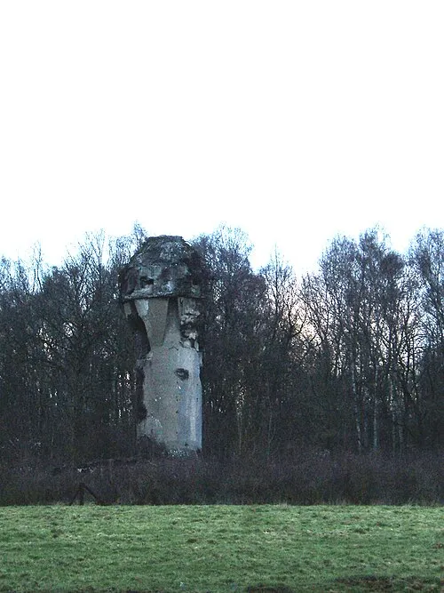
Fort de Marchovelette LHOON · CC BY 2.0


Climate of Sclayn
Best months for sightseeingBest months for sightseeing: June–September.
This month · November
A cold month
Day 9° · Night 4° · Rain 78 mm
- Hottest month
- August (day 23°)
- Coldest month
- February (night 0°)
- Wettest month
- June (80 mm)
- Driest month
- February (58 mm)
Bars: average monthly low and high temperature. Below: precipitation. Monthly averages for 1970–2000 at about 18 km resolution, adjusted for elevation. Highlighted months are mild and relatively dry. Source: WorldClim 2.1 (CC BY 4.0).
Show values as a table
| Month | Jan | Feb | Mar | Apr | May | Jun | Jul | Aug | Sep | Oct | Nov | Dec |
|---|---|---|---|---|---|---|---|---|---|---|---|---|
| Average high (°C) | 5° | 6° | 10° | 13° | 18° | 21° | 23° | 23° | 19° | 15° | 9° | 6° |
| Average low (°C) | 1° | 0° | 3° | 5° | 9° | 12° | 13° | 13° | 11° | 8° | 4° | 2° |
| Precipitation (mm) | 66 | 58 | 67 | 61 | 72 | 80 | 78 | 76 | 65 | 70 | 78 | 76 |
Other places to visit in this season: June July August September
How to get to Sclayn
The nearest airport is Liège Airport (LGG), 34 km to the northeast as the crow flies. For international flights: Brussels South Charleroi Airport (CRL) (40 km). The nearest large city is Namur, 12 km to the west.
Airports
- Liège Airport (LGG) Grâce-Hollogne 34 kmnortheast
- Brussels South Charleroi Airport (CRL) Charleroi 40 kmwest
- Brussels Airport (BRU) Zaventem 60 kmnorthwest
Nearby large cities
- Namur Population: 110.9K 12 kmwest
- Liège Population: 195.3K 41 kmnortheast
- Charleroi Population: 200.1K 42 kmwest
- Leuven Population: 101K 49 kmnorthwest
- Maastricht Population: 122.4K 61 kmnortheast
Straight-line distances; road distances are longer. Airport data: OurAirports.
Day trips from Sclayn
Within 100 km: 268 historic and cultural sites, 1,582 natural sites, 1,145 lakes, rivers and coasts.
0–25 km170 places
- Nameche terril Mountain 3 kmSW
- Bois Wanchalle Natural site 9 kmSW
- Bois des Vieilles Ferrières Natural site 24 kmW
- Bois du Tronquoi Natural site 7 kmNW
25–60 km1,149 places
- Île du Moulin Island 41 kmE
- Île Monsin Island 47 kmNE
- Île de Franche Garenne Island 52 kmNE
- Île d'Androssart Island 37 kmS
60–100 km1,676 places
- Étang de Virelles Lake 67 kmSW
- Étang de Séloignes Lake 75 kmSW
- Étang d'Oise Lake 78 kmSW
- Étang du Moulin Lake 67 kmSW
Straight-line distances.
Nearby attractions & nature
Everything nearby-
Nameche terril Mountain, Andenne3.2 km SW
-
Fort de Maizeret Historic site, Andenne4.1 km SW
-
Bois de la Justice Natural site, Namur Province4 km SE
-
Samson River, Namur Province3.6 km SW
-
Collegiale de Sainte Begge Attraction, Andenne5.1 km E
-
Fort de Marchovelette Historic site, Fernelmont6.7 km W
Sources & licences
Data last updated: · 2 independent sources