Trebinje
Located in Republika Srpska, Bosnia and Herzegovina Coordinates: 42°42′43″ N 18°20′37″ E

- Population
- 33,178
- 33.2K
- Elevation
- 278 m
- above sea level
- Local time
- UTC+01:00
- Europe/Sarajevo · UTC+01:00
- Airports
- DBV Dubrovnik Ruđer Bošković Airport18 km
- TIV Tivat Airport46 km
About Trebinje
Trebinje is a city. Location: Republika Srpska, Bosnia and Herzegovina. Population: 33,178. Elevation: 278 m.
Trebinje (Serbian Cyrillic: Требиње, pronounced [trěːbiɲe]) is a city and municipality in Republika Srpska, Bosnia and Herzegovina. It is the southernmost city in Bosnia and Herzegovina and is situated on the banks of the Trebišnjica river in the region of East Herzegovina. As of 2013, it has a population of 31,433 inhabitants.
Source: Wikipedia · CC BY-SA 4.0
Photos of Trebinje
-

Pajomm · CC BY-SA 4.0 -

Cikajoca · CC BY-SA 4.0 -

Aniabanja · CC BY-SA 4.0 -

Ljubica K-R · CC BY-SA 4.0 -

Ljubica KreškoRomanić · CC BY-SA 4.0


Travel notes for Trebinje
From Wikivoyage
Trebinje is a town in the Herzegovina region.
Understand+
Trebinje is a small city in the Trebišnjica river valley in south eastern Herzegovina, about 30 km by road from Dubrovnik, Croatia, on the Adriatic coast. Despite its small size, there is plenty going on in this town in the way of live music, festivals, outdoor activities, and nightlife. It is one of the most beautiful cities in Bosnia and Herzegovina and is called "the city of sun and plane trees". The city is the economic and cultural centre of the region of Eastern Herzegovina.
Get in+
By plane:
Dubrovnik airport in Croatia is 30 km away from Trebinje, and maintains flights to many European destinations throughout the year. A taxi to/from the Dubrovnik airport to Trebinje should cost about €25 when arranged in Trebinje (through a taxi driver or local accommodation) and normally takes around 30 minutes. If you get a taxi from Dubrovnik airport without arranging in advance, the standard price is €60.
Tivat Airport is about 60 km away. The following airlines operate to Tivat Airport: Air Serbia (Belgrade), Turkish (Istanbul). There are also charter flights from some European cities.
Podgorica Airport is 125 km away and provides access to budget airlines like Ryanair and Wizz Air. When arranged in Trebinje, a taxi to/from the airport costs 100 KM and takes about 2 hours.
By bus:
Trebinje is in close proximity to bigger, better known cities like Dubrovnik (in Croatia), Herceg Novi (in Montenegro), and Mostar, and has bus connections to these cities. There are also daily bus connections to other major cities in the region like Sarajevo, Podgorica, Kotor, Belgrade and Novi Sad. As of August 2016, the bus from Dubrovnik to Trebinje leaves M-Sa around 13:30-13:45, costs about €5, and takes 45 minutes to 1 hour. Be sure to wait for the bus to show up, as it is not uncommon for the Dubrovnik bus station to claim that the bus isn't running when it actually is. If you're coming from Kotor, consider taking a bus to Herceg Novi first, and then catch a bus from Herceg Novi to Trebinje (the last bus leaves at 20:00, costs 10 KM, and lasts about 1 hour). This will save you at least 10 KM and several hours of transit time compared to the "direct" Kotor-Trebinje bus, which makes a detour through Podgorica.
Source: Wikivoyage · CC BY-SA 4.0 · abridged
Twin towns and sister cities of Trebinje
- Nikšić· Montenegro
Source: Wikidata. Only places with a page on this site are shown.
Climate of Trebinje
Best months for sightseeingBest months for sightseeing: May–June, September.
This month · November
A wet month
Day 15° · Night 7° · Rain 166 mm
- Hottest month
- July (day 29°)
- Coldest month
- February (night 3°)
- Wettest month
- November (166 mm)
- Driest month
- July (43 mm)
Bars: average monthly low and high temperature. Below: precipitation. Monthly averages for 1970–2000 at about 18 km resolution, adjusted for elevation. Highlighted months are mild and relatively dry. Source: WorldClim 2.1 (CC BY 4.0).
Show values as a table
| Month | Jan | Feb | Mar | Apr | May | Jun | Jul | Aug | Sep | Oct | Nov | Dec |
|---|---|---|---|---|---|---|---|---|---|---|---|---|
| Average high (°C) | 10° | 10° | 14° | 17° | 22° | 26° | 29° | 29° | 25° | 20° | 15° | 11° |
| Average low (°C) | 3° | 3° | 5° | 8° | 13° | 17° | 19° | 19° | 15° | 12° | 7° | 5° |
| Precipitation (mm) | 119 | 110 | 97 | 102 | 78 | 64 | 43 | 57 | 99 | 135 | 166 | 149 |
How to get to Trebinje
The nearest airport is Dubrovnik Ruđer Bošković Airport (DBV), 18 km to the south as the crow flies. The nearest large city is Podgorica, 81 km to the east.
Airports
- Dubrovnik Ruđer Bošković Airport (DBV) Dubrovnik 18 kmsouth
- Tivat Airport (TIV) Tivat 46 kmsoutheast
- Mostar International Airport (OMO) Mostar 75 kmnorthwest
Nearby large cities
- Podgorica Population: 236.9K 81 kmeast
- Mostar Population: 104.5K 83 kmnorthwest
- Sarajevo Population: 696.7K 126 kmnorth
- Zenica Population: 164.4K 169 kmnorth
- Split Population: 149.8K 179 kmnorthwest
Straight-line distances; road distances are longer. Airport data: OurAirports.
Day trips from Trebinje
Within 100 km: 11 historic and cultural sites, 77 natural sites, 71 lakes, rivers and coasts.
0–25 km18 places
- Saint Ignatius Church Attraction 21 kmSW
- Daksa Island 24 kmW
- Lacroma Island 21 kmSW
- Dubrovnik Cathedral Attraction 21 kmSW
25–60 km49 places
- Česvinica Mountain 52 kmW
- Zec Mountain 51 kmW
- Kosor Mountain 54 kmW
- Tajan Island 45 kmW
60–100 km92 places
- Mljet Island 66 kmW
- Vrtijeljka Mountain 62 kmSE
- Vranjina Mountain 81 kmSE
- Mareza Natural site 74 kmE
Straight-line distances.
Nearby attractions & nature
Everything nearby-
 Trebinjsko Jezero Lake, Republika Srpska4.5 km E
-
 Sponza Palace Historic site, Croatia21 km W
-
 Dubrovnik Cathedral Attraction, Croatia21 km SW
-
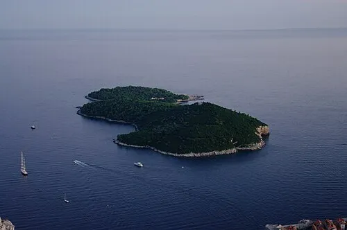 Lacroma Island, Dubrovnik-Neretva County21 km SW
-
 Bijela Gora Mountain, Montenegro20 km SE
-
Borova Mountain, Republika Srpska12 km E
-
 Velika Jastrebica Mountain, Montenegro21 km SE
-
 Orjen Mountain, Montenegro24 km SE
Other cities and towns in Republika Srpska


Sources & licences
Data last updated: · 2 independent sources