Polkovnik Ivanovo
Local name: Полковник Иваново
Located in Dobrich-Selska, Dobrich Coordinates: 43°40′54″ N 27°37′42″ E
- Population
- 146
- 146
- Elevation
- 234 m
- above sea level
- Local time
- UTC+02:00
- Europe/Sofia · UTC+02:00
- Airports
- VAR Varna Airport52 km
- CND Mihail Kogălniceanu International Airport102 km
About Polkovnik Ivanovo
Polkovnik Ivanovo is a village. Location: Dobrich-Selska, Dobrich. Population: 146. Elevation: 234 m.
Polkovnik Ivanovo is a village in the municipality of Dobrichka, in Dobrich Province, in northeastern Bulgaria.
Source: Wikipedia · CC BY-SA 4.0
At a glance
- Area
- 15.5 km²
Source: Wikidata
Population of Polkovnik Ivanovo over time
| 2014 | 76 | |
|---|---|---|
| 2015 | 75 | |
| 2016 | 71 | |
| 2017 | 73 | |
| 2018 | 66 | |
| 2019 | 59 | |
| 2020 | 56 | |
| 2021 | 60 | |
| 2022 | 52 | |
| 2023 | 48 | |
| 2024 | 47 | |
| 2025 | 44 |
Censuses and official estimates; source: Wikidata.
Climate of Polkovnik Ivanovo
Best months for sightseeingBest months for sightseeing: May–June, August–September.
This month · November
A cold month
Day 9° · Night 1° · Rain 48 mm
- Hottest month
- July (day 27°)
- Coldest month
- January (night -4°)
- Wettest month
- June (60 mm)
- Driest month
- January (31 mm)
Bars: average monthly low and high temperature. Below: precipitation. Monthly averages for 1970–2000 at about 18 km resolution, adjusted for elevation. Highlighted months are mild and relatively dry. Source: WorldClim 2.1 (CC BY 4.0).
Show values as a table
| Month | Jan | Feb | Mar | Apr | May | Jun | Jul | Aug | Sep | Oct | Nov | Dec |
|---|---|---|---|---|---|---|---|---|---|---|---|---|
| Average high (°C) | 3° | 5° | 10° | 16° | 21° | 25° | 27° | 27° | 23° | 17° | 9° | 4° |
| Average low (°C) | -4° | -3° | 0° | 5° | 10° | 14° | 16° | 15° | 11° | 7° | 1° | -2° |
| Precipitation (mm) | 31 | 32 | 36 | 43 | 49 | 60 | 44 | 42 | 44 | 38 | 48 | 39 |
Other places to visit in this season: May June August September
How to get to Polkovnik Ivanovo
The nearest airport is Varna Airport (VAR), 52 km to the south as the crow flies. The nearest large city is Varna, 56 km to the southeast.
Airports
- Varna Airport (VAR) Varna 52 kmsouth
- Mihail Kogălniceanu International Airport (CND) Constanța 102 kmnortheast
- Burgas Airport (BOJ) Burgas 124 kmsouth
Nearby large cities
- Varna Population: 318.7K 56 kmsoutheast
- Constanța Population: 317.8K 98 kmnortheast
- Burgas Population: 210.6K 131 kmsouth
- Rousse Population: 121.2K 136 kmwest
- Buzău Population: 103.5K 175 kmnorth
Straight-line distances; road distances are longer. Airport data: OurAirports.
Day trips from Polkovnik Ivanovo
Within 100 km: 5 historic and cultural sites, 18 natural sites, 3 lakes, rivers and coasts.
0–25 km2 places
- Mikovo Lake Lake 25 kmSE
- Dobrich TV Tower Landmark 21 kmSE
25–60 km8 places
- Valea Nastradinul Natural site 47 kmNE
- Valea Beilicului Natural site 47 kmN
- Valea Urluia Natural site 51 kmNE
- Ludogorsko Plato Natural site 51 kmW
60–100 km16 places
- Valea Rasovei Natural site 63 kmNE
- Valea Cocargea Natural site 62 kmNE
- Valea Chirnogi Natural site 88 kmNW
- Kartaltepe Mountain 91 kmSW
Straight-line distances.
Nearby attractions & nature
Everything nearby-
Dobrich TV Tower Landmark, Varna21 km SE
-
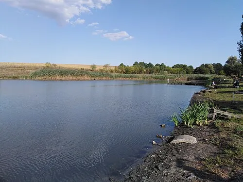 Mikovo Lake Lake, Dobrich25 km SE
Sources & licences
Data last updated: · 2 independent sources