Bjelovar
Located in Town of Bjelovar, Bjelovar-Bilogora County Coordinates: 45°53′52″ N 16°51′03″ E
- Population
- 24,392
- 24.4K
- Elevation
- 113 m
- above sea level
- Local time
- UTC+01:00
- Europe/Zagreb · UTC+01:00
- Airports
- ZAG Zagreb Franjo Tuđman International Airport63 km
- SOB Hévíz–Balaton Airport91 km
About Bjelovar
Bjelovar is a city. Location: Town of Bjelovar, Bjelovar-Bilogora County. Population: 24,392. Elevation: 113 m.
Bjelovar (Hungarian: Belovár, German: Bellowar, Czech: Bělovar or Bělovár, Kajkavian: Belovar, Latin: Bellovarium) is a city in the central Croatia, the administrative centre of Bjelovar-Bilogora County and bishoporic seat of the Diocese of Bjelovar-Križevci. In the 2021 census, its population was 36,316.
Source: Wikipedia · CC BY-SA 4.0
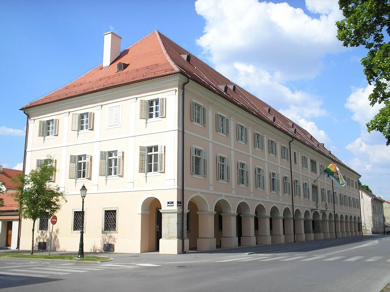
Photos of Bjelovar
-

Bjelovaracskm · CC BY-SA 4.0 -

Bjelovaracskm · CC BY-SA 4.0 -

Fraxinus Croat · CC BY-SA 3.0 -

MartinaKL · CC BY-SA 4.0 -

Fraxinus Croat · CC BY-SA 3.0


Travel notes for Bjelovar
From Wikivoyage
Bjelovar is one of the youngest cities in Croatia, officially founded in 1756. Located in central Croatia approximately 80 km east of Zagreb, this planned Baroque city serves as the administrative center of Bjelovar-Bilogora County. It has beautiful central park, elegant architecture, and agricultural heritage.
Understand+
The name Bjelovar is derived from the Croatian word "bijel" (white) combined with the Hungarian word "vár" (fortress), literally meaning "white fortress."
Construction of Bjelovar began in 1756 when land was acquired and building permits were issued, with Austrian Baron Philipp Lewin von Beck leading the development. The city was designed from the start as the center of the Varaždin Generalate, with military facilities and settlements established alongside Czech and Croatian peasants. This military heritage shaped the city's planned layout, which remains evident in its orderly street grid today.
The Cathedral of St. Teresa of Ávila, constructed in typical Baroque style between 1765 and 1772, was named after the patron saint of Habsburg Empress Maria Theresa, who was responsible for much of Bjelovar's development. The cathedral was elevated from parish church status in 2009 by Pope Benedict XVI, making it one of Croatia's youngest cathedrals.
Despite its relatively recent founding, archaeological evidence shows that the area around Bjelovar has been inhabited since prehistoric times, with Neolithic settlements dating back to 5,000 BC. Roman remains have also been discovered, including water pipes, foundations, and coins, suggesting a Roman settlement or military camp once existed in the area.
In the 20th century, Bjelovar played a role in Croatia's independence movement. September 29, 1991 became a significant date in the city's modern history and is now celebrated as Bjelovar Veterans' Day.
Get in+
By bus:
Buses run frequently from Zagreb and take approximately 1 hour 30 minutes to 2 hours depending on the service. The journey is convenient and affordable, with tickets costing around €6-7 one way. Services operate daily with several departures. Check the Zagreb Bus Station's website [1] for current timetables.
The bus station is located on the western side of town, within walking distance of the city center.
By train:
Croatian Railways (HŽPP) operates train services between Zagreb and Bjelovar. Trains depart from Zagreb Glavni Kolodvor (Main Station) approximately every 4 hours, with the journey taking approximately 1 hour 20-30 minutes. Return tickets cost around €16-17, making this an economical option. The train station is very near the bus station.
By car:
From Zagreb, take the A4 motorway (towards Varaždin/Goričan) and exit onto state road D28 near Vrbovec. A significant section of the D28 is designated as a fast road, ensuring a quicker journey. The drive takes approximately 1 hour and 15 minutes covering about 80 km. Alternatively, you can use local roads through Dugo Selo and Ivanić-Grad.
Travelers coming from Slavonia can access Bjelovar via the D28 from Virovitica or via routes through Daruvar.
By plane:
The nearest international airport is Zagreb Franjo Tuđman Airport (ZAG), located approximately 80 km west of Bjelovar. From the airport, you can rent a car or take a bus to Zagreb and then continue to Bjelovar by bus or train.
Source: Wikivoyage · CC BY-SA 4.0 · abridged
Places bordering Bjelovar
- Ivanska
Twin towns and sister cities of Bjelovar
- Imotski· Croatia
- Pakrac· Croatia
- Tapolca· Hungary
- Visoko· Bosnia and Herzegovina
Source: Wikidata. Only places with a page on this site are shown.
Climate of Bjelovar
Best months for sightseeingBest months for sightseeing: May–June, September.
This month · November
A cold month
Day 10° · Night 3° · Rain 80 mm
- Hottest month
- July (day 27°)
- Coldest month
- January (night -2°)
- Wettest month
- June (89 mm)
- Driest month
- February (44 mm)
Bars: average monthly low and high temperature. Below: precipitation. Monthly averages for 1970–2000 at about 18 km resolution, adjusted for elevation. Highlighted months are mild and relatively dry. Source: WorldClim 2.1 (CC BY 4.0).
Show values as a table
| Month | Jan | Feb | Mar | Apr | May | Jun | Jul | Aug | Sep | Oct | Nov | Dec |
|---|---|---|---|---|---|---|---|---|---|---|---|---|
| Average high (°C) | 4° | 7° | 12° | 17° | 23° | 26° | 27° | 27° | 22° | 17° | 10° | 4° |
| Average low (°C) | -2° | -1° | 2° | 7° | 11° | 15° | 16° | 15° | 11° | 7° | 3° | -1° |
| Precipitation (mm) | 46 | 44 | 51 | 63 | 74 | 89 | 78 | 78 | 72 | 67 | 80 | 61 |
How to get to Bjelovar
The nearest airport is Zagreb Franjo Tuđman International Airport (ZAG), 63 km to the west as the crow flies. The nearest large city is Zagreb, 68 km to the west.
Airports
- Zagreb Franjo Tuđman International Airport (ZAG) Velika Gorica 63 kmwest
- Hévíz–Balaton Airport (SOB) Sármellék 91 kmnorth
- Pécs-Pogány International Airport (PEV) Pécs 108 kmeast
Nearby large cities
- Zagreb Population: 663.6K 68 kmwest
- Pécs Population: 145.3K 109 kmeast
- Banja Luka Population: 221.1K 127 kmsouth
- Graz Population: 303.3K 169 kmnorthwest
- Ljubljana Population: 272.2K 183 kmwest
Straight-line distances; road distances are longer. Airport data: OurAirports.
Day trips from Bjelovar
Within 100 km: 12 historic and cultural sites, 29 natural sites, 45 lakes, rivers and coasts.
0–25 km2 places
- Sredska River 13 kmS
- Čivičevac River 24 kmNE
25–60 km24 places
- Kašina River 48 kmW
- Plitvica River 46 kmN
- Glavničica River 50 kmW
- Kamešnica Potok River 35 kmNW
60–100 km60 places
- Krndija Mountain 97 kmSE
- Ledava River 67 kmN
- Ščavnica River 81 kmNW
- Krka River 97 kmW
Straight-line distances.
Nearby attractions & nature
Everything nearbySources & licences
Data last updated: · 2 independent sources