Lumbarda
Located in Municipality of Lumbarda, Dubrovnik-Neretva County Coordinates: 42°55′22″ N 17°10′02″ E

- Population
- 1,209
- 1.2K
- Elevation
- 18 m
- above sea level
- Local time
- UTC+01:00
- Europe/Zagreb · UTC+01:00
- Airports
- BWK Brač Airport57 km
- OMO Mostar International Airport68 km
About Lumbarda
Lumbarda is a city. Location: Municipality of Lumbarda, Dubrovnik-Neretva County. Population: 1,209. Elevation: 18 m.
Lumbarda is a village and a municipality located on the eastern tip of the island of Korčula in Croatia, seven kilometers away from the town of Korčula. A road passing through a picturesque area of pine woods and olive groves connects these two places. Lumbarda is surrounded by sandy vineyards (famous white wine "Grk" produced from the native grape of the same name) and sandy beaches such as Vela Pržina, Bilin Žal and Tatinja.
Source: Wikipedia · CC BY-SA 4.0
Photos of Lumbarda
-

Quahadi Añtó 17:43, 7 August 2010 · CC BY 3.0 -

Quahadi Añtó 10:00, 18 February 2011 · CC BY-SA 3.0 -

Quahadi Añtó 09:11, 28 March 2013 · CC BY-SA 3.0 -

Quahadi Añtó 11:36, 29 March 2013 · CC BY-SA 3.0 -

Quahadi Añtó 09:46, 30 March 2013 · CC BY-SA 3.0


Travel notes for Lumbarda
From Wikivoyage
Lumbarda is a village on the island of Korčula in the Dalmatia region of Croatia.
Source: Wikivoyage · CC BY-SA 4.0 · abridged
Places bordering Lumbarda
- Town of Korčula
Climate of Lumbarda
Best months for sightseeingBest months for sightseeing: May, September–October.
This month · November
A wet month
Day 16° · Night 10° · Rain 110 mm
- Hottest month
- July (day 31°)
- Coldest month
- January (night 6°)
- Wettest month
- November (110 mm)
- Driest month
- July (29 mm)
Bars: average monthly low and high temperature. Below: precipitation. Monthly averages for 1970–2000 at about 18 km resolution, adjusted for elevation. Highlighted months are mild and relatively dry. Source: WorldClim 2.1 (CC BY 4.0).
Show values as a table
| Month | Jan | Feb | Mar | Apr | May | Jun | Jul | Aug | Sep | Oct | Nov | Dec |
|---|---|---|---|---|---|---|---|---|---|---|---|---|
| Average high (°C) | 11° | 12° | 15° | 19° | 24° | 28° | 31° | 31° | 26° | 21° | 16° | 13° |
| Average low (°C) | 6° | 6° | 8° | 11° | 16° | 19° | 22° | 21° | 18° | 14° | 10° | 7° |
| Precipitation (mm) | 89 | 77 | 78 | 69 | 54 | 43 | 29 | 45 | 68 | 98 | 110 | 96 |
How to get to Lumbarda
The nearest airport is Brač Airport (BWK), 57 km to the northwest as the crow flies. For international flights: Mostar International Airport (OMO) (68 km). The nearest large city is Mostar, 70 km to the northeast.
Airports
- Brač Airport (BWK) Gornji Humac 57 kmnorthwest
- Mostar International Airport (OMO) Mostar 68 kmnortheast
- Split Saint Jerome Airport (SPU) Split 98 kmnorthwest
Nearby large cities
- Mostar Population: 104.5K 70 kmnortheast
- Split Population: 149.8K 88 kmnorthwest
- Sarajevo Population: 696.7K 141 kmnortheast
- Zenica Population: 164.4K 154 kmnorth
- Podgorica Population: 236.9K 180 kmeast
Straight-line distances; road distances are longer. Airport data: OurAirports.
Day trips from Lumbarda
Within 100 km: 9 historic and cultural sites, 53 natural sites, 61 lakes, rivers and coasts.
0–25 km3 places
- Korčula Island 21 kmW
- Pelješac Natural site 20 kmE
- Otok Badija Island 3 kmN
25–60 km45 places
- Mljet Island 36 kmSE
- Lagosta Island Island 30 kmSW
- Česvinica Mountain 48 kmE
- Skrivena Luka Natural site 32 kmSW
60–100 km75 places
- Brač Island 62 kmNW
- Šolta Island 88 kmNW
- Otok Biševo Island 94 kmW
- Saint Ignatius Church Attraction 83 kmE
Straight-line distances.
Nearby attractions & nature
Everything nearby-
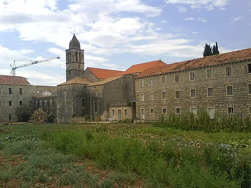 Otok Badija Island, Dubrovnik-Neretva County3.5 km N
-
 Pelješac Natural site, Croatia20 km E
-
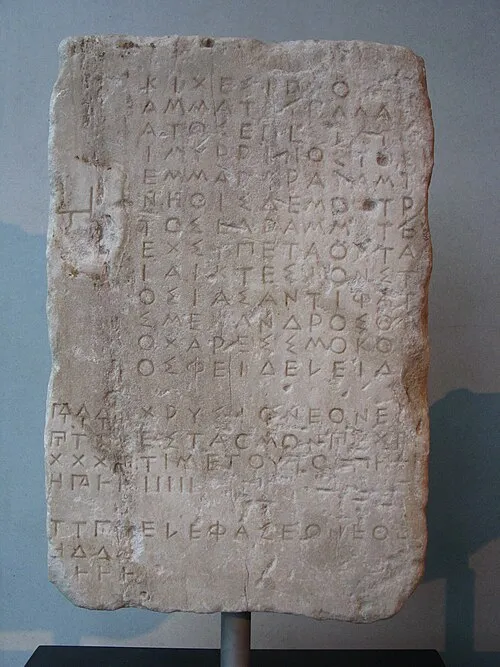 Korčula Island, Dubrovnik-Neretva County21 km W
Sources & licences
Data last updated: · 2 independent sources