Dubrava
Located in Municipality of Ston, Dubrovnik-Neretva County Coordinates: 42°53′16″ N 17°29′57″ E

- Population
- 161
- 161
- Elevation
- 157 m
- above sea level
- Local time
- UTC+01:00
- Europe/Zagreb · UTC+01:00
- Airports
- OMO Mostar International Airport52 km
- DBV Dubrovnik Ruđer Bošković Airport72 km
About Dubrava
Dubrava is a village. Location: Municipality of Ston, Dubrovnik-Neretva County. Population: 161. Elevation: 157 m.
Dubrava is a village on the Pelješac peninsula in Croatia. It is connected by the D414 highway.
Source: Wikipedia · CC BY-SA 4.0
At a glance
- Area
- 13.2 km²
Source: Wikidata
Photos of Dubrava
-

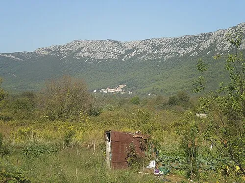
Pelješac Martin Brož · CC BY 3.0

Climate of Dubrava
Best months for sightseeingBest months for sightseeing: May–June, September.
This month · November
A wet month
Day 15° · Night 9° · Rain 117 mm
- Hottest month
- July (day 30°)
- Coldest month
- January (night 4°)
- Wettest month
- November (117 mm)
- Driest month
- July (31 mm)
Bars: average monthly low and high temperature. Below: precipitation. Monthly averages for 1970–2000 at about 18 km resolution, adjusted for elevation. Highlighted months are mild and relatively dry. Source: WorldClim 2.1 (CC BY 4.0).
Show values as a table
| Month | Jan | Feb | Mar | Apr | May | Jun | Jul | Aug | Sep | Oct | Nov | Dec |
|---|---|---|---|---|---|---|---|---|---|---|---|---|
| Average high (°C) | 10° | 11° | 14° | 18° | 23° | 27° | 30° | 30° | 25° | 20° | 15° | 12° |
| Average low (°C) | 4° | 4° | 7° | 10° | 15° | 18° | 21° | 21° | 17° | 13° | 9° | 6° |
| Precipitation (mm) | 93 | 82 | 81 | 74 | 56 | 45 | 31 | 46 | 72 | 102 | 117 | 103 |
How to get to Dubrava
The nearest airport is Mostar International Airport (OMO), 52 km to the northeast as the crow flies. The nearest large city is Split, 110 km to the northwest.
Airports
- Mostar International Airport (OMO) Mostar 52 kmnortheast
- Dubrovnik Ruđer Bošković Airport (DBV) Dubrovnik 72 kmsoutheast
- Brač Airport (BWK) Gornji Humac 80 kmnorthwest
Nearby large cities
- Split Population: 149.8K 110 kmnorthwest
- New Belgrade Population: 209.8K 317 kmnortheast
- Zemun Population: 155.6K 319 kmnortheast
- Belgrade Population: 1.3M 320 kmnortheast
- Zagreb Population: 663.6K 347 kmnorth
Straight-line distances; road distances are longer. Airport data: OurAirports.
Day trips from Dubrava
Within 100 km: 4 historic and cultural sites, 13 natural sites, 29 lakes, rivers and coasts.
0–25 km10 places
- Mljet Island 16 kmS
- Česvinica Mountain 20 kmE
- Pelješac Natural site 7 kmNW
- Baćinska Jezera Lake 22 kmN
25–60 km23 places
- Lagosta Island Island 53 kmW
- Skrivena Luka Natural site 55 kmW
- Otok Badija Island 28 kmW
- Korčula Island 48 kmW
60–100 km13 places
- Brač Island 85 kmNW
- Otok Šćedro Island 69 kmW
- Otok Sveti Klement Island 97 kmW
- Otok Jerolim Island 92 kmW
Straight-line distances.
Nearby attractions & nature
Everything nearby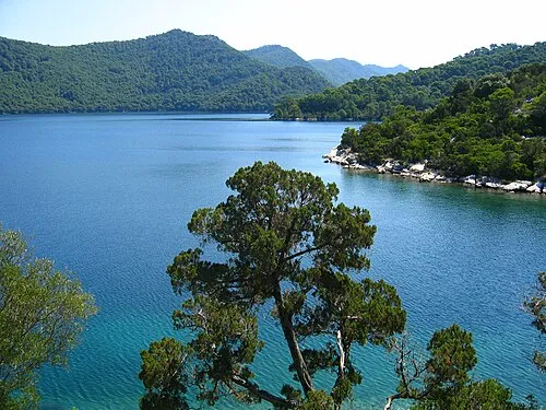


Other cities and towns in Municipality of Ston
-
 Boljenovići Village, Municipality of Ston11 km SE
-
 Metohija Village, Municipality of Ston12 km SE
-
 Sparagovići Village, Municipality of Ston10 km E
-
 Hodilje Village, Municipality of Ston16 km E
-
 Mali Ston Village, Municipality of Ston17 km E
-
Luka Village, Municipality of Ston15 km E
Sources & licences
Data last updated: · 2 independent sources