Municipality of Zažablje
Located in Dubrovnik-Neretva County, Croatia Coordinates: 43°00′40″ N 17°39′25″ E
- Population
- 553
- 553
- Elevation
- 38 m
- above sea level
- Local time
- UTC+01:00
- Europe/Zagreb · UTC+01:00
- Places inside
- 3
- listed under Municipality of Zažablje
- Airports
- OMO Mostar International Airport34 km
- DBV Dubrovnik Ruđer Bošković Airport70 km
About Municipality of Zažablje
Municipality of Zažablje is a district. Location: Dubrovnik-Neretva County, Croatia. Population: 553. The best months to visit are April–June, September–October. The nearest airport is Mostar International Airport (34 km). Nearby sights include Mislina and Pelješac Bridge.
Photos of Municipality of Zažablje
-

Mislina Ma ▀ ▄ Ga · CC BY 4.0

Climate of Municipality of Zažablje
Best months for sightseeingBest months for sightseeing: April–June, September–October.
This month · November
A wet month
Day 16° · Night 8° · Rain 127 mm
- Hottest month
- July (day 32°)
- Coldest month
- January (night 3°)
- Wettest month
- November (127 mm)
- Driest month
- July (40 mm)
Bars: average monthly low and high temperature. Below: precipitation. Monthly averages for 1970–2000 at about 18 km resolution, adjusted for elevation. Highlighted months are mild and relatively dry. Source: WorldClim 2.1 (CC BY 4.0).
Show values as a table
| Month | Jan | Feb | Mar | Apr | May | Jun | Jul | Aug | Sep | Oct | Nov | Dec |
|---|---|---|---|---|---|---|---|---|---|---|---|---|
| Average high (°C) | 10° | 12° | 16° | 20° | 25° | 29° | 32° | 32° | 27° | 21° | 16° | 11° |
| Average low (°C) | 3° | 4° | 7° | 11° | 15° | 19° | 21° | 21° | 16° | 13° | 8° | 5° |
| Precipitation (mm) | 98 | 87 | 86 | 85 | 66 | 55 | 40 | 53 | 78 | 109 | 127 | 112 |
Other places to visit in this season: April May June September October
How to get to Municipality of Zažablje
The nearest airport is Mostar International Airport (OMO), 34 km to the northeast as the crow flies. The nearest large city is Split, 113 km to the northwest.
Airports
- Mostar International Airport (OMO) Mostar 34 kmnortheast
- Dubrovnik Ruđer Bošković Airport (DBV) Dubrovnik 70 kmsoutheast
- Brač Airport (BWK) Gornji Humac 85 kmwest
Nearby large cities
- Split Population: 149.8K 113 kmnorthwest
- New Belgrade Population: 209.8K 299 kmnortheast
- Zemun Population: 155.6K 300 kmnortheast
- Belgrade Population: 1.3M 301 kmnortheast
- Zagreb Population: 663.6K 339 kmnorthwest
Straight-line distances; road distances are longer. Airport data: OurAirports.
Day trips from Municipality of Zažablje
Within 100 km: 4 historic and cultural sites, 13 natural sites, 27 lakes, rivers and coasts.
0–25 km9 places
- Česvinica Mountain 19 kmS
- Pelješac Natural site 22 kmSW
- Zec Mountain 22 kmS
- Kosor Mountain 22 kmS
25–60 km20 places
- Mljet Island 31 kmS
- Otok Badija Island 41 kmW
- Saint Ignatius Church Attraction 55 kmSE
- Daksa Island 50 kmSE
60–100 km15 places
- Brač Island 90 kmNW
- Lagosta Island Island 70 kmSW
- Skrivena Luka Natural site 72 kmSW
- Otok Šćedro Island 79 kmW
Straight-line distances.
Places in Municipality of Zažablje
3 places
Bijeli Vir
Population: 211

Badžula
Population: 56

Vidonje
Population: 2
Nearby attractions & nature
Everything nearby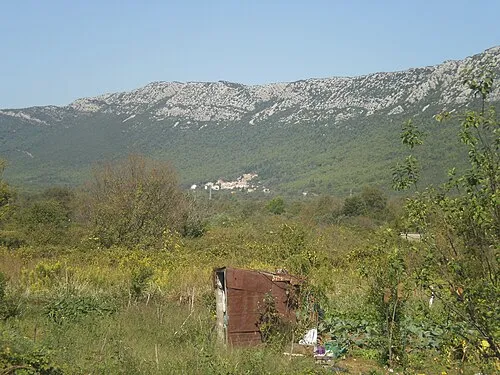
Other regions in Dubrovnik-Neretva County
-
Town of Metković District, Dubrovnik-Neretva County4.7 km N
-
 Municipality of Ston District, Dubrovnik-Neretva County19 km S
-
Town of Opuzen District, Dubrovnik-Neretva County7.6 km W
-
Municipality of Kula Norinska District, Dubrovnik-Neretva County5.1 km NW
-
 Town of Ploče District, Dubrovnik-Neretva County19 km W
-
Municipality of Slivno District, Dubrovnik-Neretva County11 km SW
Sources & licences
Data last updated: