Vrsar
Located in Municipality of Vrsar - Orsera, Istria County Coordinates: 45°08′57″ N 13°36′19″ E
- Population
- 1,535
- 1.5K
- Elevation
- 15 m
- above sea level
- Local time
- UTC+01:00
- Europe/Zagreb · UTC+01:00
- Airports
- PUY Pula Airport38 km
- TRS Trieste Airport76 km
About Vrsar
Vrsar is a city. Location: Municipality of Vrsar - Orsera, Istria County. Population: 1,535. Elevation: 15 m.
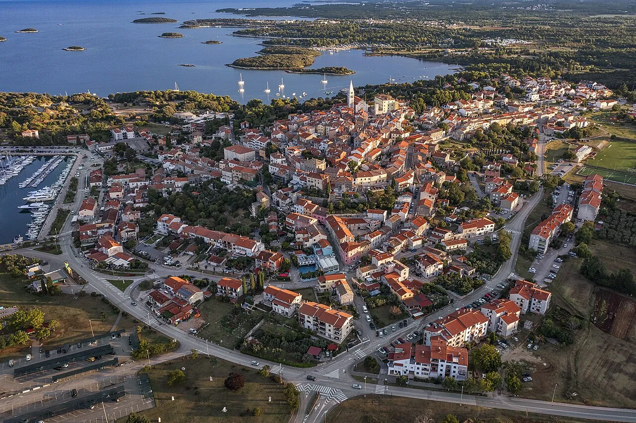
Vrsar (Italian and Venetian: Orsera) is a seaside village and a municipality in Istria, west Croatia, located 9 kilometers south of Poreč. The historical center is located on top of a hill, including the St. Martin parish church and the 40-meter high bell tower. In the 20th century, the town expanded down the hill, into the surrounding area. It is a popular summer destination with large campsites, private accommodation units and a modern marina.
Source: Wikipedia · CC BY-SA 4.0
Photos of Vrsar
-

66colpi · CC BY-SA 4.0 -

Jernej Furman from Slovenia · CC BY 2.0 -

Jernej Furman from Slovenia · CC BY 2.0 -

Tanya Dedyukhina · CC BY 3.0 -

Dguendel · CC BY 3.0


Travel notes for Vrsar
From Wikivoyage
Vrsar is a millennia-old little town in Istria. Vrsar used to be a fisherman's village, but it is now more famous as a family tourist destination. Just off Vrsar’s coast lies one of the most beautiful Istrian archipelagos with 18 uninhabited islands.
Source: Wikivoyage · CC BY-SA 4.0 · abridged
Climate of Vrsar
Best months for sightseeingBest months for sightseeing: May–June, September–October.
This month · November
Outside the best season
Day 15° · Night 7° · Rain 92 mm
- Hottest month
- July (day 29°)
- Coldest month
- January (night 2°)
- Wettest month
- October (93 mm)
- Driest month
- July (45 mm)
Bars: average monthly low and high temperature. Below: precipitation. Monthly averages for 1970–2000 at about 18 km resolution, adjusted for elevation. Highlighted months are mild and relatively dry. Source: WorldClim 2.1 (CC BY 4.0).
Show values as a table
| Month | Jan | Feb | Mar | Apr | May | Jun | Jul | Aug | Sep | Oct | Nov | Dec |
|---|---|---|---|---|---|---|---|---|---|---|---|---|
| Average high (°C) | 9° | 10° | 13° | 17° | 22° | 26° | 29° | 28° | 24° | 20° | 15° | 11° |
| Average low (°C) | 2° | 2° | 5° | 8° | 13° | 17° | 19° | 19° | 15° | 12° | 7° | 3° |
| Precipitation (mm) | 59 | 49 | 56 | 64 | 59 | 69 | 45 | 71 | 78 | 93 | 92 | 70 |
Other places to visit in this season: May June September October
How to get to Vrsar
The nearest airport is Pula Airport (PUY), 38 km to the southeast as the crow flies. The nearest large city is Rijeka, 69 km to the east.
Airports
- Pula Airport (PUY) Pula 38 kmsoutheast
- Trieste Airport (TRS) Ronchi dei Legionari/Trieste 76 kmnorth
- Rijeka Airport (RJK) Rijeka(Omišalj) 76 kmeast
Nearby large cities
- Rijeka Population: 108K 69 kmeast
- Ljubljana Population: 272.2K 122 kmnortheast
- Klagenfurt Population: 100.3K 173 kmnorth
- Zagreb Population: 663.6K 200 kmnortheast
- Graz Population: 303.3K 256 kmnortheast
Straight-line distances; road distances are longer. Airport data: OurAirports.
Day trips from Vrsar
Within 100 km: 12 historic and cultural sites, 56 natural sites, 47 lakes, rivers and coasts.
0–25 km3 places
- Euphrasius-Basilika Attraction 9 kmN
- Church of St. Euphemia Attraction 8 kmS
- Otočić Sveti Andrija Island 10 kmS
25–60 km34 places
- Markovec Mountain 44 kmN
- Montebello Mountain 56 kmN
- Slavnik Mountain 52 kmNE
- Rižana River 47 kmN
60–100 km78 places
- Krk Island 80 kmE
- Lošinj Island 88 kmSE
- Uvala Stipanja Natural site 83 kmE
- Otočić Košljun Island 81 kmE
Straight-line distances.
Nearby attractions & nature
Everything nearby-
Church of St. Euphemia Attraction, Istria County7.6 km S
-
Euphrasius-Basilika Attraction, Croatia8.9 km N
-
 Otočić Sveti Andrija Island, Istria County10 km S
Sources & licences
Data last updated: · 2 independent sources