Crveni Vrh
Located in Town of Umag - Umago, Istria County Coordinates: 45°29′26″ N 13°32′27″ E

- Population
- 177
- 177
- Elevation
- 47 m
- above sea level
- Local time
- UTC+01:00
- Europe/Zagreb · UTC+01:00
- Airports
- TRS Trieste Airport38 km
- PUY Pula Airport73 km
About Crveni Vrh
Crveni Vrh is a village. Location: Town of Umag - Umago, Istria County. Population: 177. Elevation: 47 m.
Crveni Vrh (Italian: Monte Rosso) is a coastal resort village on Savudrija peninsula in Umag municipality in Istria County, Croatia. It is located on Gulf of Piran with views towards Slovenian towns Portorož and Piran. Crveni Vrh real estate is one of the highest priced in Istria. Srečko Katanec, the former football player and national team manager, owns a villa in Crveni Vrh. The western side of the Crveni Vrh is occupied exclusively by private houses and no hotels.
Source: Wikipedia · CC BY-SA 4.0
At a glance
- Area
- 6.9 km²
Source: Wikidata
Photos of Crveni Vrh
-

Magdus Laszló Hunga… · CC BY-SA 3.0 -

Dguendel · CC BY 3.0 -

Alen Ištoković · CC BY 3.0 -

Alen Ištoković · CC BY 3.0 -

Dragonja Sl-Ziga · Public domain


Climate of Crveni Vrh
Best months for sightseeingBest months for sightseeing: May–June, September.
This month · November
A wet month
Day 14° · Night 7° · Rain 101 mm
- Hottest month
- July (day 29°)
- Coldest month
- January (night 2°)
- Wettest month
- October (109 mm)
- Driest month
- February (53 mm)
Bars: average monthly low and high temperature. Below: precipitation. Monthly averages for 1970–2000 at about 18 km resolution, adjusted for elevation. Highlighted months are mild and relatively dry. Source: WorldClim 2.1 (CC BY 4.0).
Show values as a table
| Month | Jan | Feb | Mar | Apr | May | Jun | Jul | Aug | Sep | Oct | Nov | Dec |
|---|---|---|---|---|---|---|---|---|---|---|---|---|
| Average high (°C) | 8° | 10° | 13° | 17° | 22° | 26° | 29° | 28° | 24° | 19° | 14° | 10° |
| Average low (°C) | 2° | 2° | 5° | 8° | 13° | 16° | 19° | 19° | 15° | 11° | 7° | 3° |
| Precipitation (mm) | 64 | 53 | 66 | 76 | 76 | 88 | 59 | 84 | 102 | 109 | 101 | 82 |
How to get to Crveni Vrh
The nearest airport is Trieste Airport (TRS), 38 km to the north as the crow flies. The nearest large city is Rijeka, 73 km to the east.
Airports
- Trieste Airport (TRS) Ronchi dei Legionari/Trieste 38 kmnorth
- Pula Airport (PUY) Pula 73 kmsoutheast
- Rijeka Airport (RJK) Rijeka(Omišalj) 86 kmeast
Nearby large cities
- Rijeka Population: 108K 73 kmeast
- Ljubljana Population: 272.2K 98 kmnortheast
- Klagenfurt Population: 100.3K 139 kmnortheast
- Zagreb Population: 663.6K 193 kmeast
- Graz Population: 303.3K 228 kmnortheast
Straight-line distances; road distances are longer. Airport data: OurAirports.
Day trips from Crveni Vrh
Within 100 km: 42 historic and cultural sites, 111 natural sites, 65 lakes, rivers and coasts.
0–25 km14 places
- Markovec Mountain 14 kmNE
- Rižana River 18 kmNE
- Dragonja River 4 kmSE
- Breg Mountain 14 kmE
25–60 km58 places
- Raša River 45 kmNE
- The Roman fortress Castra Historic site 53 kmNE
- Solkan Bridge Landmark 55 kmN
- Montebello Mountain 27 kmNE
60–100 km146 places
- Krk Island 96 kmSE
- Burano Island 88 kmW
- Sacca Fisola Island 96 kmW
- Uvala Stipanja Natural site 96 kmSE
Straight-line distances.
Nearby attractions & nature
Everything nearby-
Dragonja River, Slovenia3.9 km SE
-
Savudrija Lighthouse Landmark, Istria County3.9 km W
-
Sveta Marija na Krasu Attraction, Istria County5.7 km SE
-
 Museo Revoltella Museum, Trieste25 km NE
-
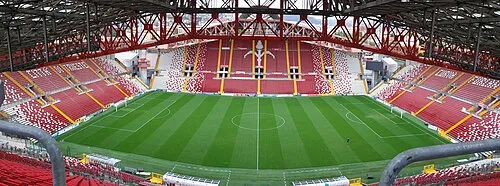 Stadio Nereo Rocco Landmark, Trieste25 km NE
-
 Rižana River, Slovenia18 km NE
Sources & licences
Data last updated: · 2 independent sources