Rogoznica
Located in Municipality of Rogoznica, Šibenik-Knin County Coordinates: 43°32′04″ N 15°58′06″ E

- Population
- 960
- 960
- Elevation
- 2 m
- above sea level
- Local time
- UTC+01:00
- Europe/Zagreb · UTC+01:00
- Airports
- SPU Split Saint Jerome Airport27 km
- BWK Brač Airport64 km
About Rogoznica
Rogoznica is a city. Location: Municipality of Rogoznica, Šibenik-Knin County. Population: 960. Elevation: 2 m.
Rogoznica is a municipality and a village on the Dalmatian coast in Croatia. It lies in the southernmost part of the Šibenik-Knin County, in a deep bay sheltered from wind, about 30 km from Šibenik. It is occasionally called Šibenska Rogoznica to distinguish it from Lokva Rogoznica, another tourist resort in Dalmatia.
Source: Wikipedia · CC BY-SA 4.0
Photos of Rogoznica
-

United Kingdom Hydrographic Office · Public domain -

Markogalicx · CC BY-SA 4.0 -

Markogalicx · CC BY-SA 4.0 -

Otok Zlarin Shanticm · CC BY-SA 3.0 -
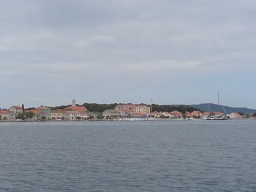
Krapanj Luka Krstulović · CC BY-SA 2.5


Climate of Rogoznica
Best months for sightseeingBest months for sightseeing: May, September–October.
This month · November
Outside the best season
Day 15° · Night 9° · Rain 87 mm
- Hottest month
- July (day 30°)
- Coldest month
- February (night 5°)
- Wettest month
- November (87 mm)
- Driest month
- July (24 mm)
Bars: average monthly low and high temperature. Below: precipitation. Monthly averages for 1970–2000 at about 18 km resolution, adjusted for elevation. Highlighted months are mild and relatively dry. Source: WorldClim 2.1 (CC BY 4.0).
Show values as a table
| Month | Jan | Feb | Mar | Apr | May | Jun | Jul | Aug | Sep | Oct | Nov | Dec |
|---|---|---|---|---|---|---|---|---|---|---|---|---|
| Average high (°C) | 11° | 12° | 14° | 18° | 23° | 27° | 30° | 30° | 26° | 21° | 15° | 12° |
| Average low (°C) | 5° | 5° | 7° | 10° | 14° | 18° | 20° | 20° | 17° | 13° | 9° | 6° |
| Precipitation (mm) | 64 | 55 | 59 | 61 | 47 | 45 | 24 | 40 | 67 | 74 | 87 | 74 |
How to get to Rogoznica
The nearest airport is Split Saint Jerome Airport (SPU), 27 km to the east as the crow flies. The nearest large city is Split, 38 km to the east.
Airports
- Split Saint Jerome Airport (SPU) Split 27 kmeast
- Brač Airport (BWK) Gornji Humac 64 kmsoutheast
- Zadar Airport (ZAD) Zadar 80 kmnorthwest
Nearby large cities
- Split Population: 149.8K 38 kmeast
- Mostar Population: 104.5K 150 kmeast
- Banja Luka Population: 221.1K 170 kmnortheast
- Zenica Population: 164.4K 172 kmnortheast
- Sarajevo Population: 696.7K 196 kmeast
Straight-line distances; road distances are longer. Airport data: OurAirports.
Day trips from Rogoznica
Within 100 km: 9 historic and cultural sites, 28 natural sites, 64 lakes, rivers and coasts.
0–25 km11 places
- Otok Zlarin Island 20 kmNW
- Krapanj Island 16 kmN
- Otok Mali Drvenik Island 13 kmSE
- Fort Saint Michael Historic site 23 kmN
25–60 km37 places
- Brač Island 59 kmSE
- Šolta Island 31 kmSE
- Otok Prvić Island 26 kmNW
- Otok Kaprije Island 28 kmNW
60–100 km53 places
- Otočić Ošljak Island 86 kmNW
- Kornat Island 62 kmNW
- Otok Biševo Island 62 kmS
- Omsica Mountain 92 kmN
Straight-line distances.
Nearby attractions & nature
Everything nearby-
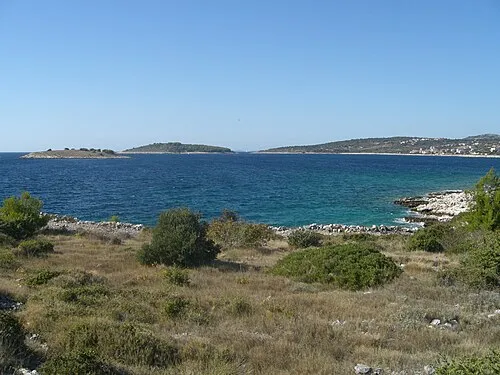 Jaz Island, Šibenik-Knin County2.9 km W
-
 Otok Mali Drvenik Island, Split-Dalmatia County13 km SE
-
Fort Saint Nicholas Historic site, Šibenik-Knin County23 km NW
-
Barone Fortress Historic site, Šibenik-Knin County23 km N
-
Fort Saint Michael Historic site, Šibenik-Knin County23 km N
-
Fort Saint John Historic site, Šibenik-Knin County24 km N
-
Krapanj Island, Šibenik-Knin County16 km N
-
Otok Veli Drvenik Island, Split-Dalmatia County17 km SE
Sources & licences
Data last updated: · 2 independent sources