- Elevation
- 107 m
- above sea level
- Local time
- UTC+01:00
- Europe/Zagreb · UTC+01:00
- Airports
- ZAG Zagreb Franjo Tuđman International Airport64 km
- BNX Banja Luka International Airport68 km
About Ilova
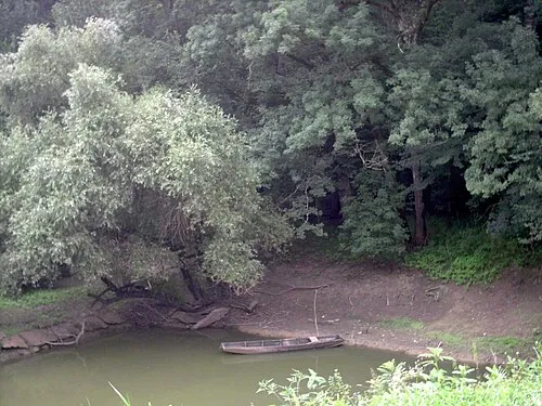
Ilova is a river. Location: Sisak-Moslavina County, Croatia.
The Ilova is a river in central Croatia, a left tributary of the Sava. It is 104.6 kilometres (65.0 mi) long and its basin covers an area of 1,796 square kilometres (693 sq mi). The Ilova rises in the hilly areas of eastern Bilogora, south of Virovitica and Suhopolje, and flows towards the southwest, forming a series of lakes near Veliki Zdenci.
Source: Wikipedia · CC BY-SA 4.0
At a glance
- Length
- 85 km
Source: Wikidata
Climate of Ilova
Best months for sightseeingBest months for sightseeing: May–June, September.
This month · November
A cold month
Day 10° · Night 3° · Rain 89 mm
- Hottest month
- July (day 27°)
- Coldest month
- January (night -2°)
- Wettest month
- June (93 mm)
- Driest month
- February (53 mm)
Bars: average monthly low and high temperature. Below: precipitation. Monthly averages for 1970–2000 at about 18 km resolution, adjusted for elevation. Highlighted months are mild and relatively dry. Source: WorldClim 2.1 (CC BY 4.0).
Show values as a table
| Month | Jan | Feb | Mar | Apr | May | Jun | Jul | Aug | Sep | Oct | Nov | Dec |
|---|---|---|---|---|---|---|---|---|---|---|---|---|
| Average high (°C) | 4° | 7° | 12° | 17° | 22° | 25° | 27° | 27° | 23° | 17° | 10° | 5° |
| Average low (°C) | -2° | -1° | 2° | 6° | 11° | 14° | 15° | 15° | 11° | 7° | 3° | -1° |
| Precipitation (mm) | 57 | 53 | 63 | 76 | 81 | 93 | 83 | 85 | 80 | 83 | 89 | 70 |
How to get to Ilova
The nearest airport is Zagreb Franjo Tuđman International Airport (ZAG), 64 km to the northwest as the crow flies. The nearest large city is Zagreb, 74 km to the northwest.
Airports
- Zagreb Franjo Tuđman International Airport (ZAG) Velika Gorica 64 kmnorthwest
- Banja Luka International Airport (BNX) Mahovljani 68 kmsoutheast
- Pécs-Pogány International Airport (PEV) Pécs 133 kmnortheast
Nearby large cities
- Zagreb Population: 663.6K 74 kmnorthwest
- Pécs Population: 145.3K 137 kmnortheast
- Rijeka Population: 108K 180 kmwest
- Graz Population: 303.3K 209 kmnorthwest
- Split Population: 149.8K 213 kmsouth
Straight-line distances; road distances are longer. Airport data: OurAirports.
Nearest towns and villages
-
Kutina City, Town of Kutina7.3 km NE
-
Bobovac Village, Municipality of Sunja7.2 km SW
-
Repušnica Village, Town of Kutina8.6 km N
-
Ivanjski Bok Village, Municipality of Sunja6.9 km S
-
Strmen Village, Municipality of Sunja8.2 km SW
-
Gornja Gračenica Village, Town of Popovača11 km N
Nearby attractions & nature
Everything nearby-
 Lonjsko Polje Nature Park Natural site, Croatia6.5 km SE
-
Lonja River, Croatia8.2 km NW
-
Sunja River, Sisak-Moslavina County12 km S
Sources & licences
Data last updated: · 2 independent sources