- Elevation
- 94 m
- above sea level
- Local time
- UTC+01:00
- Europe/Zagreb · UTC+01:00
- Airports
- ZAG Zagreb Franjo Tuđman International Airport38 km
- BNX Banja Luka International Airport95 km
About Česma
Česma is a river. Location: Sisak-Moslavina County, Croatia.
The Česma is a river in central Croatia, a left tributary of the river Lonja-Trebež. It is 106 km (66 mi) long, and its catchment area is 3,253 km2 (1,256 sq mi). It is created by merging streams Grđevica and Barna at 45°43′32″N 17°03′01″E near the village of Pavlovac in the municipality of Veliki Grđevac. The Česma basin is fan-shaped and formed by a number of streams rising on the slopes of Bilogora and Moslavačka Gora hills.
Source: Wikipedia · CC BY-SA 4.0
At a glance
- Length
- 123 km
Source: Wikidata
Climate of Česma
Best months for sightseeingBest months for sightseeing: May–September.
This month · November
A cold month
Day 10° · Night 2° · Rain 88 mm
- Hottest month
- July (day 27°)
- Coldest month
- January (night -3°)
- Wettest month
- June (91 mm)
- Driest month
- February (51 mm)
Bars: average monthly low and high temperature. Below: precipitation. Monthly averages for 1970–2000 at about 18 km resolution, adjusted for elevation. Highlighted months are mild and relatively dry. Source: WorldClim 2.1 (CC BY 4.0).
Show values as a table
| Month | Jan | Feb | Mar | Apr | May | Jun | Jul | Aug | Sep | Oct | Nov | Dec |
|---|---|---|---|---|---|---|---|---|---|---|---|---|
| Average high (°C) | 4° | 7° | 12° | 16° | 22° | 25° | 27° | 26° | 22° | 17° | 10° | 5° |
| Average low (°C) | -3° | -2° | 2° | 6° | 10° | 14° | 15° | 14° | 11° | 7° | 2° | -1° |
| Precipitation (mm) | 53 | 51 | 59 | 69 | 78 | 91 | 79 | 83 | 80 | 83 | 88 | 67 |
Other places to visit in this season: May June July August September
How to get to Česma
The nearest airport is Zagreb Franjo Tuđman International Airport (ZAG), 38 km to the northwest as the crow flies. The nearest large city is Zagreb, 48 km to the northwest.
Airports
- Zagreb Franjo Tuđman International Airport (ZAG) Velika Gorica 38 kmnorthwest
- Banja Luka International Airport (BNX) Mahovljani 95 kmsoutheast
- Maribor Edvard Rusjan Airport (MBX) Maribor 118 kmnorthwest
Nearby large cities
- Zagreb Population: 663.6K 48 kmnorthwest
- Pécs Population: 145.3K 147 kmnortheast
- Rijeka Population: 108K 162 kmwest
- Graz Population: 303.3K 185 kmnorthwest
- Klagenfurt Population: 100.3K 205 kmnorthwest
Straight-line distances; road distances are longer. Airport data: OurAirports.
Nearest towns and villages
-
Mahovo Village, Municipality of Martinska Ves5.8 km W
-
Stružec Village, Town of Popovača7.3 km SE
-
Hrastelnica Village, City of Sisak9.4 km SW
-
Potok Village, Town of Popovača8.6 km E
-
Velika Ludina City, Municipality of Velika Ludina9 km NE
-
Novoselec Village, Municipality of Križ9.8 km NE
Nearby attractions & nature
Everything nearby-
Lonja River, Croatia3.1 km NW
-
Odra River, Croatia13 km SW
-
Kupa River, Sisak-Moslavina County14 km SW
-
Lonja River, Croatia18 km SE
-
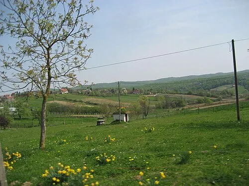 Gora Moslavačka Mountain, Croatia20 km NE
Sources & licences
Data last updated: · 2 independent sources